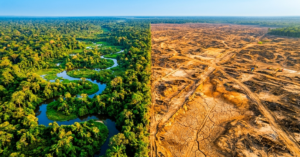
| Flood forecasting in Pakistan means predicting floods using rainfall data, river gauges, satellite images, and hydraulic models. The Pakistan Meteorological Department’s Flood Forecasting Division, based in Lahore, issues the country’s official flood warnings for the Indus River system. According to NDMA situation reports compiled through OCHA, the 2025 floods killed more than 1,000 people and affected 6.9 million. Better flood forecasting in Pakistan, backed by faster warnings, saves lives |
Pakistan faces recurrent flooding, particularly during the summer monsoon season. The damage keeps growing too. Flood forecasting in Pakistan is a major national disaster-management function. It is a critical system for protecting communities and reducing disaster losses. When that system works well, communities get time to move to safety. When it fails, the results are devastating, as the 2025 monsoon season showed once again.
This article explains how flood forecasting in Pakistan actually works today. Flood forecasting is also an important part of Pakistan’s broader climate emergency response, helping communities prepare for increasingly complex climate-related risks. It covers what the real 2025 and 2022 data show, where artificial intelligence genuinely helps, and where AI is still just a research idea. Every major claim below links back to a named, checkable source.
Why is flood forecasting in Pakistan so critically important?
Pakistan’s floods come from more than one source at once. Monsoon rain, glacial melt, and the Indus River’s complex flow patterns all combine during summer. Because of this mix, flood forecasting in Pakistan is particularly challenging. A single heavy rain event in the mountains can raise river levels hundreds of kilometers downstream, days later.
Climate change is making this harder still, as extreme weather events become more difficult to predict and manage. Warmer temperatures speed up glacial melt and intensify monsoon rainfall. As a result, historical flood patterns are becoming less reliable guides to future events. This shift is a major reason Pakistan’s forecasting systems now need real technology upgrades, not just more staff.
The Human and Economic Cost: What the Verified Data Shows
The numbers explain why flood forecasting in Pakistan matters so much.
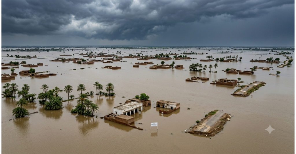
According to NDMA situation reports compiled through OCHA’s Pakistan floods support plan, the 2025 monsoon floods killed more than 1,000 people, including 275 children, between late June and mid-September. Khyber Pakhtunkhwa recorded 504 deaths, and Punjab reported 304. In total, the floods affected 6.9 million people: 4.7 million in Punjab and 1.6 million in Khyber Pakhtunkhwa. Close to 3 million people fled their homes. Many were sheltered in more than 1,580 evacuation centers.
The physical damage was severe too. Floodwaters destroyed or damaged more than 229,700 houses, 790 bridges, and 2,811 kilometers of roads. Farmers lost an estimated 2.2 million hectares of cropland. The floods also killed more than 22,800 livestock, per the same NDMA and OCHA figures.
The 2022 floods remain Pakistan’s costliest disaster on record. That year, floodwaters submerged nearly a third of the country. The World Bank’s post-disaster needs assessment put the death toll at 1,730 and the economic loss at $15.2 billion. More than 33 million people were affected, and recovery is still ongoing in some districts.
These events are not isolated. A 2025 study in the International Journal of Disaster Risk Reduction found that Pakistan’s real flood risk exposure runs roughly 30% higher than earlier estimates suggested. Meanwhile, the World Meteorological Organization projects that the world’s flood-exposed population will grow from 1.81 billion today to 2.3 billion by 2050. Pakistan sits near the center of that growing risk.
Who Is Responsible for Flood Forecasting in Pakistan?
Several agencies share this job. Coordination between them makes or breaks the warning system. The Pakistan Meteorological Department is the primary authoritative source for all flood forecasts, so every other agency depends on its data.
| Agency | Core Role |
| Pakistan Meteorological Department (PMD) | Primary authoritative source. Tracks rainfall, runs radar and satellite monitoring, and issues forecasts. |
| Flood Forecasting Division (FFD), Lahore | PMD’s operational unit. Issues daily flood bulletins during monsoon season: 135 in 2025, up from 132 in 2024. |
| National Disaster Management Authority (NDMA) | Coordinates the national response and passes warnings to provincial authorities. |
| Federal Flood Commission (FFC) | Plans flood-protection infrastructure and manages reservoir policy. |
| Provincial Disaster Management Authorities (PDMAs) | Handle last-mile warning delivery and local emergency response. |
Even with this structure in place, real gaps remain. A 2026 SWOT analysis published in Discover Geoscience found real weaknesses in the Indus Basin’s warning system: weak monitoring in mountain areas, slow data sharing between provinces, and poor last-mile delivery to rural communities. A separate 2026 study in the Journal of Water and Climate Change reached a similar conclusion after surveying flood-affected communities directly.
How Flood Forecasting Works in Pakistan: Step by Step
The process follows a clear chain. It runs from raw weather data to a household getting a warning.
- Weather monitoring: PMD tracks incoming weather systems using satellite cloud imagery.
- Rainfall measurement: Ground stations and radar record how much rain falls and where.
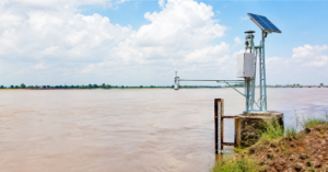
- River gauge readings: Telemetric stations along the Indus and its tributaries measure water levels in real time.
- Satellite and radar data: These fill gaps where ground stations are sparse, especially in the mountains.
- Hydraulic modeling: Hydrologists feed this data into models that project how flood waves will move downstream.
- Forecast bulletins: The FFD issues a daily bulletin, classifying rivers as normal, medium, high, or very high flood.
- Warning dissemination: NDMA and PDMA pass the warning to district authorities and, ideally, to at-risk communities.
- Emergency response: Local authorities evacuate residents, deploy rescue teams, and open relief camps.
This chain works reasonably well for large rivers with dense monitoring. However, it breaks down fastest in the mountains, where flash floods can develop within hours.
What Data Is Used for Flood Forecasting in Pakistan?
Forecasters combine several data sources at once, rather than relying on any single input:
- Rainfall data from PMD’s ground stations and Doppler radar in Lahore and at Mangla Dam.
- Satellite cloud imagery, which tracks monsoon systems moving from the Bay of Bengal toward Pakistan.
- River gauge and telemetric data from stations along the Indus, Jhelum, Chenab, Ravi, Sutlej, and Kabul rivers.
- Reservoir levels at Tarbela, Mangla, and Chashma dams are monitored by NDMA and the FFC.
- Digital elevation and GIS terrain data are used to map which areas will flood at a given water level.
- Synthetic aperture radar (SAR) satellite imagery, which can map flood extent even through cloud cover.
According to an Asian Development Bank technical report, PMD’s radar network includes 10-centimeter S-band Doppler radar in Lahore and at Mangla Dam, plus shorter-range weather radar in Dera Ismail Khan, Islamabad, Karachi, Rahim Yar Khan, and Sialkot. This network forms the backbone of today’s flood forecasting system in Pakistan.
Types of Floods in Pakistan: Riverine, Flash, and GLOF
Pakistan faces three distinct flood types. Each one needs a different forecasting approach. Treating them as one problem limits how well flood forecasting in Pakistan can prepare for any of them.
Riverine floods
These build slowly along major rivers like the Indus and Chenab. Forecasters can often see them coming days in advance because they depend on rainfall and snowmelt that build up over time.
Flash floods
These strike suddenly in mountainous areas, usually after heavy, localized rain. They can develop within hours, so there is little time to warn anyone downstream.
Glacial lake outburst floods (GLOFs)
These glacial lake outburst floods (GLOFs) happen when a glacial lake breaches its natural dam of ice or rock. They are the hardest to predict because trigger conditions change quickly and unpredictably. During the 2025 monsoon, a GLOF in Gilgit-Baltistan’s Ghizer district killed at least ten people and damaged hundreds of homes, with almost no warning time.
How Accurate Is Flood Forecasting in Pakistan?
This question really has two different answers: one for today’s operational system and one for ongoing research.
Operationally, PMD’s river-level forecasts for major rivers like the Indus and Chenab are considered reasonably reliable. They draw on decades of gauge data and established hydraulic models. However, PMD has not published a formal, peer-reviewed accuracy or skill score for its own operational forecasts. So precise public error margins do not currently exist.
Research results look more promising, but they come with real caveats. For example, a 2025 study on the Kabul River basin tested several machine learning models for short-term flow prediction. Its LSTM deep-learning model performed best, reaching an R² of 0.96 for forecasts up to five days ahead, though accuracy naturally declined for the furthest days. That is a strong research result, and it shows real promise for flood forecasting in Pakistan’s transboundary rivers.
A separate 2025 pilot study, published in the International Journal of Innovations in Science and Technology, trained a hybrid SVM-ARIMA model on two decades of weather data and reported 99.99% accuracy. However, this figure reflects the model’s performance on its study dataset, not the accuracy of Pakistan’s national flood forecasting system. The result is promising, but it has not been validated as a nationwide benchmark.
Globally, some machine learning studies have kept river-flow forecasts skillful up to seven days ahead. However, equivalent peer-reviewed lead-time results for Pakistan’s own rivers are not yet publicly available. Until they are, treat that seven-day figure as a research possibility, not a current capability.
How Are AI and Machine Learning Changing Flood Forecasting in Pakistan?
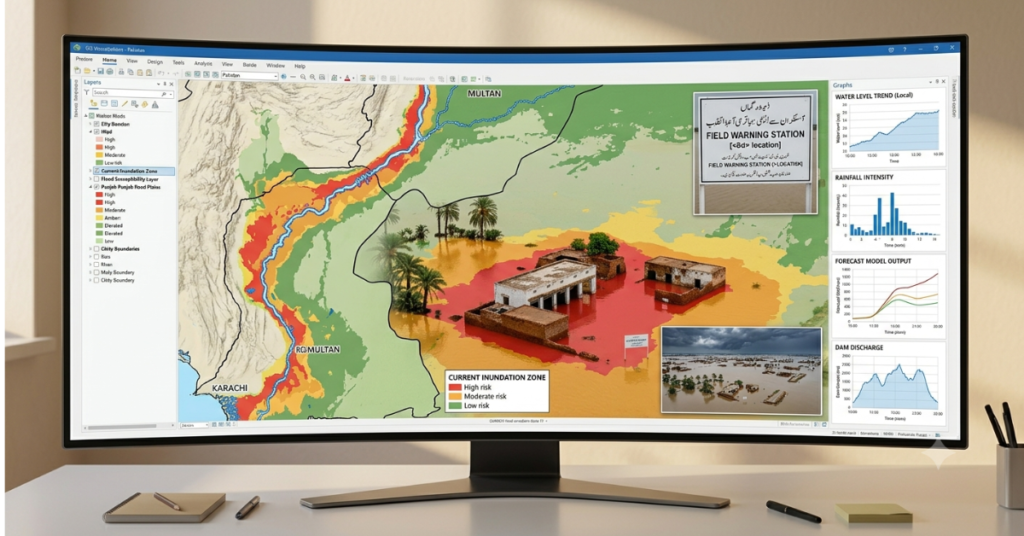
It helps to separate three categories clearly, because mixing them overstates where flood forecasting in Pakistan actually stands today.
Operational today
PMD’s radar network, satellite cloud tracking, and hydraulic routing models already run day to day. NDMA also uses satellite-based monitoring and digital mapping tools that produced national flood-extent maps within 24 hours during the 2022 floods. These tools now feed into NDMA’s workflow under the National Disaster Risk Reduction Strategy 2025-2030. AI and machine learning are increasingly built into this broader technical early-warning capability, though they are not yet the sole mechanism behind Pakistan’s flood mapping.
In research and pilot stages
Machine learning for flood susceptibility mapping falls here. A 2025 study in the Journal of Flood Risk Management tested 14 machine learning models across Pakistan’s high-risk regions. XGBoost and LightGBM performed best for accuracy. XGBoost also processed predictions fastest, at roughly 18 seconds, compared to LightGBM’s 22 and random forest’s 31, a measure of computing speed, not warning lead time. The same research produced the first national 30-meter resolution flood susceptibility maps for Pakistan, replacing older maps built at 250-meter to 25-kilometer resolution. The sharper maps found population exposure to flood risk roughly 30% higher than earlier estimates showed. A separate 2025 study on riverine flood prediction in mountainous transboundary basins reached a similar conclusion: AI-based methods still need refinement before they can match the reliability of established operational systems.
Planned for the future
Pakistan’s National Disaster Risk Reduction Strategy 2025-2030 commits to integrating AI algorithms, satellite remote sensing, and machine learning more deeply into daily forecasting by 2030. Today, this remains a policy commitment, not a fully deployed operational system. In short, Pakistan is already building AI-enabled disaster early-warning infrastructure, but AI-based flood forecasting is not yet a fully autonomous, nationwide operational system.
Pakistan’s Flood Early Warning System: What the 2026 Assessment Shows
In April 2026, UNESCO convened a validation workshop in Islamabad to finalize its Comprehensive Review of Pakistan’s Flood Early Warning System. The review brought together 37 representatives from federal and provincial governments, technical agencies, academia, and UN organizations. Crucially, it examined the full early warning chain: risk knowledge, hazard monitoring, forecasting, warning dissemination, and early community action.
The review found real progress, but also persistent gaps. It highlighted weak data integration between agencies, uneven inter-agency coordination, limited localized warning mechanisms, and continued challenges in community engagement and last-mile communication. These findings echo the SWOT analysis and community survey mentioned earlier in this article, so the pattern is consistent across independent reviews, not a one-off finding.
This 2026 assessment matters because it confirms something important: Pakistan’s technology, including its radar, satellites, and emerging AI tools, is advancing faster than the human and institutional systems needed to turn a forecast into a life saved.
What the 2025 Floods Revealed About the System’s Limits
The 2025 season tested flood forecasting in Pakistan harder than in most years. Heavy pre-monsoon rain in June combined with sustained monsoon rainfall through September. At the same time, accelerated snowmelt added additional water to river flows that rainfall forecasts alone could not fully capture.
A post-event NDMA review confirmed this pattern. Above-normal early-monsoon temperatures sped up snowmelt in the north, adding water that rainfall-based forecasts alone could not fully capture. This kind of interaction between temperature, snowmelt, and rainfall is one area where machine learning could potentially improve on simpler forecasting approaches.
Reservoir operators at Tarbela and Mangla moderated the worst flow peaks, and that action saved lives. Even so, Punjab alone saw 4.7 million people affected. That gap between accurate river-level warnings and real community impact points to a deeper issue. The limiting factor isn’t only forecast accuracy. It’s what happens after the forecast is issued.
Mountain and Rural Data Gaps in Flood Forecasting
Pakistan’s most dangerous floods, flash floods, and GLOFs tend to start in places the monitoring network barely reaches. Telemetric stations in Khyber Pakhtunkhwa and Gilgit-Baltistan remain sparse. The power supply is unreliable, and data transmission to the FFD in Lahore often fails right when it’s needed most, during peak events.
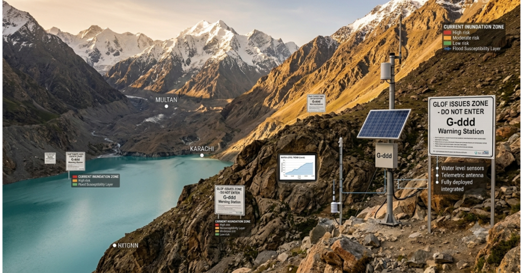
A striking real-world example surfaced in April 2026, when it emerged that a glacial lake outburst flood early warning system installed in Gilgit-Baltistan had remained inactive. Prime Minister Shehbaz Sharif ordered a high-level inquiry after the failure came to light during a pre-monsoon preparedness review. The case shows that even well-designed early warning technology fails if nobody maintains it, which is exactly the kind of implementation gap the 2026 UNESCO assessment flagged nationally.
The SWOT analysis mentioned earlier confirmed that this is one of the system’s most serious structural weaknesses. Closing this gap will likely require satellite-based monitoring to substitute for ground stations where none exist. Building dense sensor networks across remote mountain terrain remains slow and expensive, so satellites can help bridge the gap.
How Pakistan Can Improve Last-Mile Flood Warnings
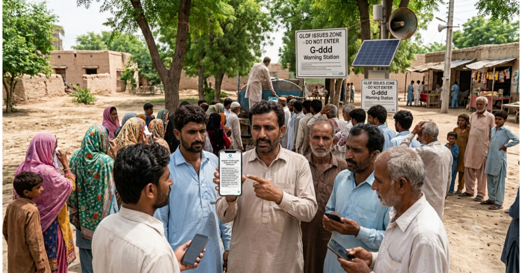
An accurate forecast helps nobody if the warning never reaches them in time. Flood forecasting in Pakistan currently faces its widest gaps in rural Sindh, southern Punjab, and lower KP districts.
Closing that gap requires several things at once. SMS alerts are useful, but they fail when networks go down during major floods. Community-based systems offer a more resilient backup. Trained local volunteers relay warnings and coordinate evacuation directly. Warnings must also reach people in Punjabi, Sindhi, Pashto, and Balochi, not only in Urdu or English, because comprehension drives action just as much as accuracy does.
A second strategy, anticipatory action, works differently. Instead of waiting for a flood to strike, agencies release aid the moment forecast probabilities cross a defined threshold. The World Food Programme and the International Federation of Red Cross and Red Crescent Societies already pilot this approach in Pakistan through a dedicated riverine flood framework. Communities that receive support before flooding tend to recover faster. They also lose fewer productive assets than those waiting for post-disaster relief.
Pakistan’s Flood Forecasting Plan Through 2030
NDMA published its National Disaster Risk Reduction Strategy 2025-2030 in July 2025. The strategy sets three clear priorities: expand GIS-based hazard mapping, deploy AI for disaster impact prediction, and integrate satellite remote sensing more deeply into daily operations.
These are strong commitments on paper. Still, Pakistan’s disaster management history shows a real gap between policy and implementation. Turning this strategy into funded programs, trained staff, and working systems will take sustained investment. Expanding telemetric stations into the mountains of KP and Gilgit-Baltistan and upgrading PMD’s radar to modern dual-polarization systems would likely deliver the biggest near-term improvement in warning time for flash floods.
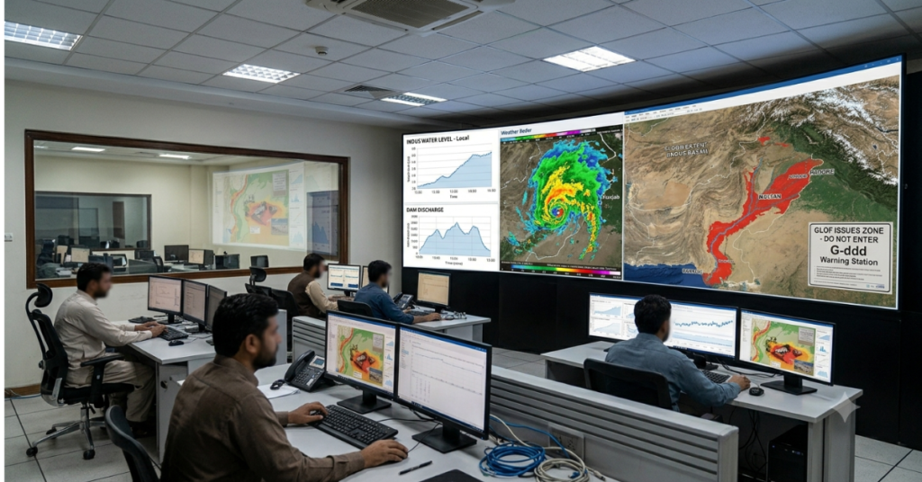
Current System vs. Research Pilots vs. 2030 Targets
| Feature | Current Operational System | Research & Pilot Stage | 2030 Target (National Strategy) |
| Flood maps | 250m–25km resolution, still in official use | 30m resolution maps from 2025 ML study | National rollout of high-resolution maps |
| Major-river forecasts | Daily bulletins, no published skill score | Pilot models with longer lead times (tested abroad and on the Kabul River) | Improved, probabilistic lead-time forecasting |
| Flash flood / GLOF warning | Minimal, sparse mountain sensors | Satellite-based pilots in test areas | Expanded telemetric plus satellite hybrid coverage |
| Inundation mapping speed | Manual mapping can take days | 24-hr satellite mapping (2022); newer GeoAI aims for faster processing | Real-time national GeoAI integration |
| Data sources | Ground gauges, PMD radar, satellite imagery | Plus SAR satellites, ML susceptibility models | Plus IoT sensors, integrated AI models |
| Last-mile warning | Phone calls, SMS, radio broadcast | Community pilot programs in some districts | Multi-channel automated system (national strategy goal) |
| Anticipatory action | Mostly post-event response | WFP / IFRC pilot cash-transfer triggers | Scaled, automated forecast-based triggers |
Key Takeaways
- Flood forecasting in Pakistan runs through PMD’s Flood Forecasting Division, but mountain monitoring, interprovincial data sharing, and last-mile warnings remain weak.
- NDMA figures show the 2025 death toll has passed 1,000, with 6.9 million people affected, most in Punjab and Khyber Pakhtunkhwa.
- Machine learning produced Pakistan’s first national 30-meter flood susceptibility maps, revealing roughly 30% more population exposure than earlier estimates.
- The 2026 UNESCO review and an inactive Gilgit-Baltistan GLOF warning system both point to the same problem: implementation, not just technology, is the weak link.
- Most AI flood forecasting results for Pakistan remain research findings, not operational, nationally validated systems.
Frequently Asked Questions
How does Pakistan forecast floods?
PMD’s Flood Forecasting Division in Lahore issues Pakistan’s official flood forecasts. It combines rainfall radar, river gauge readings, and satellite data with hydraulic models that track how flood waves move downstream. During the 2025 monsoon, the FFD published 135 bulletins covering the Indus, Chenab, Jhelum, Ravi, and Sutlej rivers.
Why is flood forecasting harder in Pakistan than elsewhere?
Pakistan’s floods come from several sources at once: monsoon rain, glacial melt, and complex mountain terrain. Monitoring stations remain sparse in the north, where flash floods and GLOFs start. Because these events develop within hours, forecasters often have very little lead time to issue warnings.
Is AI already used for flood forecasting in Pakistan?
Partly. NDMA already uses satellite-based monitoring and digital tools for flood-extent mapping, and AI/ML is increasingly built into Pakistan’s broader technical early-warning capabilities. However, models like XGBoost and SVM remain in research and pilot stages for forecasting river flow. Full AI integration into daily operational forecasting is a stated 2030 goal, not yet a reality.
How accurate are Pakistan’s flood forecasts?
PMD hasn’t published a formal accuracy score for its operational river forecasts, though decades of gauge data support its major-river predictions. Research studies report higher figures, including a Kabul River LSTM model reaching an R² of 0.96, but these remain single-study results, not nationally validated benchmarks.
What’s the difference between a flash flood and a GLOF?
A flash flood forms from sudden, heavy local rainfall and can develop within hours. A glacial lake outburst flood (GLOF) happens when a glacial lake breaches its natural barrier, releasing water suddenly. Both differ from riverine floods, which build up more slowly along major rivers over days.
How many people did the 2025 Pakistan floods affect?
According to NDMA data reported through OCHA, the 2025 monsoon floods affected 6.9 million people between late June and mid-September. Punjab alone accounted for 4.7 million of those affected, followed by 1.6 million in Khyber Pakhtunkhwa. Nearly 3 million people were displaced from their homes.
What did the 2026 UNESCO review find about Pakistan’s early warning system?
UNESCO’s 2026 review assessed Pakistan’s full flood early warning chain, from hazard monitoring to community action. It found real progress alongside persistent gaps in data integration, inter-agency coordination, and last-mile communication. An inactive GLOF warning system found in Gilgit-Baltistan that same month illustrated exactly this kind of implementation gap.
Who should rural communities trust for flood warnings?
Official warnings come from NDMA and Provincial Disaster Management Authorities, based on PMD forecasts. Because network outages are common during floods, community-based systems with trained local volunteers often provide a more reliable backup. Warnings delivered in local languages, not just Urdu, also improve how quickly people respond.
Conclusion
Flood forecasting in Pakistan is improving, but not as fast as the risk is growing. The 2025 floods proved both sides of this at once. Reservoir management saved lives at Tarbela and Mangla. Yet millions of people in Punjab still faced serious harm. The 2026 UNESCO review and the inactive Gilgit-Baltistan warning system both point to the same conclusion: the gap between a technically sound forecast and a life actually saved sits in the last mile, in mountain monitoring, and in turning research pilots into funded, maintained, operational systems.
Explore Geospatial Intelligence for Flood Risk
If your organization works on flood preparedness, hydrological monitoring, or climate adaptation in Pakistan or South Asia, AI Geo Navigators provides AI-powered geospatial intelligence and predictive risk modeling at AI Geo Navigators.
Sources & Methodology
This article draws on primary disaster-response data and peer-reviewed research, listed below. All 2025 flood statistics come from NDMA situation reports as compiled by OCHA; economic-loss figures for 2022 come from the World Bank’s post-disaster needs assessment.
- NDMA Situation Reports, 2025 (National Disaster Management Authority, Pakistan)
- OCHA, Pakistan 2025 Monsoon Floods Support Plan, October 2025
- World Bank, Pakistan Floods 2022 Post-Disaster Needs Assessment
- World Meteorological Organization, global flood exposure projections, 2022
- International Journal of Disaster Risk Reduction, 2025 flood exposure study
- Journal of Flood Risk Management (Wiley), Waleed et al., 2025
- International Journal of Innovations in Science and Technology, 2025 SVM-ARIMA study
- Discover Geoscience (Springer Nature), Indus Basin FEWS SWOT analysis, 2026
- Journal of Water and Climate Change (IWA Publishing), Jamal & Rahman, 2026
- Asian Development Bank, Indus Basin Floods technical report