We turn climate, hazard and geospatial findings into briefs, reports, maps and campaigns that policymakers, journalists and communities understand. Our communicators work with the analysts who produced the data, so every message is clear and every figure checks out.
17
alliances and university partners, from UN Global Compact to WWF
30+
projects supplying the data behind our messages
1,045km²
of flood impact explained in our published 2025 case study
4
offices: Islamabad, Lahore, Gilgit and Delaware, USA
Every piece starts with two questions: who needs to act, and what evidence will convince them. Commission a single policy brief or a full advocacy program.
A written plan that names your audiences, the change you want from each and the channels they actually use.
Short, sourced briefs that turn climate, hazard and AI findings into clear options for ministers, regulators and district officials.
Reports, fact sheets, infographics and story maps that make technical results easy to follow, with every number traceable.
Multi channel campaigns on climate and environmental issues, using social media, video, print and events to reach the public.
Consultations, meetings and outreach that bring communities, officials and partners into the conversation early, not after decisions are made.
Press releases, data notes and briefing packs that help journalists report climate and environmental findings accurately.
Good evidence often stays inside a technical report. These are the settings where turning it into a clear message matters most.
Ministries and district authorities get briefs and maps that put hazard and climate evidence in front of the people who set budgets.
Risk maps and early warning information rewritten as plain guidance that families and local responders can act on before the next flood.
Companies explain environmental performance with specific, sourced claims, the kind investors and the public now expect instead of general climate statements.
Project results shared with donors, partners and communities in the format each one reads, from a donor report to a village meeting.
We check the evidence before we write a word. Each stage ends with something you can review and approve.
We read your data, reports and policy context and note what has already been said.
Evidence and audience review
We identify who decides, who influences them and what each group needs to hear.
Stakeholder map
Core messages, proof points and one clear ask, tested with your team.
Message framework
Briefs, maps, reports, video and campaign assets, with every figure checked by our analysts.
Approved content package
We support the launch, outreach or consultation, then report on reach and response.
Engagement summary
Our communication work draws on findings from our own projects, such as flood monitoring, district risk portals and coastal ecosystem research.
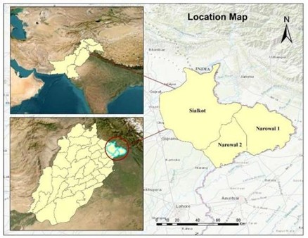
Sialkot and Narowal, Punjab · Aug 2025
Flood extent from Sentinel-1 radar, read through cloud, with CHIRPS rainfall to explain the drivers.
1,045 km² affected land mapped
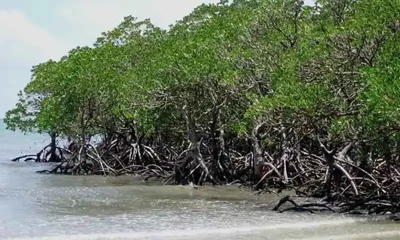
Indus Delta, Sindh · Sep 2025
Evaluation of reforestation and rehabilitation approaches in the Indus Delta with DEV~CONSULT and WWF-Pakistan.
Geospatial and ecological expertise
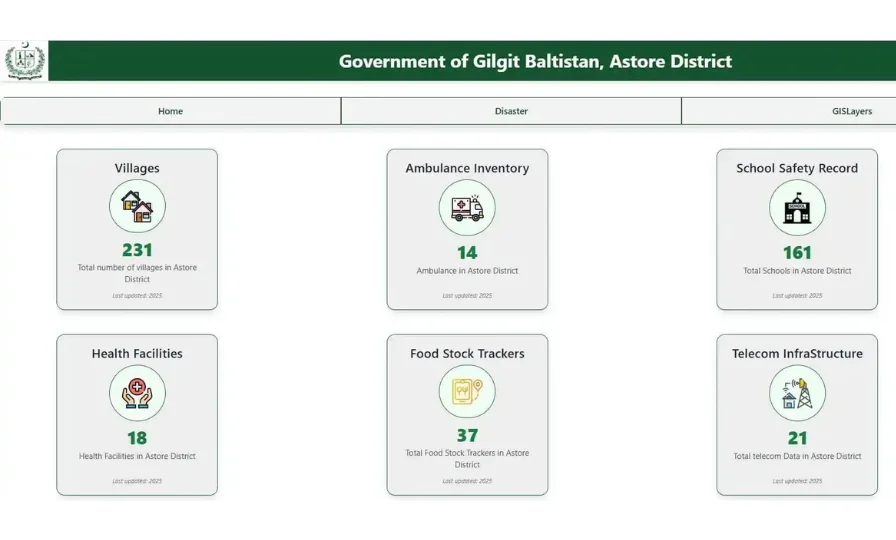
Astore, Gilgit-Baltistan
Interactive GIS portal with hazard, vulnerability and risk layers and live dashboards for the district administration.
Certificate of appreciation, Deputy Commissioner Astore
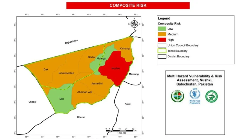
Nushki, Balochistan
Mapping of risk prone zones, communities, assets and infrastructure for the National Disaster Management Authority.
Client: NDMA
Our analysts sit next to AI and climate specialists, so a map can grow into a forecast or an early warning without a second vendor.
We survey on the ground, fly drones, process satellite data and build the web platform. One team, one handover.
Our ISO/IEC 27001 certification covers GIS solutions, drone surveys, cadastral mapping and ESG consulting.
Offices in Islamabad, Lahore and Gilgit, a US office in Delaware, and delivered work in Saudi Arabia.
Still unsure what you need? Tell us the problem and the area. We will suggest the simplest way to solve it.
It covers the work of getting climate and environmental evidence understood and used. That includes communication plans, policy briefs, reports, maps, awareness campaigns, media materials and stakeholder consultations. For longer advisory and training programs, see our advisory, communication and capacity building service.
A general agency often writes the message first and looks for data later. We start from the data. Our communication team works with the GIS, remote sensing and climate analysts who produced the findings, so maps are drawn correctly, figures are checked and every claim stays within what the evidence supports.
Yes. We read the full report, pull out the findings that matter to the decision at hand and write a short brief with clear options and the evidence behind each one. Where a map or chart explains the point faster, our cartography team prepares it. You review every draft before it goes out.
Every number in our content traces back to a source: a dataset, a report or a field record. We avoid vague claims, such as calling a project green without evidence, and we state uncertainty instead of hiding it. That protects your credibility with regulators, journalists and the communities you serve.
Since April 2026 we have been a member of UNESCO’s network on AI ethics and policy. Our alliances also include UN Global Compact, AI for Good by ITU, WWF, UN-Women and SDPI, along with universities such as Karakoram International University and the University of the Punjab. These relationships keep us close to current discussions on climate, AI and sustainability.
It depends on the outputs, the audiences and the timeline. A single policy brief, a report with maps and a multi channel campaign are priced very differently. We do not promise media coverage or policy change, since those depend on others. We do promise accurate material and a clear plan. Contact us for a scoped quote.
Send us the report, data or issue you want heard. We will suggest the audience, the format and a realistic plan.