Extreme weather has completely changed the world over the past decade. It has become the ‘new normal.’ Along with inflation, we experienced 58 disasters last year that crossed the billion-dollar mark. In total, the world lost over $320 billion to devastating weather, which is a 40% increase from the last decade. Extreme weather killed 25,000 people in 2025, with Los Angeles wildfires breaking records to become the most expensive in history. Last year’s deadliest billion-dollar disaster was the Texas Hill Country flash flood, killing 135 people in one night.
Unfortunately, no weather event this devastating is truly random, nor are they caused by natural events. Given sufficient evidence, climate change affects the severity and deadliness of most natural disasters. With rapid technological advances, we can now implement measures to save lives. In the most extreme weather year on record, the data extracted and provided in this document is more than actionable. There is a true opportunity to make big-loss-to-little-cost changes at a community level that could affect entire nations.
What Is Extreme Weather, and Why Has It Become So Much Worse?
Extreme weather refers to weather events that depart significantly from historical norms in intensity, frequency, duration, or geographic reach. This includes the hottest heatwaves, the wettest floods, the driest droughts, and the most destructive storms the world has ever recorded.
We are in the first instance of the baseline of the climate being changed by the release of greenhouse gases. Earth’s atmosphere is now warmer, more humid, and more energetic than at any time in the past 125,000 years.
The Physics Behind the Chaos: Why Every Degree of Warming Matters
According to the IPCC’s Sixth Report, each 1°C of warming increases atmospheric moisture by about 7%. This is more moisture that can contribute to stronger rainfall and storms that can cause more intense flooding. It can also cause more intense and faster storms. Warmer oceans cause fuel and faster hurricane formation (which is similar to the formation of storms). Hotter, drier conditions are now driving megafires, with many regions already in drought.
2024 was the hottest year ever recorded, approximately 1.5°C above pre-industrial levels. 2025 was the third hottest. These are not anomalies. They are a trajectory, and every fraction of a degree creates real consequences. Understanding how remote sensing services using advanced satellite technology track atmospheric moisture, sea surface temperatures, and land surface heat in real time explains why today’s extreme weather intelligence is more urgently needed than ever.

Attribution Science: Now We Can Prove Climate Change’s Fingerprint on Each Disaster
Extreme event attribution, a key scientific advance, measures how climate change alters a disaster’s likelihood or severity. Carbon Brief’s database of over 600 studies shows 74% of all studied events were made worse by climate change. Climate change intensified the June 2025 England heatwave by 2–4°C, strengthened Hurricane Melissa by 10 mph, and worsened the drought before the Texas floods.
These are forensic reconstructions of events that already happened. They directly inform how we invest in climate resilience and adaptation strategies going forward.
The Alarming Numbers: What Extreme Weather Cost the World in 2024 and 2025
Behind every figure in this section is a destroyed home, a failed harvest, a community that will spend the next decade rebuilding. The numbers are staggering, but they represent something far heavier than money
2024: 58 Billion-Dollar Disasters, $320 Billion in Losses
Yale Climate Connections confirmed that 2024 produced 58 billion-dollar weather disasters globally, the second-highest total ever recorded. Munich Re reported total natural disaster losses of USD 320 billion, of which USD 140 billion was insured. Weather catastrophes drove 93% of overall losses and 97% of insured losses.
The year’s defining events included:
- Hurricanes Helene and Milton — the two most destructive US disasters of 2024. Helene alone caused USD 56 billion in total losses. Attribution research confirmed that climate change directly caused 44–45% of both storms’ economic damages
- China’s summer flooding — USD 31 billion in losses, tied for China’s second-costliest weather disaster on record
- Severe convective storms across the US — USD 57 billion in losses, making 2024 the second-costliest thunderstorm year ever recorded
- Canada recorded its highest disaster losses since 1980, USD 10 billion total.
A climate risk adaptation and early warning system, one delivering real-time, community-level risk intelligence before hazards strike, would have materially reduced both the human and economic toll across all of these events.
2025: Record Wildfires, Deadly Floods, and 25,000 Heat Deaths
2025 broke records across every category. The Los Angeles Palisades and Eaton fires became the costliest wildfires ever recorded globally, with combined damages of $65 billion. According to Aon’s 2026 Climate and Catastrophe Insight report, extreme heat killed at least 25,000 people worldwide. Severe convective storms generated $61 billion in insured losses, the third-highest annual total in history.
Hurricane Melissa struck Jamaica with 185 mph winds, causing $8.8 billion in losses. In H1 2025 alone, global insured disaster losses hit $81 billion, the highest first-half total ever recorded. The Texas Hill Country flash floods of July 2025 killed over 135 people in a single night. Scientists call this “hydroclimate whiplash”, the same climate change that deepens droughts also intensifies the floods that follow.
The Hidden Toll: Indirect Economic Losses Nobody Talks About
Including indirect losses and disruptions reveals a much higher true annual cost than direct damage alone. A 151% increase in reported economic losses was recorded between 1998 and 2017. Across 104 countries, ‘invisible’ smaller disasters caused 68% of losses, largely borne by low-income households and local governments.
Six Deadly Types of Extreme Weather Intensifying Right Now

As the climate shifts beyond its natural limits, the disasters we once called rare are becoming routine.
Heatwaves, The Silent Mass Killer Getting Deadlier Every Year
Heatwaves kill more people than any other extreme weather event, often invisibly through heatstroke and organ failure. Over 60,000 people died from extreme heat in Europe in summer 2022 alone. In 2025, heat claimed at least 25,000 lives globally. According to the IPCC AR6, heatwaves that once occurred every 50 years now occur 5 times per decade at 1.5°C of warming, and 14 times per decade at 2°C.
Cities amplify this through the heat island effect, running 5–7°C hotter than surrounding areas. Only 13.1% of urban residents in high-risk countries own air conditioning. Climate resilience strategies, such as urban heat mapping, cooling centres, and green infrastructure, reduce heat mortality but require investment before, not after, heatwaves.
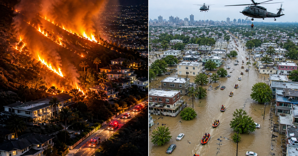
Flash Floods

Flooding is becoming the costliest type of extreme weather worldwide. As the Earth’s temperature rises by 1°F, the atmosphere can retain about 4% more moisture, worsening rain and flooding. The frequency of compound flooding is increasing with the rise of storm surge and high river flows.
The 2025 Texas floods killed over 135 people, while many in South and Southeast Asia suffered flood losses due to a lack of insurance. Millions had no way to cope with financial loss due to insurance gaps. As they face massive amounts of rainfall, GIS services become useful to help assess good evacuation routes.
Wildfires
In the past five years, five of the ten deadliest wildfires have occurred, and wildfire seasons are lengthening worldwide. Fire weather is becoming more intense and widespread, and tensions are increasing. Climate Central states that these conditions cause fires more often than in the past.
The 2025 Los Angeles wildfires show how drought and Santa Ana winds can turn a single ignition into a $65 billion catastrophe. What was once a regional fire season has become a year-round global fire threat. AI research in Nature Communications shows that machine learning can predict wildfire dynamics and megafire intensification beyond traditional models. Real-time vision AI models are playing a growing role in early fire detection and spread prediction.
Clean energy solutions that reduce the fossil fuel emissions driving climate change are the fundamental long-term answer to worsening fire weather, because without rapid decarbonisation, every other wildfire management strategy fights against an accelerating headwind. Meanwhile, real-time satellite detection of fire spread is giving communities the lead time that saves lives.
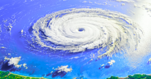
Tropical Cyclones
Warmer oceans are making tropical cyclones intensify faster and maintain strength farther poleward than historical patterns. Attribution science has confirmed that climate change strengthened Hurricane Melissa’s wind speed by approximately 10 mph. In 2024, tropical cyclones contributed USD 135 billion to total global disaster losses, the single largest category.
Rapid intensification, when storm winds increase by 35 mph in 24 hours, is becoming more common as sea surface temperatures rise. This compresses the warning time available to coastal communities and makes evacuation planning more difficult. AI-powered predictive modelling trained on evolving sea surface temperatures and atmospheric data, these models extend cyclone forecast lead times, giving communities critical evacuation hours.
Droughts
Drought is extreme weather’s least-covered category, and potentially its most consequential for long-term civilisational stability. Between 2000 and 2024, drought caused average annual losses of USD 40 billion globally. In recent years, Syria, Iraq, and Iran have faced severe drought, with Iranian officials suggesting in November 2025 that Tehran may need to be relocated.
A World Weather Attribution study found these conditions would not have occurred without human-caused climate change. Aon projects that 54% of global coffee crops face drought exposure risk by 2050. Smart agriculture technology that uses satellite-based soil moisture monitoring and AI-driven irrigation management. It is one of the most powerful and immediately deployable tools for helping farming communities adapt to intensifying drought cycles.
Compound Events
A major concern in climate science is the increasing frequency of compound events, where multiple hazards occur together or in quick succession, amplifying their impacts beyond single-event models.
The IPCC AR6 confirms with high confidence that concurrent heatwaves and droughts are becoming more frequent and will increase further with warming.
Fire climate, the compound of warm, dry, and windy conditions, is growing in more than one area concurrently. Compound flooding, combining hurricane surge, excessive rainfall, and river flooding, is growing as sea levels rise. The 2025 Texas floods were a compound event, where drought-hardened soils were overwhelmed by extreme rainfall exceeding drainage capacity.
Geospatial data production that models compound risk scenarios, not just individual hazards in isolation, is now the minimum standard for credible extreme weather risk assessment. Compound hazard maps are increasingly the difference between a risk that is managed and one that is catastrophic.
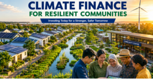
The Powerful Benefits of Acting on Extreme Weather Now
Preparing for extreme weather used to feel like an expense. New data is reframing it as the smartest investment a government, or a community, can make
Early Warning Systems Return $4–$36 for Every $1 Invested.
The single most cost-effective investment in extreme weather preparedness is a multi-hazard early warning system. The World Meteorological Organisation documents returns of $4–$36 in avoided losses for every dollar invested in early warning infrastructure. Half the world’s countries still lack adequate multi-hazard early warning systems, with the largest gaps in high-risk regions.
A 24-hour warning of an approaching extreme weather event reduces subsequent damage by up to 30%. Mobile-based warning systems combined with community-level response planning are already saving lives at scale in Bangladesh, the Philippines, and Cuba. The technology investment is modest. The return in lives and avoided losses is enormous. Understanding how climate intelligence platforms are powering the next generation of early warning systems explains why this investment is increasingly within reach of even resource-limited governments and institutions.
Resilient Infrastructure Protects Economies and Lives Simultaneously
Infrastructure designed for future extreme weather, rather than historical conditions, is the most durable form of climate adaptation. Every dollar invested in resilient infrastructure before an extreme weather event saves an average of $6 in avoided damages. Mapping, cartography, and spatial visualisation tools model infrastructure vulnerability against future extreme weather. They help engineers choose resilient designs from the start. This avoids costly rebuilding after disasters.
Data-Driven Adaptation Keeps Communities Functioning Under Pressure
Communities with strong climate data infrastructure and early warning systems consistently achieve better outcomes in extreme weather events. They evacuate earlier, respond faster, allocate resources more precisely, and recover more quickly.
The research is detailed: even actionable forecasts can fail if not communicated properly. Despite four-day advance predictions of Mediterranean storm Daniel’s landfall, inadequate communication contributed to catastrophic casualties in Libya. Floods killed over 200 people each in Germany (2021) and Spain (2024), despite modern meteorological systems, due to failures in warning communication. Risk analytics and decision intelligence platforms bridging the gap between raw weather data and community-level action are key to reducing extreme weather mortality.
Proven Strategies That Are Already Reducing Extreme Weather Impacts
The solutions are not waiting to be invented. They are already deployed, already working, and already saving lives, in countries that chose to act before the next disaster struck.
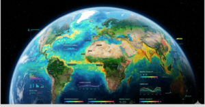
Real-Time Satellite Monitoring and Hazard Detection
The foundation of every effective extreme weather response is real-time knowledge of what is developing, where, and at what intensity. Satellite-based remote sensing and image analytics now provide continuous, global-scale monitoring of every extreme weather type, from atmospheric moisture anomalies that precede extreme rainfall to sea surface temperature patterns driving rapid cyclone intensification to land surface heat signatures identifying urban heat islands before a heatwave peaks.
A review of 8,642 studies confirms this. AI-driven satellite forecasting and flood prediction are the two leading research areas in extreme weather science today. Real-time satellite data is no longer a scientific luxury; it is an operational infrastructure for extreme weather management.
Predictive AI Modelling for Smarter, Faster Risk Management
Five principal research themes have emerged from the AI-for-extreme-weather literature: forecasting and prediction; flood prediction and risk assessment; drought monitoring and agricultural risk; wildfire detection and modelling; and heatwave prediction. Across all five areas, machine learning and deep learning now dominate, outperforming traditional physics-based models in lead time, accuracy, and spatial resolution.
AI GIS mapping services combine satellite-derived hazard data with granular vulnerability analysis to produce integrated risk maps that allow extreme weather managers to see, before any storm or flood arrives, exactly where their highest-priority interventions should be concentrated. This integration of spatial data with AI represents the operational frontier of extreme weather risk management.
Climate-Smart Agriculture and Resilient Land Use Planning
Agriculture is highly exposed to extreme weather, but it also has powerful adaptation tools now available. Data-driven high-yield agricultural solutions using satellite soil moisture monitoring. AI irrigation scheduling and precision weather forecasting help farmers adjust planting, irrigation, and harvesting in real time.” .
Smart real estate development and zoning optimisation that uses geospatial analysis to direct development away from flood-prone, fire-prone, and heat-amplifying locations is one of the highest-leverage upstream interventions available. Decisions made today about where buildings are located will determine extreme weather losses for the next 50 years.
Urban Heat Resilience and Green Infrastructure
Cities are on the front line of extreme heat risk. Automated urban management solutions, integrating real-time temperature monitoring, heat island mapping, green corridors, and adaptive building codes, enable climate-responsive cities that reduce heat mortality.
Green infrastructure like urban forests, green roofs, permeable pavements, and wetlands also reduces heat, flooding, and pollution. It is the most multifunctional extreme weather adaptation investment available to city governments, delivering co-benefits across every hazard type simultaneously.
How AI and Geospatial Intelligence Are Transforming Extreme Weather Response
We used to wait for floods to arrive before calling for help. Today, a satellite and a machine learning model can tell you exactly where the water will be, three days before it gets there.
From Reactive to Predictive
For most of human history, extreme weather management was reactive; we responded after disasters struck. Today, satellite monitoring, machine learning, and geospatial analytics have made genuinely predictive management possible. Climate intelligence platforms fusing AI with real-time environmental data extend warning lead times, improve pre-event resource positioning, and reduce response time from days to hours.
This is not simply a technical upgrade. This is a fundamental shift that, at scale, could break the compounding cycle of losses, making extreme weather an existential threat to billions.
Research published in Nature Communications emphasises that the most urgent challenge is not the AI models themselves, but ensuring their outputs are transparent enough to trust and communicated effectively enough to trigger community action. Advisory and capacity-building services that help governments translate AI-generated risk intelligence into real preparedness actions are as critical as the technology itself.
The Platforms and Products Making Extreme Weather Survivable
A comprehensive suite of AI-driven geospatial products is bringing this predictive intelligence within reach of governments, NGOs, communities, and the private sector at every scale:
- Real-time extreme weather dashboards integrating live satellite imagery, meteorological data, and historical hazard records into a single operational picture for emergency managers and local authorities
- Multi-hazard vulnerability maps combining population exposure data, infrastructure inventories, and socioeconomic vulnerability layers, identifying the communities most at risk from every category of extreme weather simultaneously
- Compound event modelling tools that assess the probability and impact of simultaneous or cascading hazard scenarios, filling one of the most critical gaps in current extreme weather risk assessment
- An AI-powered mobile geospatial platform that puts real-time extreme weather intelligence directly into the hands of field responders, community coordinators, and local officials, offline-capable and designed for the high-pressure, resource-constrained environments in which extreme weather decisions must be made
- Geo parcel mapping tools that identify which specific land parcels are in high-risk zones, supporting evacuation planning, post-disaster damage assessment, and resilient land use planning
- The MHVRA Muzaffarabad platform, a live, operational multi-hazard vulnerability and risk assessment system deployed in one of the world’s most disaster-exposed regions, demonstrates integrated real-time extreme weather risk intelligence at project scale.
These tools are supported by a full services infrastructure: spatial databases and Web GIS systems integrating data across agencies; GIS consultancy building institutional spatial capability; on-premise AI deployment for government environments with data sovereignty requirements; and environmental sustainability services that help organisations measure and reduce the emissions driving the extreme weather they are managing.
Explore our full AI-powered geospatial intelligence solutions platform and browse climate and weather projects, including multi-hazard vulnerability assessments in Pakistan’s most disaster-exposed northern regions, Indus Delta flood risk and mangrove conservation work, and large-scale geospatial mapping supporting community-level resilience planning.
What You Can Do, From Personal Preparedness to Policy Advocacy

Extreme weather is a collective challenge, and every level of action changes outcomes. Here is how to make your contribution count:
As an individual or household:
- Know your specific extreme weather risks, check the latest geospatial climate data, and expert insights to understand exactly what your area faces and how risk is trending
- Build a 72-hour emergency kit: 4 litres of water per person per day, food, medications, critical documents, a battery-powered radio, and a fully charged power bank
- Know your evacuation routes before you need them under stress, and check on elderly neighbours when heat warnings are issued
- Register for official local early warning alerts and follow them without hesitation when issued
- Reduce your carbon footprint actively; every tonne of CO₂ not emitted is a real, measurable reduction in the severity of future extreme weather events
As a business or organisation:
- Commission an extreme weather risk assessment using AI-powered risk analytics to identify your highest-priority operational and supply chain vulnerabilities before the next event strikes
- Integrate ESG consulting to measure and disclose your climate exposure, increasingly required by institutional investors, insurers, and government procurement processes.
- Develop and test a business continuity plan that explicitly addresses your most likely extreme weather scenarios, including cascading grid and supply chain disruption.
- Invest in renewable energy, globally, 70% of the increase in electricity demand in 2024 was met by renewables. The economics are compelling. The climate co-benefits are decisive.
As a policymaker or government official:

- Mandate the geospatial data production of multi-hazard risk maps for every municipality and make them publicly accessible. The communities most at risk are consistently those least able to commission their own assessments.
- Prioritise early warning system investment as a first-order budget item; the return of $4–$36 per dollar invested is unmatched by any other extreme weather expenditure.
- Enforce risk-informed zoning using mapping and spatial visualisation tools that make hazard zone data legally actionable for planners and developers.
- Follow weather policy developments and climate intelligence updates to align national strategy with the latest evidence and evolving international frameworks.
The most important shift any individual, business, or institution can make is from treating extreme weather as an unpredictable shock to treating it as a manageable, data-driven risk. The science is unambiguous. The tools are operational. The returns on investment are extraordinary. What we need now is the collective decision to use them, at the speed and scale that 25,000 annual heat deaths demand.
Conclusion
Extreme weather is not something we need to worry about – it’s here. In 2024, 58 billion-dollar disasters have resulted in $320 billion of damage. Fires, heatwaves, and flash floods are all increasing faster than ever with each tenth of a degree of global warming.
But there are solutions. For every $1 we spend on early warning systems, we save $4-$36. Resilient infrastructure saves $6 for every dollar spent. Artificial intelligence is extending warning lead times from hours to days, and geospatial systems enable real-time risk management at all scales.
We are already moving from reactive to predictive climate response in communities that see the value of doing so. The technology exists. Will we use it fast and fairly enough?
Take action today, discover how AI-powered geospatial and climate intelligence is making extreme weather survivable for communities and governments worldwide. Reach out now to lead the shift from climate chaos to climate resilience.
FAQs
1. What is extreme weather, and why is it getting worse?
Heatwaves, floods, wildfires, cyclones, and droughts are becoming more severe as climate change warms the atmosphere. Carbon Brief’s analysis of 600+ studies shows 74% of extreme events were worsened or made more likely by human activity.
2. How much did extreme weather cost in 2024 and 2025?
In 2024, natural disasters caused $320 billion in global losses, nearly 40% above the decade average. In 2025, the LA wildfires alone caused $65 billion in damage, extreme heat killed 25,000 people, and first-half insured losses hit a record $81 billion.
3. What are the most dangerous types of extreme weather?
Heatwaves are the deadliest, floods cause the greatest economic damage, wildfires generate the fastest-growing losses, and compound events are the most destructive overall.
4. How does climate change cause extreme weather? For every 1°C of warming, the atmosphere holds 7% more moisture, intensifying rainfall and flooding. Warmer oceans fuel faster hurricanes. Higher temperatures drive drought and megafires. Climate change made the 2025 England heatwave 2–4°C hotter and strengthened Hurricane Melissa’s winds by 10 mph.
5. What is the most cost-effective way to reduce losses?
Early warning systems pay back between $4-36. Disaster damages can be reduced by 30% with a 24-hour warning. Sturdy infrastructure pays off at 6:1.
6. How does AI help manage extreme weather?
AI can predict floods, droughts, wildfires, and heatwaves more accurately than traditional models, enabling governments to shift from reactive to proactive risk management.
7. Who is most vulnerable?
The burden is the most relevant in low- and middle-income countries. Women, the elderly, and people in poverty face the highest risks due to unequal access to early warnings, cooling, and financial recovery support.