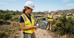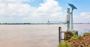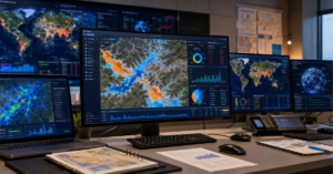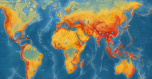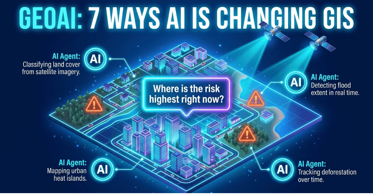
GeoAI is helping address the growing challenge of analyzing Earth-observation data at scale. Floods are among the most frequent and costly natural hazards worldwide, while growing data volumes are making conventional geospatial workflows harder to scale.
GeoAI, or geospatial artificial intelligence, combines machine learning and deep learning with geographic information systems to analyze satellite imagery, sensor data, and other location-based information. It is increasingly used for climate resilience, disaster response, land cover mapping, and smarter infrastructure planning.
In this guide, you’ll learn 7 ways AI is changing GIS, how GeoAI works, how it differs from conventional GIS, and what emerging technologies such as geospatial foundation models could mean for the future of geospatial analysis.
| Quick Answer: What is GeoAI? GeoAI, or geospatial artificial intelligence, is the application of machine learning and deep learning to location-based data, such as satellite imagery, GPS records, and sensor feeds. It helps organizations analyze geographic patterns and support decisions in areas like urban planning, agriculture, disaster management, and climate risk, often faster than conventional GIS methods alone. |
What Is GeoAI?
GeoAI stands for geospatial artificial intelligence. It combines AI techniques, mainly machine learning and deep learning, with geographic information systems and spatial data.
Instead of relying only on human analysts, GeoAI can automate tasks such as flood-boundary mapping and land-cover classification. It trains models to recognize patterns across large datasets. These datasets would be difficult to process manually at the same scale and speed.
The result is faster analysis of large volumes of Earth observation data. GeoAI can help identify where a wildfire is spreading or where a coastline is eroding.
How GeoAI Relates to GIS and Remote Sensing
GIS, remote sensing, and GeoAI are related but distinct fields, not a strict hierarchy. GIS is the software and database layer used to store, map, and analyze location-based data. Remote sensing refers to collecting information about Earth’s surface using satellites, drones, or aircraft.
GeoAI applies AI methods, including machine learning and deep learning, to data from both fields. AI applied to geospatial remote-sensing problems is commonly considered part of the broader GeoAI landscape. In practice, GeoAI can draw on GIS databases, remote sensing imagery, or both.
Why GeoAI Matters Now
Three forces have converged to make GeoAI increasingly important in 2026. Earth observation satellites now generate very large daily volumes of imagery. Cloud computing has made the processing power needed for deep learning more affordable. And climate volatility has made timely geospatial intelligence a matter of public safety rather than a research exercise. GeoAI-assisted workflows can significantly accelerate flood-damage assessment by automating parts of the image analysis and mapping process.
How GeoAI Works: Machine Learning and AI in GIS
GeoAI works by combining AI models with geospatial data to detect patterns, make predictions, and turn complex location-based information into actionable insights.
Machine Learning and Deep Learning in GIS
At its core, GeoAI applies two main types of AI in GIS workflows. Machine learning models learn statistical relationships between inputs and outputs. Inputs can include elevation, rainfall, and soil type. Outputs may include flood likelihood or other risk indicators.
Deep learning, particularly convolutional neural networks, is useful for image-heavy tasks. These include land-cover classification and building detection from satellite imagery. Many supervised approaches require substantial labeled geospatial data for reliable training. However, newer self-supervised and transfer-learning methods are reducing this dependency.
Satellite Imagery AI and Computer Vision
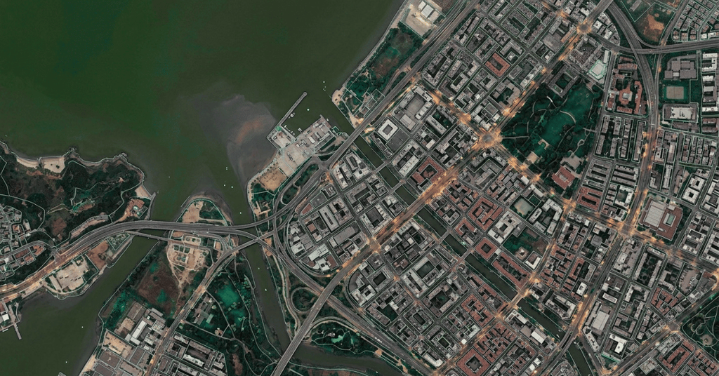
Computer vision models scan satellite and drone imagery to detect features such as roads, crop boundaries, flooded areas, and damaged buildings.
Modern satellite imagery AI systems can process multispectral and synthetic aperture radar (SAR) data. SAR is especially valuable because it can capture images through clouds and in darkness. This makes SAR useful during disaster response. Optical imagery may be unavailable when cloud cover or poor visibility limits observations.
Data Fusion: Combining Multiple Geospatial Data Sources
GeoAI systems rarely rely on a single data source. Data fusion combines satellite imagery, IoT sensor readings, weather models, demographic records, and historical disaster data into one unified model. This allows AI-powered climate risk platforms to indicate not just where flooding may occur, but which specific buildings, roads, and populations are most exposed. Predictive modeling and AI development work of this kind is typically what turns fused geospatial data into a usable, decision-ready output.
The GeoAI Workflow, Step by Step
A typical GeoAI project moves through four stages: data acquisition from satellites, drones, sensors, and open data portals; preprocessing to clean, georeference, and cloud-mask imagery; model training and validation, often using historical events as ground truth; and deployment, delivering outputs as dashboards, APIs, or alerts. Each stage requires close collaboration between data scientists and geospatial analysts, since an accurate model still needs correct spatial context to be useful.
GeoAI in Practice: From Satellite Data to Decisions
A practical GeoAI workflow can turn raw Earth-observation data into a decision-ready GIS layer. A typical process looks like this:
Satellite imagery and sensor data → preprocessing → AI model → spatial validation → GIS layer → decision dashboard
For example, in flood-risk assessment, satellite imagery can be combined with rainfall, elevation, and river data. A trained AI model can then identify areas with a higher likelihood of flooding, while GIS analysis adds information about exposed roads, buildings, and communities. The final output can be delivered as a map or dashboard that helps planners and emergency teams prioritize action.
This same workflow can support flood forecasting, landslide-risk mapping, GLOF monitoring, urban heat analysis, and agricultural monitoring. The key role of GeoAI is not simply to automate mapping, but to turn large volumes of spatial data into information that can support real-world decisions.
7 Ways AI Is Changing the World of GIS
From smarter cities and precision agriculture to disaster response and climate monitoring, GeoAI is expanding what GIS can do across industries and real-world challenges.
1. Urban Planning and Smart Cities
City planners use GeoAI applications to model traffic flow, identify urban heat islands, and simulate the impact of new infrastructure before a single shovel hits the ground. AI-powered GIS platforms can flag underused land parcels, predict where population growth will strain utilities, and help optimize public transit routes based on real movement data rather than assumptions.
2. Agriculture and Precision Farming
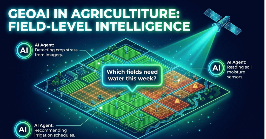
In agriculture, GeoAI combines satellite imagery with soil sensors and weather data to detect crop stress, estimate yields, and recommend irrigation schedules, often at the level of individual fields rather than entire regions.
3. Transportation and Logistics
Logistics is one of the more mature use cases for AI-powered applications. Large delivery networks combine GPS data, road networks, and AI-driven routing to shorten delivery times and cut fuel costs, with well-documented industry cases showing meaningful reductions in driven distance, fuel use, and operating costs when AI-optimized routing is deployed at scale.
4. Public Health and Epidemiology
Public health agencies apply GeoAI to track disease spread, model outbreak risk based on population density and travel patterns, and identify underserved areas that need mobile health clinics or vaccination campaigns.
5. Disaster Management
GeoAI supports disaster management by combining satellite imagery, elevation data, and historical event records to help identify areas at higher risk before floods, wildfires, and landslides strike, and to help responders assess damage more quickly once a disaster occurs.
6. Climate Risk and Environmental Monitoring
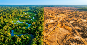
Climate scientists and environmental agencies use GeoAI to monitor deforestation, glacier retreat, coastal erosion, and air quality over time, comparing satellite scenes across years to detect change that would be difficult to track through manual review alone.
7. Insurance and Infrastructure Risk
Insurers and infrastructure planners use GeoAI to assess property and asset exposure to flooding, wildfire, and other hazards, combining hazard maps with building footprints and historical data to support underwriting and resilience planning.
| Way | Primary Use Case | Example Data Inputs |
| Urban Planning | Smart city and infrastructure planning | Traffic sensors, zoning data, satellite imagery |
| Agriculture | Precision farming and yield forecasting | Multispectral imagery, soil sensors, weather data |
| Transportation | Route optimization and fleet management | GPS data, road networks, real-time traffic |
| Public Health | Outbreak tracking and resource allocation | Population density, mobility data, case reports |
| Disaster Management | Flood, wildfire and landslide response | SAR imagery, elevation models, rainfall data |
| Climate & Environment | Monitoring change over time | Multi-year satellite archives, sensor networks |
| Insurance & Infrastructure | Property and climate risk underwriting | Flood maps, building footprints, claims history |
GeoAI for Climate Risk and Disaster Management
The value of GeoAI becomes especially clear in situations where conditions change rapidly, and decisions must be made before or during a disaster. By combining satellite imagery, weather data, terrain models, sensor feeds, and historical records, GeoAI can help turn complex geospatial data into risk maps, forecasts, and decision-support outputs.
Flood Risk Mapping and Early Warning
Flood risk assessment is a strong example of how GeoAI combines multiple datasets to support time-sensitive decisions. AI models can analyze rainfall forecasts, river levels, elevation, and historical flood patterns to identify areas with a higher likelihood of flooding. Satellite imagery can then help monitor changing water extent, while GIS analysis can identify exposed roads, buildings, and communities.
This combination can support early-warning systems by helping authorities understand where flooding may occur, how conditions are changing, and which assets or populations may be exposed. Our detailed breakdown of flood forecasting in Pakistan explores how AI-driven early-warning approaches are being applied in the region.
Wildfire and Landslide Risk Assessment
GeoAI can also combine terrain, vegetation, weather, and historical event data to assess wildfire and landslide risk. For wildfire monitoring, satellite sensors can detect changes in vegetation and thermal conditions, while AI models can help identify areas showing signs of active fire or elevated risk.
For landslides, models can analyze factors such as slope, rainfall, land cover, and soil characteristics to identify areas with greater susceptibility. In mountainous regions such as Gilgit-Baltistan, these approaches can support the assessment of landslide and glacial hazards. Our companion piece on landslide risk assessment in Pakistan explores this application in greater detail.
Climate Risk Modeling for Infrastructure and Communities
Climate risk modeling extends the same approach beyond individual disasters. GeoAI can combine hazard data with building footprints, infrastructure networks, land use, and demographic information to estimate which assets and communities may be most exposed to changing climate risks.
For insurers, infrastructure planners, and public agencies, this can provide a more detailed spatial picture of exposure and vulnerability. Rather than treating climate risk as a single regional value, GeoAI can help identify where risk is concentrated and which assets may require greater attention.
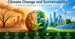
Our guide to AI in disaster management examines the wider role of AI in disaster preparedness and response, while our overview of climate change and sustainability provides broader context on climate resilience.
From Prediction to Response
The key advantage of GeoAI in disaster management is not that it can predict every event with certainty. Its value lies in connecting different sources of spatial information quickly enough to support better decisions.
A typical disaster-response workflow may look like:
Risk data → AI analysis → hazard mapping → exposure assessment → GIS visualization → early warning or response action
This makes GeoAI particularly useful when the same location needs to be monitored repeatedly as conditions change.
AI in Remote Sensing and Earth Observation
By applying AI to satellite and aerial imagery, remote sensing can move beyond simply observing Earth to detecting changes, extracting features, and generating insights at scale.
Satellite Imagery AI for Land Cover Classification
AI in remote sensing has changed how quickly land cover can be classified. Tasks that previously required extensive manual digitization can now be automated with deep learning models trained on labeled satellite scenes, reducing the time required for land-cover classification.
AI-Powered GIS Tools and Platforms
Commercial and open-source AI-powered GIS platforms now offer built-in deep learning models for feature extraction, change detection, and classification. According to Esri, GeoAI is being used to accelerate real-world understanding of business opportunities, environmental impacts, and operational risks by fusing artificial intelligence with geospatial data, science, and technology. Providers of remote sensing and image analytics apply these platforms to client projects, from land cover mapping to infrastructure monitoring.
From Data to Decisions in Disaster Response
The UN-SPIDER Regional Support Office network has documented that GeoAI now lets disaster response teams convert large volumes of satellite imagery into decision-ready layers in minutes rather than days, a capability once limited largely to the biggest national space agencies and increasingly available to offices with more modest resources.
Conventional GIS Workflows vs GeoAI-Enabled Workflows
Understanding the difference between conventional GIS and GeoAI helps clarify when rule-based spatial analysis is enough and when AI can add greater speed, prediction, and pattern-recognition capabilities.
What Separates GeoAI From Legacy GIS
Conventional GIS workflows often rely on explicit spatial queries, rules, and analyst-defined methods to map and analyze location data. GeoAI-enabled workflows combine that same geospatial foundation with machine learning and AI-based methods, allowing systems to learn patterns from data rather than depending solely on rules a person has predefined in advance.
| Aspect | Conventional GIS Workflow | GeoAI-Enabled Workflow |
| Method | Explicit spatial queries, rules, and manual digitization | Machine learning and deep learning applied to geospatial data |
| Speed at scale | Well suited to smaller, well-defined tasks | Can process large datasets more efficiently once a model is trained |
| Pattern detection | Follows predefined rules | Learns patterns directly from data |
| Best for | Static mapping, defined spatial queries | Prediction, classification, anomaly detection |
| Data needs | Structured, curated datasets | Often benefits from large, representative labeled datasets |
| Example task | Digitizing a flood boundary from one image | Estimating flood extent from rainfall and terrain data |
When to Use Each Approach
Conventional GIS remains well suited to well-defined, rule-based tasks such as zoning queries or distance calculations. GeoAI adds the most value when the task involves prediction, image classification at scale, or finding patterns across datasets too large for manual review. Many organizations use GeoAI alongside conventional GIS workflows rather than treating one as a replacement for the other.
Benefits, Challenges and Limitations of GeoAI
Benefits of GeoAI
One of the clearest benefits is speed: AI can automate repetitive geospatial tasks and reduce the time required to process large datasets. GeoAI also improves consistency, since a trained model applies the same criteria across an entire dataset, and it can surface patterns humans would likely miss in noisy, high-volume geospatial data.
Challenges and Limitations
GeoAI models are only as good as their training data, and this creates several well-documented challenges. A model trained on satellite imagery from one climate zone or region often performs poorly when applied elsewhere without retraining, a problem known as domain shift or generalization error. Spatial bias can also creep in when training data over-represents certain regions, land types, or building styles. Other practical constraints include the computing cost of training and running deep learning models. Explaining why a model produced a specific output can also be difficult.
Interoperability between GIS and AI platforms may create additional challenges. GeoAI outputs also need to be validated against ground-truth field data. Predictions should not be trusted without proper validation.
Overcoming the Challenges
Organizations can address these limitations by building diverse and regionally representative training datasets. They can also validate model outputs against ground-truth field data.
Pairing AI-enabled systems with human analysts can help identify errors that automated pipelines may miss. Many practitioners also recommend ethical AI frameworks and participatory approaches.
Local communities can help validate outputs and improve trust in GeoAI systems. However, adoption of these practices still varies across the industry.
The Future of GeoAI: Trends and Market Growth
The future of GeoAI is being shaped by rapid advances in AI, growing geospatial datasets, and increasing demand for faster, data-driven decision-making.
Market Growth Behind GeoAI
According to market research firm Global Market Insights, the global GIS software market is projected to grow from roughly 12.7 billion US dollars in 2026 to 43.4 billion US dollars by 2035. Separately, Markets and Markets projects the climate risk management market, which includes applications that can use GeoAI and other digital technologies, to grow from roughly 8.59 billion US dollars in 2026 to 19.08 billion US dollars by 2031, with the same report estimating that the geospatial and remote sensing segment could account for close to a third of that market. Figures like these vary by research firm and market definition, but together they indicate continued investment in GIS, climate-risk management, and related geospatial technologies.
Emerging Trends to Watch
Expect continued movement toward multimodal AI that fuses imagery, text, and sensor data in a single model, and edge deployment that runs GeoAI directly on drones and field devices for real-time analysis without needing a constant cloud connection.
Geospatial Foundation Models: What’s Next for GeoAI?
One of the most significant shifts underway is the rise of geospatial foundation models, large AI models pre-trained on extensive satellite and Earth-observation archives that can then be fine-tuned for a specific region or task, such as flood mapping or crop classification, typically with far less local training data than earlier approaches required. Alongside multimodal AI and edge deployment, foundation models are expected to make GeoAI more accessible to organizations that previously lacked the data or compute resources to build custom models from scratch.
Conclusion
GeoAI has moved beyond research environments into real-world decision-making. Its ability to combine AI with GIS, remote sensing, and other geospatial data is changing how organizations analyze complex location-based problems.
Three key takeaways stand out from this guide. First, GeoAI can process large volumes of geospatial data and identify patterns that may be difficult to detect through manual workflows alone. Second, AI-powered approaches are increasingly being applied to climate risk, disaster management, infrastructure planning, and environmental monitoring. Third, these systems work best when combined with skilled analysts, high-quality data, and proper validation rather than treated as black-box solutions.
As satellite constellations expand and AI models become more capable, including emerging geospatial foundation models, GeoAI will continue to evolve. These technologies can help organizations move from simply collecting geospatial data to generating insights that support faster and more informed decisions.
If your organization is exploring AI-powered GIS, climate risk modeling, or disaster early-warning systems, AI Geo Navigators can help turn geospatial data into practical solutions. Get in touch to start the conversation.
FAQs
What is the difference between GeoAI and geospatial AI?
GeoAI and geospatial AI are generally used as synonyms for the same field: the application of artificial intelligence to location-based data and geographic problems. Some practitioners use geospatial AI more broadly to cover AI applied to any spatial data, while GeoAI is often used specifically within the GIS and remote sensing community, but in practice the two terms describe the same discipline.
What industries use GeoAI?
Disaster management, climate risk and insurance, agriculture, urban planning, transportation, and public health are among the industries where GeoAI applications have matured fastest, largely because each depends on processing large volumes of location-based data quickly and accurately.
Can GeoAI predict natural disasters?
GeoAI cannot predict disasters with certainty, but it can support more timely and data-driven early-warning systems. By combining rainfall, terrain, and historical event data, AI for disaster management can help flag areas at higher risk before a flood, wildfire, or landslide occurs, giving communities more time to prepare and respond.
What data does GeoAI need to work?
GeoAI typically needs satellite or drone imagery, elevation and terrain models, historical event records, and ideally, ground-truth field data to validate accuracy. The quality and regional relevance of this training data directly affect how reliable the model’s outputs will be.
Is GeoAI expensive to implement?
Costs vary widely. Cloud-based AI-powered GIS platforms have lowered the barrier to entry significantly, but building a custom AI-enabled system still requires investment in skilled data scientists, quality training data, and ongoing model validation, which smaller organizations often outsource to specialized geospatial firms.
What are geospatial foundation models?
Geospatial foundation models are large AI models pre-trained on broad satellite and Earth-observation datasets, then fine-tuned for specific tasks such as flood mapping, crop monitoring, or building detection. Because they start from a strong general understanding of geospatial imagery, they typically need less task-specific training data than models built entirely from scratch.