| Quick Answer: GLOF Gilgit-Baltistan risk is among the highest in Pakistan: the region is home to over 7,000 glaciers on its own. Across Gilgit-Baltistan and Khyber Pakhtunkhwa combined, glacier retreat has formed more than 3,000 glacial lakes, of which 33 are rated hazardous by Pakistan’s Ministry of Climate Change and the UNDP GLOF-II project. Those two provinces together account for roughly 7.1 million people living within reach of GLOF risk. |
GLOF Gilgit-Baltistan risk is shaped by geography: the region sits at the meeting point of the Hindu Kush, Karakoram, and Himalayan ranges, making it one of the most heavily glaciated areas outside the polar ice caps. For a full explanation of how these floods form, their causes, and how they are monitored using GIS and satellite data, see our GLOF causes and GIS monitoring guide. This page focuses specifically on why Gilgit-Baltistan is uniquely exposed, what has already happened here, and what is being done about it.
Why GLOF Gilgit-Baltistan Risk Is So High
GLOF Gilgit-Baltistan exposure comes from a combination of geography and climate. The region alone is home to more than 7,000 glaciers. As those glaciers retreat, glacial lakes form and expand; across Gilgit-Baltistan and Khyber Pakhtunkhwa combined, more than 3,000 such lakes have now formed, and 33 have been formally assessed as hazardous by Pakistan’s Ministry of Climate Change and the UNDP-backed GLOF-II project.
Most communities in GB sit close to glacier-fed valleys, on the only viable flat land for agriculture and settlement. That proximity, combined with unstable moraine dams that can fail with little warning, is what makes even a single glacial lake a direct threat to homes, roads, and farmland downstream.
GLOF Gilgit-Baltistan: What Causes These Floods
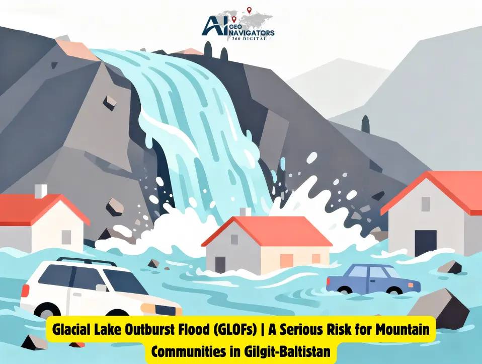
GLOF Gilgit-Baltistan events result from a combination of glacier change, unstable glacial lakes, and sudden natural triggers. Understanding these causes is important because a glacial lake can remain stable for years, but it can become dangerous when its natural dam weakens or is suddenly disturbed.
Rapid Glacier Melting and Lake Formation
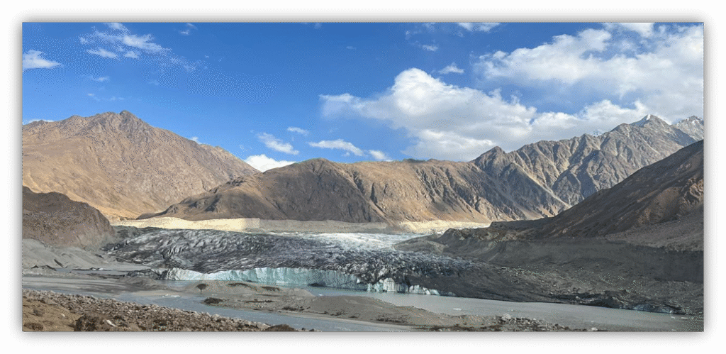
Rising temperatures are accelerating glacier melt across much of Gilgit-Baltistan. As glaciers retreat, increasing amounts of meltwater collect in depressions near glacier fronts, forming new glacial lakes or causing existing lakes to expand. Larger lakes hold greater volumes of water, increasing the potential impact if their natural dams fail.
Weak and Unstable Moraine Dams
Many glacial lakes are held back by natural dams made of loose rocks, soil, and glacial sediments known as moraines. Unlike engineered dams, these structures can be unstable and may weaken as water levels rise or as meltwater erodes the surrounding material. If the dam suddenly collapses, a large volume of water can rush downstream as a GLOF.
Ice Avalanches and Landslides
Ice avalanches and landslides from steep mountain slopes can fall directly into glacial lakes. The sudden displacement of water can generate large waves that overtop or damage the moraine dam. In a region as steep and geologically active as Gilgit-Baltistan, these events can act as sudden triggers for GLOFs.
Overtopping and Internal Erosion
A moraine dam can also fail when rising lake water flows over its crest, gradually eroding the loose material. Internal erosion, sometimes called piping, can occur when water seeps through weak sections of the dam and creates channels inside it. As these channels grow, the dam can become increasingly unstable and eventually collapse.
Earthquakes and Other Natural Triggers
Gilgit-Baltistan is located in a seismically active mountain region. Earthquakes can destabilize steep slopes, trigger landslides or rockfalls, and weaken already unstable moraine dams. These disturbances can cause sudden waves or structural failure that release lake water downstream.
Climate Change as an Overarching Driver
Climate change does not cause every GLOF directly, but it can increase the underlying conditions that make glacial lakes more hazardous. Rising temperatures, changing snowfall patterns, and glacier retreat can contribute to the formation and expansion of glacial lakes, while extreme weather and other natural triggers can further increase the likelihood of sudden lake drainage. In Gilgit-Baltistan, these interacting factors make continuous monitoring and early warning systems essential for reducing GLOF Gilgit-Baltistan risk.
Glacial Lakes and High-Risk Areas in Gilgit-Baltistan
GLOF Gilgit-Baltistan monitoring relies heavily on the Gilgit and Indus river basins, which contain the largest concentration of glacial lakes in the region. Pakistan’s national space agency, SUPARCO, monitors potentially dangerous glacial lakes by satellite on behalf of the Ministry of Climate Change’s GLOF Technical Committee, working with the Gilgit-Baltistan Disaster Management Authority (GBDMA) and WAPDA’s Glacier Monitoring and Research Centre.
This monitoring list is updated regularly as lakes expand or new ones form, a sign that GLOF risk in GB is an active, changing hazard rather than a fixed, one-time count.
Major GLOF Events in Gilgit-Baltistan
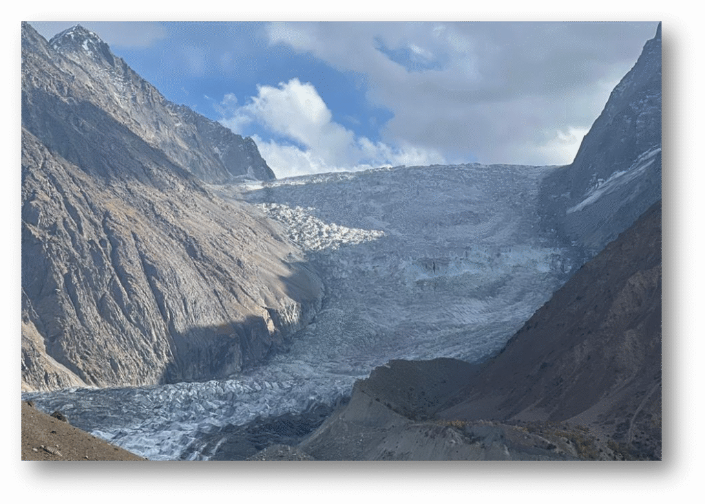
Hassanabad (2022): A GLOF from the Shisper glacier area swept away a major bridge and damaged the Karakoram Highway, cutting off downstream communities and disrupting the region’s main trade and travel route.
Shisper Glacier surge: Periodic surging of the Shisper glacier in Hunza has repeatedly created temporary ice-dammed lakes, several of which have breached and triggered flash floods with very little advance warning.
These events illustrate a recurring pattern in GB: floods that develop and travel downstream within hours, leaving little time for manual warning or evacuation without automated monitoring in place.
Socio-Economic Impacts on Mountain Communities
Most GB households depend on agriculture, livestock, and seasonal tourism. A single GLOF event can destroy a season’s crops, irrigation channels, and grazing land in minutes, pushing affected families into food insecurity that can take years to recover from.
Infrastructure damage compounds the impact. Many villages rely on a single access road or bridge; when a GLOF takes that route out, communities can be cut off from healthcare, supplies, and rescue services for extended periods. Housing built from local stone and mud offers little resistance to fast-moving debris flows.
Climate Change and Glacier Retreat in GB
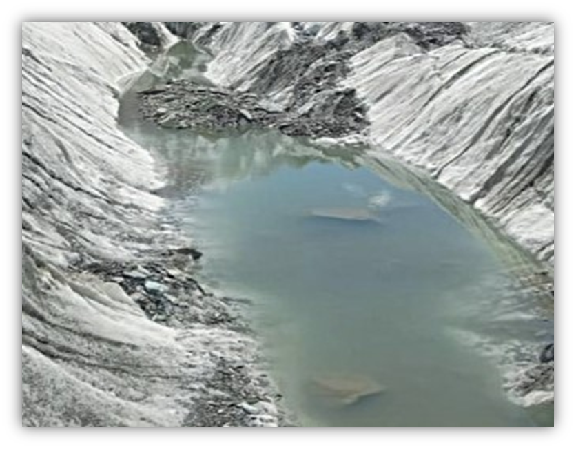
Rising temperatures, reduced winter snowfall, and more frequent heatwaves are accelerating glacier melt across most of Gilgit-Baltistan. One notable exception is the so-called “Karakoram Anomaly,” where a subset of Karakoram glaciers has shown stable or slightly positive mass balance even as neighboring ranges lose ice; researchers do not yet fully agree on why. Outside this anomaly, most small and medium glaciers in GB are retreating, feeding the continued growth of glacial lakes.
Monitoring and Early Warning for GLOF Gilgit-Baltistan
Early warning in GB combines satellite monitoring (SUPARCO), ground-based hazard assessment (GBDMA, WAPDA), and, increasingly, dedicated, internationally funded disaster-risk-reduction programs targeting the region’s most exposed valleys directly.
The GLOF-II Project: How Gilgit-Baltistan Is Being Protected
The most significant on-the-ground response to GLOF Gilgit-Baltistan risk is the Scaling-Up of Glacial Lake Outburst Floods Risk Reduction in Northern Pakistan project known as GLOF-II. Led by Pakistan’s Ministry of Climate Change with UNDP support and roughly US$37 million in Green Climate Fund financing, the project targets 24 of the most climate-vulnerable valleys across Gilgit-Baltistan and Khyber Pakhtunkhwa: 16 valleys in GB alone and 8 in KP.
GLOF-II builds directly on lessons from an earlier phase, GLOF-I, and focuses on three things: giving communities the tools to identify and manage their own GLOF risk, strengthening the public disaster-management services that respond when a flood hits, and building physical infrastructure that reduces damage before it happens.
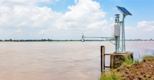
On the ground, this has meant installing automated early warning systems and weather stations engineered for high-mountain terrain, training Pakistan Meteorological Department and disaster-management staff on operating them, and establishing 23 Community-Based Disaster Risk Management Centres that act as local hubs for preparedness planning. The project has also built 60 evacuation shelters, locally called “safe havens,” in high-risk valleys, and carried out slope-stabilization work using bio-engineering techniques across roughly 760 hectares to reduce landslide and erosion risk around unstable lakes.
Livelihood support runs alongside the engineering work: the project includes training and water-efficient farming support aimed at households whose land sits in flood-exposed valleys, with a specific focus on women’s participation in food-security and livelihood programs. Combined, these measures represent one of the largest coordinated GLOF risk-reduction efforts anywhere in the Hindu Kush-Karakoram-Himalaya region, and they directly target the same 33 hazard-rated lakes referenced by the Ministry of Climate Change.
What Can Be Done to Reduce GLOF Risk
- Continue expanding satellite and ground-sensor monitoring, and early warning system coverage, to all 33 hazard-rated lakes; GLOF-II currently covers 24 valleys, leaving room to extend coverage further.
- Maintain and scale the Community-Based Disaster Risk Management Centre model beyond its current 23 sites.
- Build climate-resilient road and bridge infrastructure that can withstand debris-flow impact, particularly along the Karakoram Highway corridor.
- Support livelihood diversification so a single flood event does not eliminate a household’s entire income source.
- Continue slope-stabilization and lake-lowering engineering interventions at the most unstable sites.
Conclusion
GLOF Gilgit-Baltistan risk comes down to glacier density, unstable moraine-dammed lakes, and exposed downstream communities, a combination that makes this one of Pakistan’s highest-risk regions for glacial lake outburst floods. The GLOF-II project’s early warning systems and community risk-management centres are the clearest sign of progress so far, but with 33 hazard-rated lakes across the region and only 24 valleys currently covered, expanding that coverage remains the priority. For the broader mechanics of how GLOFs form and are monitored using GIS, see our complete GLOF guide.
FAQs
How many glacial lakes make up the GLOF Gilgit-Baltistan risk?
Gilgit-Baltistan and Khyber Pakhtunkhwa combined have more than 3,000 glacial lakes (about 3,044, per UNDP GLOF-II project data), of which 33 are formally rated as hazardous by Pakistan’s Ministry of Climate Change.
What was the Hassanabad GLOF?
A 2022 glacial lake outburst flood originating near the Shisper glacier that destroyed a major bridge and damaged the Karakoram Highway, cutting off downstream communities in Hunza.
Who monitors GLOF risk in Gilgit-Baltistan?
SUPARCO (Pakistan’s national space agency) monitors potentially dangerous glacial lakes by satellite, working with the Gilgit-Baltistan Disaster Management Authority and WAPDA’s Glacier Monitoring and Research Centre, alongside the UNDP-backed GLOF-II early warning project.
What is the GLOF-II project?
A Ministry of Climate Change and UNDP initiative, funded by roughly US$37 million from the Green Climate Fund, that installs early warning systems and builds disaster-preparedness infrastructure across 24 of the most GLOF-vulnerable valleys in Gilgit-Baltistan and Khyber Pakhtunkhwa.
Why is Gilgit-Baltistan more at risk than other regions?
GB alone holds over 7,000 glaciers and combines a very high glacial-lake density with communities and infrastructure concentrated in narrow downstream valleys; the same terrain that makes farming possible also puts settlements directly in the path of potential floods.
Sources
UNDP Pakistan, GLOF-II Project overview and press releases (2018-2026); Pakistan Ministry of Climate Change figures as reported by UNDP and Pamir Times (August 2026); SUPARCO satellite monitoring updates (2026).