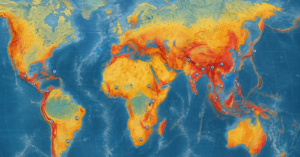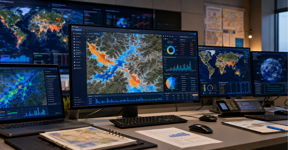
| AI in disaster management uses machine learning, computer vision, satellite analytics, GeoAI, and natural language processing to improve disaster prediction, response, and recovery. It can predict floods days in advance. It can detect wildfires within minutes and assess damage through satellite imagery. AI also helps emergency teams allocate resources more efficiently. Faster warnings give communities more time to prepare. Accurate risk maps support better decisions. Smarter planning helps teams respond faster and reduce loss of life. |
AI uses machine learning, computer vision, satellite analytics, GeoAI, and natural language processing to improve disaster prediction and response. These technologies can predict floods days in advance, detect wildfires quickly, and assess disaster damage.
As disasters become more frequent and complex, traditional disaster management tools struggle to keep pace. AI is changing this by enabling faster predictions, smarter responses, and more effective decisions that can ultimately save lives.
This article explores the key applications, benefits, challenges, and future opportunities of AI in disaster management, with a focus on practical tools for planners and policymakers.
What is AI in disaster management and why is it so urgently needed now?

AI in disaster management covers a wide range of technologies. These include machine learning, deep learning, computer vision, and natural language processing. Each tool plays a role at a different stage of a disaster. Together, they speed up predictions, sharpen responses, improve damage assessments, and target recovery efforts more precisely.
This urgency is real. Conventional forecasting and response systems simply cannot meet the needs of the most disadvantaged communities. In fact, global disaster losses reached $320 billion for 2024 (Munich Re, 2025).
The alarming scale of global disaster losses in 2024 and 2025
These losses are extensive, and they highlight why the world urgently needs stronger preparedness and early warning systems. For example, flood disasters now strike more than twice as often as they did in 2000. Climate change drives most of this increase (Google Research, 2024). Meanwhile, a World Bank cost-benefit analysis found something striking: upgrading hydro-meteorological early warning systems in developing countries to developed-country standards could save an average of 23,000 lives every year.
On top of that, almost half of all developing countries still lack even basic multi-hazard early warning systems. This is exactly the gap that AI in disaster management is being deployed to fill. Therefore, adopting these technologies is no longer just a research goal. It is a global emergency response.
Understanding how the intensifying frequency of extreme weather events is driving the demand for smarter disaster tools is essential context for anyone working in this field. Simply put, the data shows the status quo is no longer acceptable.
How AI transforms the four phases of disaster management
AI in disaster management improves all four core phases of the disaster cycle:
● Preparedness: Machine learning models study historical weather, seismic, and environmental data to flag high-risk areas before disasters strike. As a result, teams can run better training simulations, pre-position resources, and communicate risks more clearly.
● Early warning: Similarly, AI-powered forecasting models can predict floods, wildfires, hurricanes, and earthquakes earlier and more accurately than traditional physics-based models. Notably, they work even in data-scarce regions.
● Response: Computer vision systems process satellite and drone imagery to assess damage in real time. At the same time, natural language processing scans social media and emergency channels to find where help is needed most. From there, AI optimizes how rescue teams and relief supplies get deployed.
● Recovery: AI analytics help prioritize infrastructure repairs, guide post-disaster needs assessments, and support longer-term climate resilience planning. Additionally, AI-powered tools speed up insurance claims and loss accounting.
Together, these capabilities mark a real turning point. In short, they are changing how the world prepares for and responds to disasters.
How is AI in disaster management revolutionizing early warning systems?
AI in disaster management is transforming early warning by bringing accurate predictions to areas that lack ground-based sensors. Google’s Flood Hub, for example, now operates in over 150 countries. It protects more than 2 billion people with a 7-day flood warning. Moreover, AI-based adaptive forecasting extends reliable weather forecasts from hours to several days. This especially benefits regions that once had little or no sensor coverage.
Google Flood Hub: protecting 2 billion people with machine learning
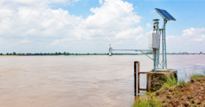
Google Flood Hub stands out as one of the most powerful examples of AI in disaster management working at global scale. It predicts river floods up to 7 days ahead, thanks to machine learning models that Google Research first released publicly in 2022. Like other flood tools, Flood Hub relies on rainfall and river data. Unlike most others, though, it learns global rainfall patterns. Moreover, it can generate flood predictions in regions with little or no local monitoring.
On March 12, 2026, Google announced the rollout of Groundsource, a new AI method that extends Flood Hub to urban flash floods. This system can now predict flash floods up to 24 hours in advance. Built on Gemini, it analyzed public disaster reports and identified more than 2.6 million historical flood events across 150-plus countries. Using this data, it built training sets for flash flood forecasting. Traditional river-gauge systems cannot track these floods well. Moreover, flash floods can strike anywhere in a city, not only near a river. As a result, communities can receive warnings before floods hit. This is especially valuable in the Global South, where flash floods can occur within six hours of heavy rain.
Remarkably, Google made Flood Hub freely available, with no paywall and no registration required. Consequently, the communities that need it most can access life-saving forecasts, regardless of financial resources.
AI wildfire detection and earthquake prediction breakthroughs
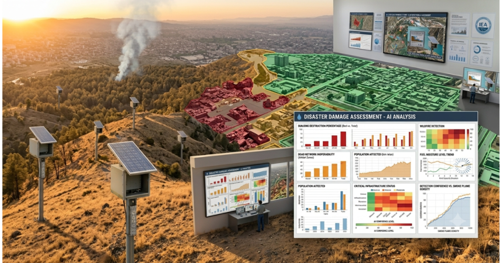
Beyond flooding, AI in disaster management is also delivering breakthroughs across other hazards. For wildfires, AI systems now combine smart camera networks, satellite imagery, and environmental sensors. Together, these tools can detect fires at their earliest stage, often before a person would even notice smoke. For instance, the ALERTCalifornia initiative runs a network of cameras paired with AI algorithms that continuously scan the horizon for early fire signs. Similarly, other AI models analyze vegetation, temperature, humidity, and terrain to build fire risk maps. These maps help agencies pre-position resources before conditions turn critical.
For earthquakes, AI is making real progress on one of science’s hardest prediction problems. Machine learning algorithms now study microseismic activity, groundwater pressure shifts, electromagnetic changes, and GPS deformation data. From these signals, they identify precursor patterns tied to larger events. Additionally, AI systems using satellite navigation data can predict tsunami wave heights more accurately after an undersea earthquake. This gives coastal communities more reliable warning time.
How satellite-based remote sensing and AI analytics are being applied to multi-hazard detection across vulnerable regions demonstrates precisely how these capabilities are being translated from research into operational practice by agencies and governments worldwide.
How does AI improve disaster response and search and rescue operations?
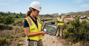
AI in disaster management is reshaping response and recovery by analyzing drone and satellite imagery alongside sensor data. Together, these tools assess damage, locate victims, and guide resource allocation. As a result, emergency teams make faster decisions than traditional, human-led approaches allow.
After Hurricanes Helene and Milton in 2024, the nonprofit GiveDirectly used a Google-designed AI tool to pinpoint areas with the highest poverty and economic distress. Within days, cash-based emergency support reached affected communities, and households received a $1,000 grant each. This stands in sharp contrast to the slower pace of traditional humanitarian response.
Computer vision and satellite imagery for real-time damage assessment

Speed matters. A key challenge in disaster response is assessing damage quickly enough to direct resources where they matter most. In the past, this meant sending human teams into dangerous or inaccessible areas. That process could take days, even weeks, of critical response time.
AI-powered computer vision has changed this. After the 2020 Beirut port explosion, AI tools rapidly analyzed satellite images and created color-coded damage maps for emergency personnel. Similarly, after the 2015 Nepal earthquake, drone imagery combined with photogrammetry software helped map damaged areas and locate survivors trapped under rubble. That effort became an early precursor to today’s AI-powered damage assessment tools, and it saved valuable time for rescue crews.
AI-powered GeoAI disaster risk prediction tools can now produce national-scale flood inundation maps within 24 hours of major rainfall. This was demonstrated during the 2022 Pakistan floods. That speed advantage over manual mapping translated directly into faster search-and-rescue operations and more targeted emergency logistics
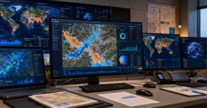
Decision support and applied GIS solutions for disaster response coordination help emergency managers combine real-time hazard data, infrastructure layers, and population vulnerability maps into a single operational dashboard. This supports faster, better-informed decisions under pressure.

AI-powered resource allocation and humanitarian logistics
Effective disaster response depends on more than finding affected areas quickly. It also depends on getting the right resources to the right places at the right time. Here too, AI in disaster management is transforming logistics through intelligent optimization.
Reinforcement learning algorithms and multi-objective optimization models now allocate emergency resources dynamically. This includes rescue personnel, medical supplies, water, and shelter materials, based on real-time needs. Moreover, AI systems can forecast resource needs, such as bottled water or shelter capacity, based on disaster severity and local population models. This lets agencies pre-position supplies before the worst impacts even arrive.
At the same time, natural language processing tools monitor emergency channels, social media, and disaster reports all at once. As a result, they spot patterns of need and distress that human operators would likely miss in the flood of incoming data. Because of this, response coordination centers now make faster, better-targeted decisions than at any point in the history of disaster management.
Risk analytics and decision intelligence services are increasingly essential for translating real-time hazard data into prioritized response recommendations, helping agencies and humanitarian organizations allocate scarce resources with greater confidence and precision.
Is your organization working to strengthen disaster preparedness using AI and geospatial intelligence? Explore the full range of risk analytics, predictive modeling, and climate tech services at AI Geo Navigators. Smarter tools lead to faster, better decisions when it matters most.
What role does GeoAI play in smarter disaster risk reduction?
GeoAI blends geospatial data with machine learning and deep learning. This combination plays a critical role in disaster risk reduction, since it makes hazard mapping faster, more accurate, and more accessible in data-scarce regions. Specifically, GeoAI combines satellite imagery, topographic data, land use information, population density layers, and climate projections. Together, these inputs produce dynamic, spatially precise risk maps that support preparedness planning, early warning, and damage assessment across every hazard type.
Predictive hazard mapping and vulnerability assessment
GeoAI is fundamentally changing how we visualize and quantify disaster risk. Traditional hazard maps were static products. Often, they were years out of date and built at resolutions too coarse for local decision-making. GeoAI, by contrast, produces dynamic, regularly updated risk layers. These capture changing exposure patterns as cities grow, land use shifts, and climate conditions evolve.
For flood risk specifically, machine learning models trained on satellite imagery and topographic data can now classify flood-prone areas down to the street level. They identify which buildings and infrastructure segments face the highest risk. They can also model inundation scenarios under different rainfall and sea level conditions. Similarly, for earthquake risk, deep learning models analyze historical seismicity patterns and soil liquefaction susceptibility. This produces granular vulnerability maps that inform building codes and infrastructure investment.
GIS-based environmental monitoring that supports real-time disaster risk tracking is one of the most powerful operational tools in this space, providing continuously updated spatial data that keeps risk assessments current rather than static.
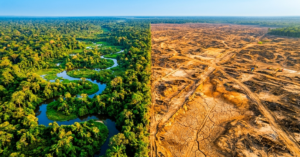
Moreover, how geospatial intelligence platforms track land cover changes that intensify disaster risk shows how environmental data layers are being integrated with hazard models to produce more accurate, contextually grounded vulnerability assessments.
How geospatial intelligence fills the dangerous data gap in developing countries
One of the most alarming constraints on effective disaster management worldwide is the severe shortage of quality hazard and exposure data. Ironically, this shortage hits hardest in the countries that face the greatest disaster risk. Many developing nations simply lack the meteorological stations, stream gauges, and ground monitoring networks that wealthier countries rely on.
Here, GeoAI is addressing the gap directly. Because satellite imagery is now available globally at increasingly fine resolution, machine learning models can generate meaningful risk assessments even where ground-based infrastructure is absent. This matters most in sub-Saharan Africa, South Asia, and parts of Latin America. In these regions, climate change is intensifying hazard exposure, yet the communities most at risk still receive the least investment in early warning infrastructure.
Geospatial data production services for disaster risk and climate assessment are closing the data gap by generating high-quality, analysis-ready spatial datasets for regions where this information has previously been unavailable, making AI-powered risk management viable even in the most data-scarce environments.
Furthermore, what the accelerating pace of disaster displacement reveals about the urgency of better risk data in vulnerable regions makes the equity case for investing in GeoAI capabilities in developing countries not just a technical argument but a moral one.
What are the most alarming challenges holding AI disaster management back?

The most alarming challenges facing AI in disaster management include data scarcity in high-need regions, algorithmic bias against marginalized communities, and a trust gap between AI systems and local emergency managers. In addition, AI systems often fail to reach vulnerable populations with actionable warnings. So despite major technical progress, these barriers still prevent many disaster-prone communities from benefiting fully.
Data scarcity, bias, and equity gaps
AI systems are only as good as the data behind them. In disaster management, this creates a dangerous and persistent inequity: the regions with the greatest disaster risk often have the least historical data for training effective models. Consequently, AI systems trained mostly on data from Europe, North America, and East Asia may perform far less well in sub-Saharan Africa, South Asia, or Small Island Developing States.
Furthermore, when historical data reflects existing social inequalities, such as under-reporting in poor or remote communities, AI models can reproduce and even amplify those biases. For example, a flood prediction model never calibrated against real flood events in an ungauged Sahel river basin may generate dangerously inaccurate warnings for the people living alongside it.
Addressing this challenge requires deliberate investment in data collection, community-level validation, and open data sharing across national and institutional lines. Still, progress is happening. Google’s Flood Hub, for instance, was specifically designed to perform well in data-scarce settings by learning global rather than local patterns. Its performance across Africa and South America has since been validated through real-world deployments.
Trust, accountability, and the last-mile problem
Technical accuracy alone does not save lives. For an AI early warning to actually protect a community, that community must receive the warning in time. It also needs the message in a language and format people understand, through channels they already trust, with enough clarity to know exactly what action to take.
This last-mile problem remains one of the most critical, and most underappreciated, challenges in AI disaster management. According to Columbia University’s National Center for Disaster Preparedness, many existing early warning systems remain reactive and fragmented. Notably, the areas most in need of effective warning systems are also the most data-scarce and hardest to reach (NCDP, 2025).
Beyond the last mile, accountability frameworks for AI in disaster contexts remain underdeveloped. For instance, when an AI system triggers a false alarm and causes an unnecessary evacuation, or fails to warn people before a deadly event, clear lines of responsibility must exist. Furthermore, the lessons from Pakistan’s El Niño disaster response demonstrate that even well-designed technical systems fail to protect communities if the human and institutional systems around them are not equally prepared.
What does the future of AI in disaster management look like through 2030?
The future of AI in disaster management through 2030 centers on three major shifts. First, anticipatory action frameworks will release pre-disaster funding before disasters strike. Second, AI early warning systems will reach more vulnerable and underserved populations worldwide. Third, large language models and multimodal AI will support day-to-day crisis management. Already, AI-based forecast models are improving weather prediction across Africa and Asia to match standards once available mainly in Europe.
Anticipatory action and pre-disaster financing
One of the most powerful, and still underused, applications of AI in disaster management is anticipatory action. This means releasing humanitarian funding and protective resources before a disaster strikes, triggered automatically once AI forecasts reach defined probability thresholds.
The World Food Programme and several major humanitarian organizations are already piloting these frameworks in flood-prone regions of Ethiopia, Bangladesh, and the Sahel. These systems use AI flood and drought forecasts to trigger pre-positioned cash transfers, seed distributions, and livestock movement support before disaster arrives. In turn, this protects livelihoods that would otherwise be destroyed.
Accordingly, AI in disaster management is shifting the field from a reactive posture to a genuinely predictive one. How AI-powered predictive modeling is being applied to anticipatory disaster risk financing represents one of the most exciting frontiers in this space, combining probabilistic hazard forecasting with automated financial disbursement mechanisms.
Where the most transformative breakthroughs are coming from
The most exciting breakthroughs in AI disaster management through 2030 are converging from several directions at once. Large language models are being built into crisis communication systems, so emergency agencies can generate accurate, localized, multi-language safety alerts at scale and speed. Meanwhile, computer vision models use high-resolution satellite and drone imagery to assess damage in near real time, so rapid damage assessment is quickly becoming a standard capability. On top of that, AI-powered Internet of Things sensors are creating real-time hazard monitoring networks across cities and watersheds, offering far more coverage than the sparse instruments used in the past.
The AI-powered climate tech platform sits at the forefront of these efforts, combining satellite analytics, machine learning hazard models, and geospatial decision support tools into one operational framework accessible to governments and humanitarian agencies worldwide.
Environmental sustainability and climate resilience planning services are increasingly incorporating AI-powered risk projections to ensure that long-term development investments are resilient to the disasters that AI systems are now predicting with growing confidence.
Comparison table: traditional vs. AI-powered disaster management
| Feature | Traditional approach | AI-powered approach |
| Flood forecast lead time | 12 to 24 hours in well-resourced regions | Up to 7 days, even in data-scarce regions |
| Damage assessment speed | Days to weeks with human field teams | Hours, using satellite imagery and computer vision |
| Warning coverage | Limited to countries with ground sensors | 150+ countries and 2 billion people (Google Flood Hub) |
| Resource allocation | Manual, experience-based decisions under pressure | AI-optimized, real-time, based on live needs data |
| Wildfire detection | Ground patrols and watchtowers | AI camera networks spot fires within minutes |
| Search and rescue targeting | Grid-based physical searches | AI drone mapping flags likely survivor locations |
| Cost of early warning | High; needs dense physical infrastructure | Lower; satellite and ML-based, infrastructure-light |
| Performance in data-scarce regions | Very limited; depends on local gauges | Much stronger; trained on global patterns |
| Anticipatory action | Rare; response usually starts after impact | Automated funding triggers based on forecast thresholds |
| Lives saved per event | Significant, but limited by response speed | Measurably higher: up to 43% fewer flood deaths |
Key takeaways
- AI in disaster management is already saving thousands of lives every year. Google Flood Hub alone protects more than 2 billion people across 150-plus countries, with flood forecasts up to seven days ahead.
- Separately, Google Research’s flood forecasting study found that AI-adaptive early warning systems can cut flood-related deaths by up to 43% and reduce economic losses by 35 to 50%, compared with systems that lack AI forecasting. Even a 12-hour lead time on flash flood warnings reduces damage by 30 to 60%.
- GeoAI tools that pair satellite imagery with machine learning are closing the dangerous data gap in developing countries. As a result, they produce actionable risk maps in regions where traditional monitoring infrastructure simply does not exist.
- The most urgent challenges include delivering AI warnings to vulnerable communities, reducing data bias against marginalized populations, and establishing clear accountability for AI-assisted decisions.
- Moreover, anticipatory action frameworks can automatically release pre-disaster funding once AI forecasts cross defined thresholds. This remains a transformative but underinvested area of disaster risk management through 2030.
Conclusion
AI in disaster management is not a future technology or a pilot program. It is already operational. It is already protecting hundreds of millions of people, and it is already measurably reducing deaths and economic losses from some of the world’s most devastating hazards. In short, the evidence is compelling, the progress is real, and the urgency is undeniable.
However, the most vulnerable communities still do not fully benefit from these capabilities. Data gaps, last-mile delivery issues, and inequality between well-resourced and data-scarce regions remain critical challenges. Therefore, closing these gaps requires better algorithms alongside sustained investment in geospatial data infrastructure, community trust, and systems that turn AI forecasts into effective action.
If your organization works on disaster preparedness, climate adaptation, or humanitarian response, and you want to understand how AI and geospatial intelligence can strengthen your capabilities, explore the full range of services at AI Geo Navigators. From satellite-based remote sensing and hazard analytics to predictive modeling and AI development, the platform delivers the spatial intelligence that effective disaster management demands.
Disasters will not wait for better tools to arrive. The time to invest in AI-powered disaster preparedness is now. Contact the AI Geo Navigators team and find out how smarter geospatial intelligence can protect the communities and systems that matter most.
FAQs
Q: How is AI currently being used in disaster management?
AI in disaster management is used across all four phases of the disaster cycle. It predicts hazards with machine learning models, delivers early warnings through platforms like Google Flood Hub, assesses damage through computer vision and satellite imagery, and optimizes resource allocation and humanitarian logistics. Today, AI-based early warning systems cover more than 150 countries and reach 2 billion people. As a result, they protect hundreds of millions who once lacked adequate flood forecasting.
Q: How much can AI reduce disaster losses?
AI-adaptive early warning flood systems cut the loss of life by up to 43%, and reduce economic loss by 35 to 50% (Google Research). Meanwhile, the World Bank estimates that upgrading early warning systems in developing nations to developed-country standards, a gap AI is actively closing, could save an average of 23,000 lives per year (World Bank, 2012). Even a 12-hour lead time for flash flood warnings delivers a 60% reduction in damage.
Q: What is GeoAI and why does it matter for disaster risk reduction?
GeoAI combines geospatial data, including satellite imagery, topographic data, and land use information, with machine learning and deep learning to produce dynamic hazard and vulnerability maps. It matters for disaster risk reduction because it generates accurate risk assessments even in data-scarce regions. Moreover, it continuously updates risk maps as conditions change and offers far greater spatial precision than traditional hazard mapping. Increasingly, GeoAI forms the foundation of early warning systems, damage assessment tools, and anticipatory action frameworks worldwide.