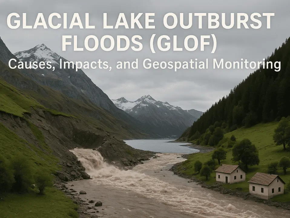
| Glacial Lake Outburst Floods (GLOF) occur when a glacial lake’s natural dam, made of ice or loose rock, suddenly collapses, releasing a massive wall of water within minutes. It’s one of the deadliest hazards in high-mountain regions like the Himalayas, Karakoram, and Andes, and it’s happening more often as glaciers melt faster than ever. GIS, Remote Sensing, and satellite monitoring help assess risks and support early warning systems. |
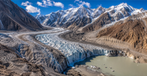
Glacial Lake Outburst Floods (GLOFs) are among the most dangerous climate-related hazards in high-mountain regions. They occur when the natural dam holding a glacial lake, typically made of loose moraine or ice, suddenly fails, releasing millions of cubic metres of water, rock, mud, and debris downstream within minutes. As climate change accelerates glacier retreat, the number and size of glacial lakes are increasing, making GLOFs more frequent and placing millions of people at risk.
What looks like a peaceful mountain lake can transform into a devastating flash flood within minutes. A glacial lake may appear calm, but its natural dam can weaken over time due to glacier melt, heavy rainfall, earthquakes, or ice and rock avalanches. Once that barrier collapses, the lake can empty rapidly, generating a powerful flood capable of destroying villages, roads, bridges, farmland, and hydropower infrastructure far downstream.
The growing threat is backed by scientific evidence. Recent regional analysis from ICIMOD’s GLOF documentation effort found that more than 7,000 people have died from GLOFs in High Mountain Asia over the past 190 years, and over 70% of those events have happened in just the last 50 years. These findings highlight that GLOF frequency and associated risks are increasing as climate change accelerates glacier retreat
Fortunately, advances in Geographic Information Systems (GIS), Remote Sensing (RS), satellite imagery, and geospatial analytics now enable scientists and governments to monitor glacial lakes, assess flood hazards, predict potential outburst events, and issue early warnings before disasters occur.
How Does a Glacial Lake Outburst Flood Actually Form?
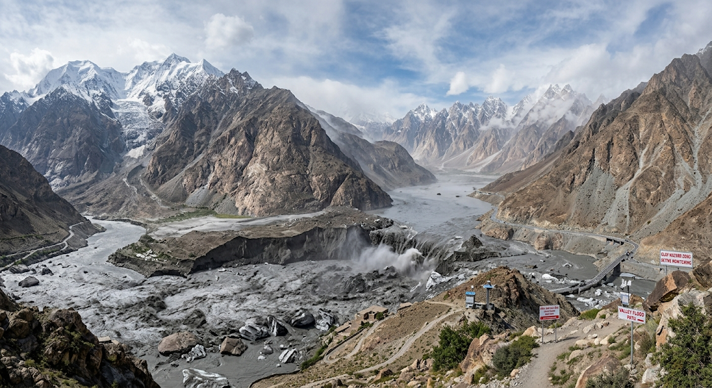
A GLOF doesn’t happen overnight. It builds in stages, usually over years, before it releases in minutes.
1. Glacier Melting
As global temperatures rise, glaciers melt faster than they can rebuild themselves through fresh snowfall. This is called glacial retreat, and it’s happening across nearly every major mountain range on Earth. The meltwater has to go somewhere, and often, it collects in low points near or beneath the glacier.
2. Water Accumulation
That meltwater builds up in a depression at the glacier’s edge, forming what’s known as a glacial lake. These lakes aren’t static. They keep growing as more ice melts, and the more water they hold, the more pressure builds against whatever is holding them back.
3. Weak Barriers
Most glacial lakes are held in place by a moraine dam, a loose pile of rock, soil, and debris left behind by the glacier, or by an ice dam. Neither is particularly strong.
● Loose composition: Moraine dams are made of loose, unpacked material that erodes easily under water pressure.
● Ice dams melt too: If the dam itself is made of ice, rising temperatures melt it from within, weakening it over time.
● Internal erosion: Water sometimes flows underneath or through the dam, quietly eroding it from the inside where no one can see it happening.
● Seismic activity: Earthquakes and ground tremors can crack or shift a dam that was already unstable.
4. The Trigger
Eventually, something pushes the dam past its breaking point: heavy rainfall, an earthquake, or a chunk of ice or rock crashing into the lake. Once that barrier fails, the entire lake empties in a rush. That sudden release is the GLOF itself, and it can travel down a valley at devastating speed.s damage downstream.
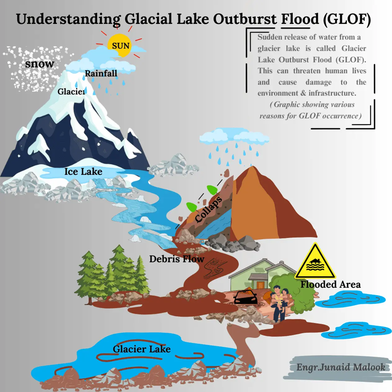
What Are the 5 Deadly Causes of a GLOF?
While the formation process explains how a glacial lake becomes dangerous, these are the specific triggers that push an unstable dam actually to fail:
1. Ice or Rock Avalanches: A large mass of rock or ice crashing into the lake displaces water violently, sending waves that overtop and breach the dam.
2. Glacier Calving: When a chunk of ice suddenly breaks away from the glacier’s front and falls into the lake, it can destabilize the dam in the same way an avalanche does.
3. Seismic Activity: Earthquakes weaken the physical structure of moraine and ice dams, sometimes causing sudden, total collapse.
4. Intense Rainfall or Rapid Snowmelt: Heavy precipitation or fast snowmelt adds volume to the lake quickly, increasing pressure on a dam that may already be unstable.
5. Subsurface Drainage: Buried ice within the moraine can melt unnoticed, creating hidden weak points that eventually give way without warning.
What Impact Does a GLOF Have on Communities?
When a GLOF hits, it hits fast, and the damage is rarely limited to one thing.
● Loss of life and property: Downstream communities often have minutes, not hours, to react once a dam fails.
● Infrastructure damage: Roads, bridges, irrigation channels, and hydropower plants are frequently destroyed in a single event.
● Agricultural loss: Farmland and crops are washed away, threatening food security for entire valleys.
● Environmental disruption: Rivers change course, sediment buries fertile land, and local ecosystems take years to recover.
Pakistan has already felt this firsthand. In Gilgit-Baltistan, several GLOF events in recent years have damaged villages, hydropower infrastructure, and farmland a pattern consistent with the broader climate change trends reshaping Pakistan’s glaciers and water systems, where accelerating glacial melt is placing millions of people at growing risk.
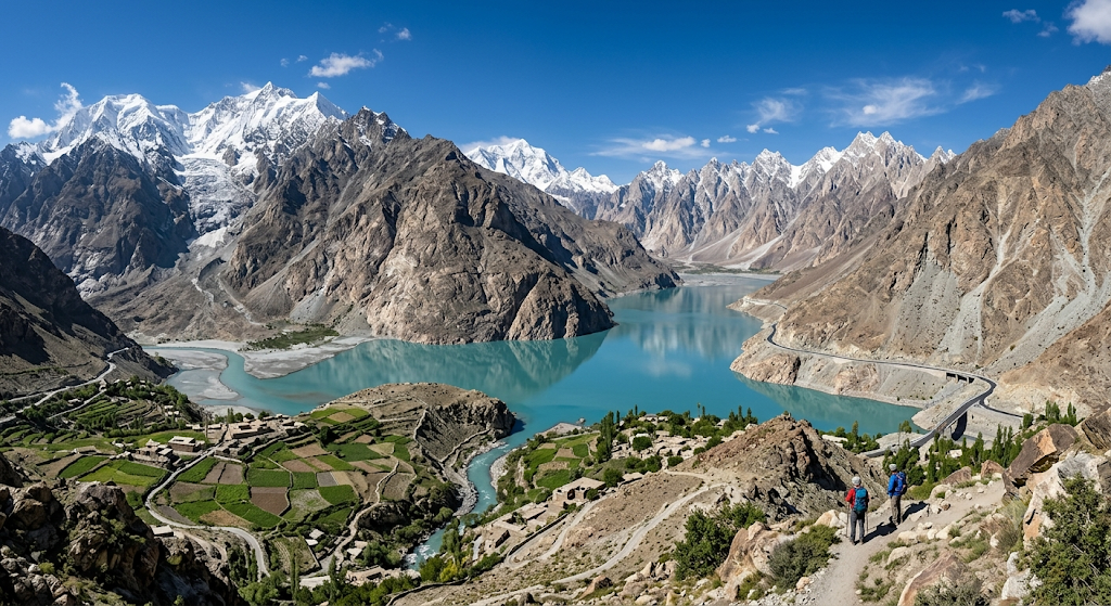
How Is GLOF Risk Monitored Using GIS and Remote Sensing?
You can’t stop a glacier from melting, but you can watch it closely enough to see trouble coming. That’s where geospatial technology comes in, combining satellite data with GIS modeling to track glacial lakes, flag rising risk, and give communities real lead time before disaster hits.
The Role of Remote Sensing in GLOF Monitoring
Satellites give scientists eyes on remote, often inaccessible mountain terrain, day after day.
● Optical imagery: Landsat and Sentinel-2 capture high-resolution images that help map glacial lakes and track how their size changes over time, useful for spotting a lake that’s growing faster than it should.
● Synthetic Aperture Radar (SAR): Sentinel-1’s SAR technology uses radar instead of visible light, so it keeps working through cloud cover, storms, and darkness critical in mountain regions where clear skies aren’t guaranteed.
● MODIS: Provides near-daily coverage, useful for tracking flood extent across large regions quickly.
● DEMs: Digital Elevation Models map the terrain itself, showing exactly which valleys and slopes are in a flood’s likely path.
The Role of GIS in GLOF Monitoring
Remote sensing collects the data. GIS is what turns that data into decisions.
● Hazard zonation: Combining elevation, rainfall, and river network data to flag the highest-risk areas.
● Flood simulation models: Predicting how far and how deep a potential flood could reach.
● Risk mapping: Overlaying glacial lake data with population and infrastructure maps to identify exactly who and what is exposed.
● Decision support systems: Turning all of the above into clear, actionable maps for policymakers and disaster response teams.
This is exactly the kind of work AI Geo Navigators specializes in: combining AI-powered geospatial intelligence with hydrological modeling to help governments and organizations move from reactive disaster response to proactive risk management. Explore how our decision support and applied GIS solutions are helping mountain communities prepare before disasterS strike, not just respond after.
A separate 30-year satellite survey from NASA’s Sea Level Change Portal found that the total volume of glacial lakes worldwide has grown by roughly 50% since 1990: a clear sign that this risk is expanding globally, not just in South Asia.
Glacial melt doesn’t just create GLOF risk upstream; it also determines how much water reaches the rivers that hundreds of millions of people depend on downstream. In Pakistan, that means the Indus River system, whose flows are governed by the Indus Water Treaty, making glacier and GLOF monitoring directly relevant to long-term water security planning, not just disaster response.
Traditional GLOF Monitoring vs GIS-Based Monitoring
| Traditional Monitoring | GIS & Remote Sensing Monitoring |
| Field surveys | Satellite imagery and GIS analysis |
| Limited coverage | Large-area monitoring |
| Periodic inspections | Continuous monitoring |
| Time-consuming | Near real-time updates |
| Difficult in remote terrain | Ideal for inaccessible mountain regions |
| Reactive approach | Early warning and proactive risk assessment |
Why Are GLOFs Increasing Due to Climate Change?
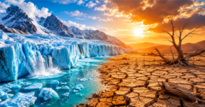
Climate change is a major factor behind the increasing risk of Glacial Lake Outburst Floods (GLOFs). Rising temperatures are accelerating glacier loss, expanding glacial lakes, and weakening natural barriers that hold back millions of cubic metres of water.
Accelerating Glacier Retreat
Rising temperatures are causing glaciers in regions like the Himalayas, Karakoram, and Andes to retreat faster. As glaciers shrink, meltwater collects in newly formed or expanding glacial lakes, increasing pressure on unstable natural dams.
Warming Temperatures and Increased Meltwater
Higher temperatures accelerate glacier melting and increase water flow into glacial lakes. The growing water pressure can weaken moraine and ice dams, making sudden failures more likely.
Expansion of Glacial Lakes
Many glacial lakes are expanding due to continuous glacier retreat. Larger lakes store more water, increasing the potential severity of a GLOF. GIS and remote sensing help track lake growth and identify high-risk areas.
Extreme Rainfall and Changing Weather Patterns
Climate change is increasing extreme rainfall events in mountain regions. Heavy precipitation can rapidly raise lake levels, trigger landslides, and destabilize already fragile glacial dams.
Unstable Moraine Dams
Most glacial lakes are held back by moraine dams made of loose rock, sand, and debris. These natural barriers can weaken due to erosion, rising water pressure, melting buried ice, and seismic activity, increasing the risk of sudden collapse.
Understanding how climate change drives GLOF risk highlights the importance of GIS-based monitoring, satellite observations, and early warning systems to protect vulnerable mountain communities.
Mitigation and Adaptation Strategies
● Engineering interventions: Controlled drainage, siphoning systems, and reinforcing moraine dams before they fail.
● Community-based preparedness: Awareness campaigns, evacuation drills, and community-installed early warning systems.
● Policy integration: Building GLOF risk into national disaster management plans and climate adaptation strategies.
● Geospatial risk assessments: Ongoing satellite monitoring and GIS-based mapping to track vulnerable lakes as conditions change.
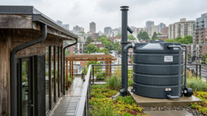
Downstream communities can also reduce their exposure by managing water more resiliently at the household and community level. Approaches like rainwater harvesting as a water scarcity solution help buffer against the unpredictable water availability that glacial melt and GLOF-driven flooding create, giving communities a more stable water supply even as upstream conditions shift.
Conclusion
Glacial Lake Outburst Floods are a growing threat in high-mountain regions, intensified by climate change and accelerating glacier retreat. But this isn’t a risk we’re facing blind. The combination of GIS and remote sensing has fundamentally changed how early we can spot danger, how accurately we can map it, and how much warning time communities get before a lake breaks loose.
By pairing geospatial technology with community preparedness and stronger policy frameworks, it’s possible to reduce the devastating impact of GLOFs and build real resilience in the mountain communities most exposed to this risk. Explore AI Geo Navigators’ full range of geospatial and mapping services to see how data-driven monitoring is helping protect vulnerable communities
FAQs
Q: What exactly causes a GLOF?
A GLOF happens when the natural dam holding a glacial lake in place, usually made of loose moraine rock or ice, suddenly fails. The five most common triggers are ice or rock avalanches, glacier calving, seismic activity, intense rainfall or snowmelt, and hidden subsurface erosion within the dam itself.
Q: How dangerous is a GLOF?
Extremely. A GLOF can release millions of cubic meters of water within minutes, traveling down a valley at high speed with enough force to destroy roads, bridges, hydropower plants, and entire villages with little to no warning.
Q: Can GLOFs be predicted?
To an extent, yes. Satellite monitoring through optical imagery, radar (SAR), and elevation data lets scientists track glacial lakes for warning signs of rapid growth, unstable dam conditions, or rising water levels and issue early warnings, sometimes days or weeks in advance.
Q: Which regions are most at risk from GLOFs?
The Hindu Kush-Karakoram-Himalaya region, including northern Pakistan, Nepal, and Bhutan, faces some of the highest GLOF risk in the world due to its dense concentration of glaciers and glacial lakes. The Andes and parts of the Alps also face significant exposure.
Q: How does GIS help in monitoring GLOF risks?
GIS helps monitor GLOF risks by combining satellite imagery, elevation data, glacier information, rainfall patterns, and population maps to identify vulnerable areas. It supports hazard mapping, flood modelling, early warning systems, and better disaster preparedness for communities living downstream.