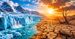
Climate intelligence is no longer a luxury; it’s a matter of survival. Every year, extreme weather events cost the world over $280 billion in economic damages, and that number keeps rising. The hard truth is this: we have more climate data than ever before, yet decision-makers still struggle to turn it into action fast enough.
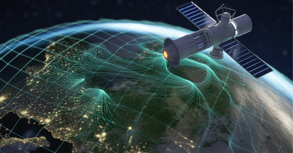
That’s exactly where AI Geo Navigators steps in and changes everything. By combining the power of artificial intelligence, GIS mapping, and remote sensing, AI Geo Navigators transform complex environmental data into clear, actionable insights. Whether you’re a government planner, a disaster response team, or a sustainability researcher, this technology is built to help you make smarter decisions, faster.
In this article, you’ll discover what climate intelligence really means, how AI Geo Navigators work, and the breakthrough benefits that are already reshaping how the world responds to climate change.
To understand how geospatial data is already helping protect our planet, explore this detailed guide:
https://aigeo360.com/gis-specialists-geospatial-data-saves-earth/
What Is Climate Intelligence, And Why It Matters More Than Ever

Climate intelligence refers to the ability to gather, analyze, and act on environmental and climate data at scale. It goes far beyond simply reading weather reports. In fact, it combines satellite imagery, sensor data, historical climate records, and predictive modeling to build a living, breathing picture of our planet’s health.
The urgency has never been greater. According to the World Meteorological Organization (WMO), climate-related disasters have increased fivefold over the past 50 years. Meanwhile, half of all countries still lack adequate early warning systems. This is a critical gap, one that costs lives every single day.
The Growing Crisis That Data Alone Cannot Solve
Here’s the problem: we are drowning in data but starving for insight. Satellites generate petabytes of imagery every day. Sensors track temperature, humidity, rainfall, and air quality across millions of locations. However, without intelligent systems to process and interpret all of that information, it remains largely useless to the people who need it most.
Traditional methods simply cannot keep up. Manual analysis is slow, expensive, and prone to human error. Furthermore, climate systems are deeply interconnected; a drought in one region can trigger food insecurity thousands of miles away. Understanding these complex relationships requires a new kind of intelligence.
How AI is Rewriting the Rules of Environmental Analysis
This is where Artificial Intelligence becomes a true game-changer. AI systems, particularly machine learning and deep learning models, can process vast datasets in minutes, identify hidden patterns, and generate highly accurate forecasts. Moreover, they improve over time as they learn from new data.
When AI is combined with geospatial tools like GIS and remote sensing, the results are transformative. Suddenly, decision-makers don’t just see data, they see the story behind it. They see which communities are at risk, where floods are likely to occur, and how land-use changes are affecting climate systems in real time.
Explore our AI & Machine Learning Services
What is AI Geo Navigators and How Does it Work?
AI Geo Navigators is a climate-intelligence and geospatial firm that specializes in converting climate and environmental data into actionable insights. The organization integrates artificial intelligence, specifically machine learning and deep learning, into GIS, remote sensing, and traditional data analytics.
Think of it as a translator between the raw language of the Earth and the clear decisions that governments, planners, and communities need to make. Every map they create, every model they build, is designed to serve one goal: helping people adapt to and mitigate the effects of climate change.
Try AI Geo GPT, Our AI-Powered Geospatial Assistant
From Raw Satellite Data to Actionable Climate Insights
The process begins with data collection. Satellites, drones, and ground-based sensors continuously feed streams of environmental information, from vegetation indices (NDVI) to soil moisture, greenhouse gas concentrations, and land surface temperature. This raw data, on its own, is overwhelming and difficult to interpret.
AI Geo Navigators’ intelligent platform processes these data streams using advanced algorithms. Deep learning models detect patterns that human analysts would miss. For example, time-series analysis using LSTM (Long Short-Term Memory) neural networks can identify the early signs of drought progression months before it becomes a visible crisis.
The result? Decision-ready insights delivered through interactive maps, dashboards, and reports that non-technical users can actually understand and act on.

The Powerful Tech Stack Behind AI Geo Navigators (GIS + ML + Remote Sensing)
The technology behind AI Geo Navigators is built on three powerful pillars:
- GIS (Geographic Information Systems): The spatial backbone. GIS allows teams to layer multiple datasets, flood zones, population density, and infrastructure maps, and visualize them together.
- Remote Sensing: The eyes from above. Satellite and drone imagery provide continuous, large-scale monitoring of the Earth’s surface without the need for physical access.
- Machine Learning & Deep Learning: The brain. AI models analyze patterns, make predictions, and automate complex tasks that would take human analysts weeks to complete.
Together, these three pillars create a system that is not only powerful but also scalable and accessible. Whether mapping a single flood-prone district or monitoring deforestation across an entire continent, the platform adapts to the scale of the challenge.
6 Breakthrough Benefits of AI Geo Navigators for Climate Intelligence
So what can this technology actually do? Let’s break down the most impactful benefits.
1. Real-Time Disaster Prediction, Save Lives Before It’s Too Late
One of the most urgent applications of climate intelligence is disaster early warning. Flooding alone results in $50 billion of economic damage each year, affecting 1.5 billion people globally. AI-powered geospatial systems can now forecast flood events up to seven days in advance, giving communities the critical time they need to evacuate and prepare.
AI Geo Navigators’ remote sensing capabilities detect changes in water levels, soil saturation, and weather patterns in real time. As a result, emergency responders receive alerts faster, resources are deployed more efficiently, and lives are saved that would otherwise be lost.
Explore MHVRA Muzaffarabad, Our Disaster Risk Tool
2. Smarter Climate Risk Mapping for Governments and Businesses
Climate risk is no longer just an environmental concern. It’s a business and governance issue. From infrastructure planning to insurance underwriting, organizations need to understand where climate risks are concentrated and how they will evolve over the next few decades.
For instance, AT&T used climate data and geospatial AI to map potential flooding risks to its US infrastructure through 2050. This kind of forward-looking analysis is now available to any organization willing to leverage geospatial intelligence. AI Geo Navigators enables governments and businesses to move from reactive crisis management to proactive risk planning.
3. Precision Agriculture: Feeding the World in a Changing Climate
Agriculture is on the front lines of climate change. Shifting rainfall patterns, rising temperatures, and increasingly unpredictable growing seasons threaten food security for billions of people. AI-driven geospatial tools are helping farmers and agricultural agencies adapt.
By analyzing drone data, satellite imagery, and weather forecasts together, AI models can detect pest outbreaks, water stress, and soil degradation in near real time. Furthermore, predictive analytics help farmers make better decisions about irrigation, planting schedules, and crop selection, reducing waste and maximizing yields even as conditions change.
4. Urban Planning Powered by Geospatial AI
Cities are growing faster than their infrastructure can handle. At the same time, climate change is intensifying heat waves, flooding, and air pollution in urban environments. Smart urban planning requires a much deeper understanding of how cities interact with their surrounding environment.
AI Geo Navigators supports urban planners by modeling land-use and land-cover (LULC) changes, predicting future sprawl, and identifying areas vulnerable to climate impacts. As a result, cities can design greener, more resilient infrastructure from the very beginning, rather than scrambling to adapt after problems appear.
5. Monitoring Deforestation and Biodiversity Loss From Space
Every minute, the world loses forests the size of a football field. Deforestation drives climate change, destroys biodiversity, and destabilizes local water cycles. Monitoring these changes across millions of square kilometers is impossible without AI-powered remote sensing.
By integrating satellite imagery with machine learning algorithms, AI Geo Navigators can detect deforestation events, track illegal land clearing, and measure biodiversity loss in near real time. Moreover, these insights feed directly into policy discussions, giving governments the evidence they need to take action.
6. Building Climate Resilience for Vulnerable Communities
Perhaps the most powerful benefit of climate intelligence is its potential to protect the world’s most vulnerable populations. Low and middle-income countries (LMICs) are often most exposed to climate risks yet have the least capacity to monitor and respond to them.
AI Geo Navigators brings cutting-edge geospatial intelligence to communities that need it most. By combining satellite data with AI analytics, the organization helps local governments and NGOs build early warning systems, design climate-resilient infrastructure, and develop data-driven adaptation strategies, even in regions with limited technical resources.
Explore ESG Carbon Emission Tool
How AI Geo Navigators Drive Best Results, Real-World Use Cases
The proof, of course, is in the results. Let’s look at how this technology is already making a difference.
Disaster Management: Faster Flood Warnings, Fewer Casualties
In flood-prone regions, the difference between life and death can come down to hours. AI Geo Navigators’ integration of remote sensing with predictive models allows disaster management teams to issue targeted, location-specific warnings well in advance. Instead of broad regional alerts that cause unnecessary panic, communities receive precise information about which areas to evacuate and when.
Furthermore, after a disaster strikes, the same tools accelerate damage assessment. AI algorithms process post-event satellite imagery to identify damaged infrastructure, flooded roads, and displaced populations, information that is critical for coordinating relief efforts efficiently.
Climate Policy: Turning Satellite Proof Into Government Action
One of the biggest challenges in climate policy is accountability. Countries make emissions reduction commitments, but tracking whether those commitments translate into real action on the ground is extremely difficult. Satellite-based climate intelligence is changing that.
By tracking greenhouse gas concentrations, land-use changes, and vegetation loss from space, AI Geo Navigators provides governments and international organizations with independent, transparent evidence of climate impact. Consequently, policy decisions are no longer based on estimates and self-reported data alone; they are grounded in observable, verifiable facts.
Challenges and the Road Ahead for Climate Intelligence AI
Despite its enormous potential, climate intelligence AI faces real challenges that must be honestly addressed.
Overcoming Data Gaps and Accessibility Barriers
Not all regions of the world have equal access to high-quality data or the technological infrastructure to process it. High costs, limited connectivity, and a shortage of trained geospatial analysts remain significant barriers, particularly in the developing world, where climate risks are often highest.
However, the trend is encouraging. Open-source platforms, freely available satellite data (such as NASA’s MERRA-2 dataset), and cloud-based AI tools are rapidly democratizing access to geospatial intelligence. Organizations like AI Geo Navigators are actively working to bridge this gap through capacity building and collaborative frameworks.
The Future: Digital Twins, Edge AI, and Hyperlocal Climate Forecasting
Looking ahead, the next frontier for climate intelligence involves digital twins, virtual replicas of real-world environments that can simulate climate scenarios in real time. Platforms like NVIDIA’s Earth-2 and the European Space Agency’s Destination Earth are already pushing these boundaries.
Simultaneously, edge AI, processing data closer to where it is collected, rather than in centralized data centers, promises to deliver faster, hyperlocal insights. Imagine a sensor network in a flood-prone valley that processes satellite data on-site and automatically triggers community alerts without needing an internet connection to a central server.
These innovations will make climate intelligence faster, cheaper, and more accessible than ever before.
Why AI Geo Navigators Stand Out in the Geospatial Intelligence Space
In a crowded field that includes global giants like Esri, Descartes Labs, and Maxar, AI Geo Navigators carve out a distinctive and important niche. What sets them apart is not just their technology, but their mission.
The organization is guided by a vision of intelligent mapping with sustainability and ethical transparency at every step. Rather than simply selling data products, they are committed to building genuine climate resilience, particularly for communities and governments that have historically been underserved by the geospatial industry.
Their integrated approach, combining GIS, remote sensing, AI, and environmental sustainability consulting, means that clients receive not just maps and models, but comprehensive, actionable intelligence that can drive real-world change.
Moreover, AI Geo Navigators operates with a clear understanding that technology alone is never enough. Human expertise, local knowledge, and collaborative frameworks are equally essential to turning data into decisions that actually protect people and the planet.
Conclusion
Climate change is the defining challenge of our time. The decisions we make today, about where to build, how to farm, which communities to protect, and how to reduce emissions, will shape the planet for generations to come.
Climate intelligence, powered by AI Geo Navigators technology, gives us the tools to make those decisions with clarity, speed, and confidence. From real-time disaster prediction to long-term climate risk mapping, geospatial AI is no longer a futuristic concept; it is a present-day necessity.
The question is not whether your organization can afford to adopt climate intelligence. The real question is whether it can afford not to.
Are you ready to harness the power of AI-driven climate intelligence? Explore what AI Geo Navigators can do for your organization, your community, and your future. The time to act is now.
FAQs
Q1: What exactly is climate intelligence?
Climate intelligence is the process of collecting, analyzing, and interpreting environmental and climate data, using tools like AI, GIS, and remote sensing, to support better decision-making. It transforms raw data from satellites, sensors, and models into clear, actionable insights for governments, businesses, and communities.
Q2: How does AI Geo Navigators use artificial intelligence for climate analysis?
AI Geo Navigators integrates machine learning and deep learning into geospatial workflows. This includes processing satellite imagery, running predictive models for flood and drought forecasting, automating land-cover classification, and generating real-time environmental monitoring dashboards.
Q3: What is GeoAI, and how is it different from regular AI?
GeoAI (Geographic Artificial Intelligence) is the application of AI to geospatial data, meaning maps, satellite images, GPS data, and spatial databases. Unlike regular AI, GeoAI is specifically designed to understand relationships in physical space, making it ideal for environmental monitoring and climate analysis.
Q4: Can AI Geo Navigators help with disaster management?
Yes. One of the most powerful applications is disaster early warning. AI-powered remote sensing can forecast floods up to 7 days in advance, identify wildfire-risk zones, and accelerate post-disaster damage assessment, helping emergency responders act more quickly and effectively.
Q5: Is climate intelligence technology accessible for developing countries?
Access is improving rapidly. Open-source platforms, freely available NASA and ESA satellite data, and cloud-based AI tools are making geospatial climate intelligence more affordable. Organizations like AI Geo Navigators actively work to build local capacity and create accessible solutions for LMICs.
Q6: What industries benefit most from AI geospatial climate intelligence?
Key beneficiaries include government and disaster management agencies, agriculture and food security organizations, urban planners and infrastructure developers, insurance and financial services, environmental NGOs, and climate policy researchers. Explore all our services here
Q7: What is the future of climate intelligence technology? The future includes digital twins of entire ecosystems, edge AI for hyperlocal forecasting, and tighter integration with SDG (Sustainable Development Goal) monitoring frameworks. As satellite constellations grow and AI models become more powerful, climate intelligence will become faster, more precise, and more widely accessible.