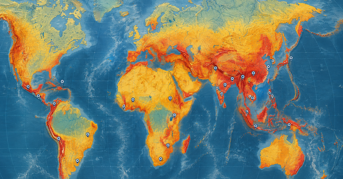
| Quick answer: Disaster risk management (DRM) is the systematic process of identifying, reducing, and preparing for disaster risks before they cause widespread harm. It combines risk assessment, prevention, preparedness, early warning systems, and resilient recovery. Modern DRM increasingly uses GeoAI, GIS, satellite data, and community-based preparedness to identify vulnerable areas and support faster decisions. The goal is to reduce deaths, economic losses, and long-term disruption rather than relying mainly on post-disaster response. |
Every disaster tends to follow the same preventable pattern: warnings go unheeded, response consumes far more funding than prevention ever received, and the same vulnerable communities pay the price again and again. Disaster risk management (DRM) exists to break that cycle. It brings together early warning systems, GeoAI risk mapping, community-based preparedness, and climate-adaptive planning so that disasters are anticipated and reduced before they strike, rather than simply cleaned up afterward.
In a single year, floods can destroy crops, earthquakes can level schools, and storms can drive millions into poverty. Disaster preparedness is now a priority, and one of the most urgent life-saving needs for governments and communities. Unfortunately, most countries still allocate more resources to disaster recovery than to prevention and risk reduction. This priority gap highlights the need for stronger risk reduction strategies.
This article outlines some of the highest-impact, innovative, and transformative DRM systems. It focuses on real-world statistics and concise, evidence-based analysis while examining critical gaps in current disaster risk management practices.
What is disaster risk management, and why does it matter so urgently right now?
It is a systematic approach to identifying, minimizing, and coping with the threats to people, economies, and ecosystems from disasters. It incorporates prevention, mitigation, readiness, response, and recovery. The main aim is to prevent a disaster and lessen the catastrophic effects if it occurs.
According to the UNDRR Global Assessment Report 2025, disaster costs now exceed $2.3 trillion annually when cascading and ecosystem losses are included. That jaw-dropping figure makes an undeniable case. Every dollar invested in disaster risk reduction returns four to seven dollars in avoided losses. Yet most nations remain dangerously trapped in a destructive cycle of debt and expensive rebuilding.
Of greater concern is that the rate of the world’s disasters is increasing. With each decade, climate change is increasingly creating more disaster-related hazards. In addition, urban growth is increasingly placing populations at risk within areas prone to flooding, earthquakes, and other hazards. The greatest burden is falling on the world’s most vulnerable populations. These communities are often least able to cope with the financial impacts of disasters, despite contributing the least to the underlying risks, particularly climate change.
The four critical pillars of disaster risk management
Disaster risk management is based on intertwined pillars, and all four pillars are required to implement effective protection mechanisms:
- Risk identification: use of community knowledge, satellite data, and GIS tools to identify hazards, exposure, and vulnerability before the disaster occurs.
- Risk reduction: includes the planning and design of flood walls, building codes that specify earthquake-resistant construction, and the planning and regulation of land use.
- Preparedness: includes the planning of evacuation and exercises, the storage of emergency supplies, and the establishment of community participation and response mechanisms.
- Recovery and reconstruction: building back stronger and smarter to improve community resilience.
These pillars can’t be separated. Furthermore, they need to be incorporated into the budgets and plans of national development, local governance, and community plans.
How Climate Change Is Increasing Disaster Risk
Climate change is a powerful, relentless risk multiplier. Rising temperatures are intensifying the frequency and severity of extreme weather events worldwide. The UNDRR 2025 Global Status Report on DRR Strategies confirms that in 2024 alone, disasters caused 45.8 million displacements. That figure is more than double the annual average of the previous decade.
Understanding the full, terrifying scale of this threat is essential for any planner or decision-maker. A deeply researched look at how extreme weather events are permanently reshaping disaster risk worldwide shows just how dramatically the risk environment has changed in recent years, and why urgent action cannot wait.
Additionally, many developing nations now face dangerous compounding stressors. These include widespread poverty, rapid urbanization in flood plains, weak governance structures, and limited access to climate and hazard data. As a result, the same flood that causes property damage in a wealthier country can destroy entire livelihoods in a vulnerable one.
What are the costs of ignoring disaster risk management?
The real costs of ignoring disaster risk management are increasing financial costs, lives lost, and increasing poverty. In the United States in 2024, there were 27 weather and climate-related disasters. They caused more than $1 billion in damage, with a total damage estimate of $182.7 billion (NOAA, 2024). For poorer nations, this is equivalent to losing in a matter of days the financial progress of several years.
Economic losses are breaking catastrophic records
Disaster losses are becoming a predictable cost of inaction, placing increasing financial pressure on governments and communities. According to the World Bank, natural disasters caused an estimated $330 billion in global economic losses in 2024, a stark reminder of how quickly climate risk is escalating, particularly for countries with limited financial buffers. The poorest nations bear the brunt of these costs. These losses also include indirect impacts, such as infrastructure destruction, reduced tax revenues, and the disruption of essential services.
The insurance protection gap is also alarmingly wide. A closer look at why prevention is always better than disaster response makes it crystal clear that most losses in developing countries go entirely uninsured, forcing governments to absorb enormous costs that crowd out vital spending on health, education, and basic development.
For context: in 2024, US natural catastrophes had more than $112 billion in insured losses (Insurance Information Institute). Natural disasters are becoming more frequent and costly in many regions, while their impacts are becoming increasingly severe. This growing risk demands a stronger focus on prevention, preparedness, and long-term resilience.
Who suffers most when disasters strike?
Disasters do not affect all communities equally, and this disparity is not coincidental. The combination of informal housing and inadequate emergency services creates the perfect storm for increased mortality in low-income and climate-vulnerable countries, including Pakistan, where a large share of the population lives in informal settlements with limited disaster response infrastructure. Women, children, the elderly, and the disabled have the greatest level of exposure to disasters coupled with the least level of recovery resources.
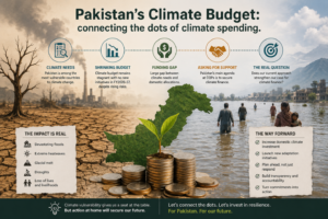
The 2022 Pakistan floods submerged one-third of the entire country in a single catastrophic event. That disaster caused over $30 billion in damage and affected 33 million people. Despite this breathtaking destruction, Pakistan contributes less than 1% of global greenhouse gas emissions. That brutal injustice sits at the heart of why communities displaced by climate and disasters deserve urgent global support.
Furthermore, the unstoppable rise of severe weather and its devastating impacts on the most fragile communities make painfully clear that inaction carries a human cost that no responsible leader can afford to ignore.
What are the most proven and powerful disaster risk management solutions?
Multi-hazard early warning systems and community-based preparedness programs are some of the most effective disaster risk management solutions. Countries that use these methods in combination record fewer deaths and have significantly decreased financial losses caused by disaster events. GeoAI tools are among the most promising risk-informed technologies for urban design and planning. These tools assess and map the risk and potential impacts of disasters in real time.
Life-saving early warning systems that actually work
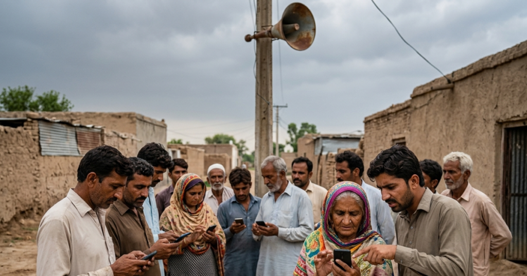
Early warning systems (EWS) are among the most effective life-saving systems available in the field of disaster risk management. Investing in a good early warning system provides time for evacuation and the securing of essential resources and infrastructure. The World Meteorological Organization states that a 24-hour advance early warning reduces damage by approximately 30%.
According to the 2024 Global Status Report on Multi-Hazard Early Warning Systems. The gap is most severe in sub-Saharan Africa and large parts of South Asia. This coverage gap is particularly concerning because it leaves millions of people without timely warnings when disasters threaten. The United Nations Secretary-General’s early warnings for all initiative strives to close the remaining gaps by the year 2027. The goal is to do this as quickly as possible
Key features of truly effective, life-saving early warning systems include:
- Real-time monitoring using satellite imagery, weather radar, and dense ground sensor networks
- Clear, accessible alerts delivered in local languages through multiple reliable channels simultaneously
- Tested community protocols that translate warnings into immediate, life-saving protective action
- Regular simulation drills so systems stay functional, trusted, and genuinely effective
Transformative community-based disaster preparedness
Community-based disaster preparedness (CBDP) empowers people with both the important knowledge of the risks and the preparedness response. These programs have proven effective in strengthening local preparedness and resilience. For example, they teach communities to identify their local hazards and maintain emergency supplies to care for their vulnerable neighbors.
Evidence consistently shows that well-designed community preparedness programs can reduce disaster-related deaths and injuries while helping communities recover faster. Communities with stronger disaster preparedness programs tend to experience fewer deaths and injuries and recover more quickly after disasters. In Bangladesh, CDP programs have established cyclone shelters that volunteer networks now use to warn others to evacuate. Today, deaths from cyclones in Bangladesh are 100 times lower than in the 1970s, and this happened despite worsening storms.
Moreover, understanding the frightening scale of what communities now face from changing weather patterns is essential for preparedness planning. How El Niño’s climate impacts are intensifying disaster risks across vulnerable regions shows precisely why seasonal forecasting data must be integrated into smarter, more anticipatory DRM strategies.
The GIS consultancy services offered by AI Geo Navigators help local governments and community planners visualize layered risk data, including flood zones, fault lines, population density, and critical infrastructure exposure. This powerful capability ensures that preparedness programs target the most vulnerable areas first, rather than spreading limited resources ineffectively.
How GeoAI and Smart Technologies Improve Disaster Risk Management
Artificial intelligence and smart technology are redefining the management of disaster risk in an unprecedented way. GeoAI can merge different types of spatial data with machine learning and deep learning. With this technology, it is now possible, within hours after the occurrence of a given rainfall, to prepare flood inundation maps, model the impact of an earthquake and the subsequent needs of a rescue operation, and assess the population that is most vulnerable and most likely to be displaced as a result of the impact of a given storm.
In the case of the 2022 Pakistan floods, the use of fully automated GeoAI and a series of other technologies enabled the rapid and timely mapping of a national-scale view of the water extents in the multiple flood events of that year. The rapid rate at which this technology achieves results far surpasses manual mapping methods and significantly reduces the time and resources of search and rescue operations.
The AI-powered climate tech platform using GIS and machine learning allows disaster managers and planners to toggle flood hazard, elevation, land use, precipitation, and population vulnerability layers for any target region. This kind of accessible, real-time intelligence is closing the dangerous gap between global risk data and local decision-making.
Furthermore, predictive modeling and AI development services are enabling governments and humanitarian agencies to shift from reactive emergency scrambling toward genuinely anticipatory action that protects lives before disasters strike. The risk analytics and decision intelligence services turn complex hazard datasets into clear, actionable guidance for planners and policymakers who need answers fast.
Ready to strengthen your organization’s disaster resilience with smart geospatial intelligence? Explore AI-powered hazard mapping, risk analytics, and climate tech tools at AI Geo Navigators. Smarter decisions start with better data, and better data starts here.
How does the Sendai Framework guide global disaster risk reduction?
The Sendai Framework for Disaster Risk Reduction (2015-2030) governs DRR as the world’s principal international accord. It creates seven global objectives, which include the decrease of disaster-related deaths and economic loss, and the creation of national DRR strategies by a greater number of member states. By 2025, over 100 states had developed these strategies, although goals have been met with high variability in the quality and depth of implementation.
Remarkable progress has been made, and critical gaps remain
The Sendai Framework also marks the first truly global shift from prevention of costly disaster responses to smart disaster prevention. Countries that have aligned local policies, programs, and national budgets to the framework’s targets are showing a measurable decline in disaster-related deaths.
The UNDRR 2025 midterm review found that implementation frequently stalls at the national level and rarely reaches the local communities most at risk. Many nations commit to overly optimistic plans that are comprised of empty words and offer no budgets, no laws that can be enforced, and no monitoring systems. The disconnection between these policies and the reality on the ground represents a perilous state in global DRM.
The review emphasized a vitally urgent gap. For risk information to be useful, especially where it matters most, at the community level, it needs to be standardized, accessible, open-source, and genuinely comparable across different regions.
Smart, risk-informed development in real-world practice
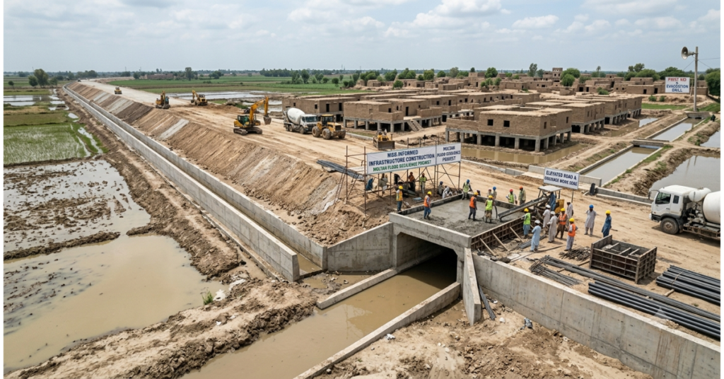
The World Bank provides a practical example of risk-informed development through its integration of disaster risk management into infrastructure financing, urban planning, and social protection programs, especially in the drastic changes they’re making by incorporating DRM in their infrastructure loans, urban planning, and even social safety nets in the multitude of nations where they operate.
An excellent example of this development approach is designing road infrastructure in flood-risk regions using elevated and fully drained road systems to boost regional connectivity while simultaneously cutting future disaster impact mitigation costs.
Environmental sustainability consulting further supports risk-informed development by embedding long-term ecological thinking into planning processes, ensuring that growth today does not create catastrophic vulnerabilities tomorrow.
What role does climate change adaptation play in disaster risk management?
Climate change adaptation and disaster risk management are inseparable. Adaptation to the changing climate means reducing the risk of exposure to the potential climate impacts and protecting vulnerable populations from climate-induced disasters. It also means creating systems that are adaptable and flexible to repeated climate impacts. For countries that integrate national adaptation plans with disaster risk management strategies, the benefits are improved, and the costs are reduced.
Nature-Based Solutions for Disaster Risk Reduction
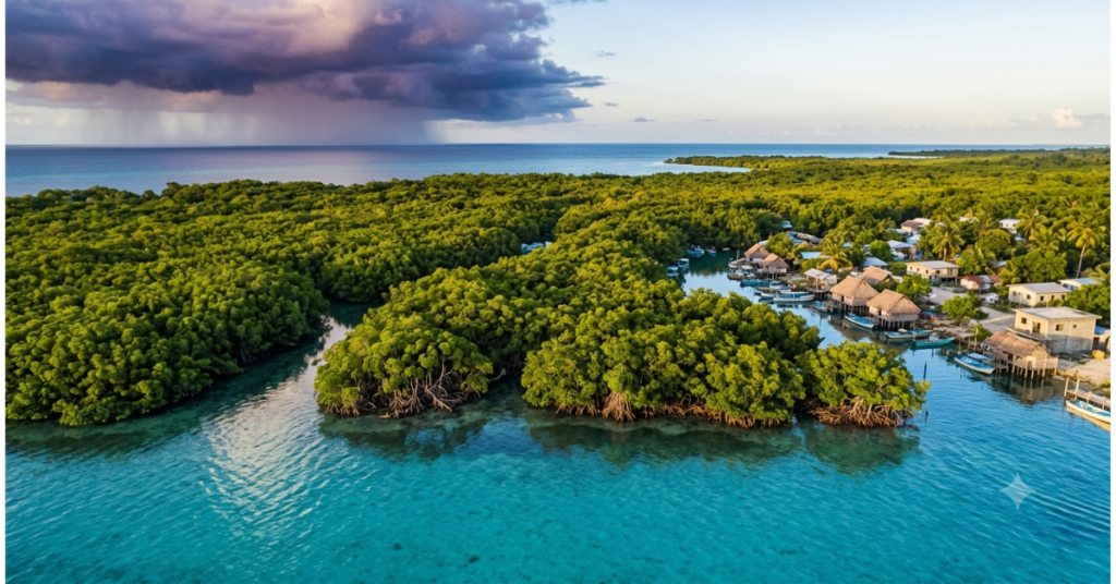
In the context of disaster risk reduction, nature-based solutions (NbS) are a proven large-scale risk-reduction approach that uses healthy ecosystems. The development of healthy forest ecosystems leads to a reduction in landslides. Developed wetland ecosystems can absorb large volumes of damaging floodwaters. Mangrove forests can reduce the impact of cyclone-driven storm surges along vulnerable coastlines. Urban ecosystems can diminish the intensity of life-threatening heat and flooding.
As noted in the UNDRR GAR 2025, smarter investment in NbS “can break the devastating cycle of disaster, debt, un-insurability and humanitarian crisis.” Moreover, NbS is one of the few approaches to disaster risk reduction that offer so many co-benefits, such as biodiversity, improved water quality, and carbon sequestration. Sadly, the current investment levels are making no progress. Less than 3% of global adaptation financing has been spent on nature-based solutions. This is a striking disconnect between their value and proven efficacy and supporting funding, which is one of the greatest risks in global climate and disaster policy.
The staggering scale of climate-driven risks is increasingly evident in the growing frequency and intensity of disasters associated with global warming and climate change mean for disaster frequency and intensity. The data is sobering, and it demands bold, immediate action from every government and institution.
Linking DRM with climate finance for real, lasting impact
There is an urgent need to strengthen the connection between climate finance and disaster risk management. Currently, disaster relief funding is many times greater than funding for disaster prevention, and the savings from prevention greatly surpass the costs. It is estimated that for every dollar spent on disaster risk reduction, $4 to $7 will be saved in subsequent recovery efforts. This funding should be impossible to ignore; however, funding is still insufficient.
For the most vulnerable countries, accessing climate finance for DRM remains an enormous, frustrating challenge. Small island developing states and least-developed countries bear deeply disproportionate disaster burdens despite contributing virtually nothing to global emissions. Remote sensing and image analytics services help bridge the critical data gap that too often prevents these nations from accessing international adaptation funding by generating the credible, evidence-based risk assessments that donors and financial institutions require.
Climate finance for resilient communities is not an abstract policy debate. As one important analysis makes clear, it is the lifeline that millions of people across the most vulnerable regions are urgently, desperately waiting for right now.
How can the most vulnerable communities build real, lasting disaster resilience?
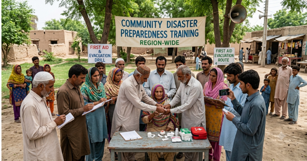
Vulnerable communities build genuine, lasting disaster resilience through strong local leadership, community-level risk awareness, inclusive planning, and sustained government support. Evidence consistently shows that communities with active disaster preparedness plans, trained local responders, and reliable connections to early warning networks suffer fewer casualties and recover faster after disasters.
Local governance and transformative community leadership
Effective disaster risk management must be deeply, genuinely local. National frameworks and international funding matter enormously, but the first responders to any disaster are always community members themselves. Therefore, investing in local government capacity, including training officials, funding community response teams, and formally embedding community plans into official DRM systems, pays outsized dividends over time.
The most successful community resilience programs share revealing common features: strong community ownership over the entire process, transparent decision-making, inclusive participation by historically marginalized groups, and sustained funding over multiple years rather than damaging one-off grants. Top-down programs that ignore local knowledge and social structures consistently fail to take root or deliver lasting protection.
Decision support and applied GIS solutions are now making it far easier for local governments to incorporate complex spatial risk data into preparedness planning, turning sophisticated geospatial information into clear, immediately actionable guidance for local decision-makers.
Gender and inclusion in disaster preparedness
Disasters do not affect everyone equally, and that deadly inequality is no accident. Women are statistically more likely to die in disasters in societies where gender inequality restricts their mobility, access to warning information, and economic independence. However, when meaningfully included in planning and leadership roles, women consistently prove to be extraordinarily powerful agents of disaster risk reduction.
Research from the ADB’s 2024-2030 Disaster Risk Management Action Plan confirms that promoting women as DRM champions and building genuinely gender-responsive programs leads to more effective and more equitable outcomes for entire communities.
Additionally, the intensifying El Niño crisis in Pakistan demonstrates how climate-driven hazards compound existing vulnerabilities and demand both technical solutions and inclusive community approaches working in tandem.
GIS-based environmental monitoring further supports inclusive, evidence-based resilience building by giving communities and local governments access to real-time environmental data that was previously available only to well-resourced national agencies.
Comparison table: reactive vs. proactive disaster risk management
Here’s how reactive and proactive disaster risk management compare across cost, community role, technology, and long-term outcomes:
| Feature | Reactive approach | Proactive DRM approach |
| Focus | Emergency response after the event | Prevention, preparedness, and risk reduction |
| Cost timing | High costs after disaster strikes | Lower upfront investment, massive long-term savings |
| Return on investment | Very low; losses already incurred | $4 for every $1 invested (World Bank) |
| Community role | Passive recipients of aid | Active participants in planning and response |
| Climate integration | Minimal or none | Central to all planning and investment decisions |
| Technology use | Post-event damage assessment only | GeoAI, early warning, real-time risk mapping |
| Equity outcomes | Vulnerable groups are most severely harmed | Inclusive planning reduces disparity in disaster impact |
| Recovery speed | Slower; no pre-designed recovery systems | Faster; recovery plans exist before disasters strike |
| Long-term resilience | Repeated cycles of destruction | Steadily growing community and institutional capacity |
Key takeaways
- Disaster risk management reduces losses, saves lives, and protects hard-won development gains, but only when prevention receives equal priority and funding to respond.
- Early warning systems and community-based preparedness are among the most powerful, cost-effective investments available, yet approximately half the world still lacks adequate multi-hazard warning coverage.
- GeoAI tools are revolutionizing how governments, communities, and humanitarian agencies predict, map, and respond to disaster risk in real time, faster and smarter than ever before.
- The Sendai Framework provides a proven global roadmap, but implementation must genuinely reach local communities to deliver transformative, life-saving impact.
- Climate change and disaster risk management are completely inseparable. Nature-based solutions and dedicated climate finance must scale up rapidly and decisively to meet the escalating global disaster burden.
Conclusion
Disaster risk management is not about preventing every disaster. It is about ensuring that when disasters strike, and they inevitably will- communities are prepared, critical systems hold, and recovery is swift rather than agonizing and generational. The evidence is unambiguous: investing in prevention is smarter, far cheaper, and infinitely more humane than waiting for catastrophe to force action.
The solutions are proven, available, and ready to scale right now. Early warning systems save lives every single day. Community preparedness programs work brilliantly when properly funded and locally led. GeoAI is making previously invisible risk visible and actionable in real time. Nature-based approaches protect people and ecosystems together at extraordinary value. What the world desperately needs now is the political will and the financial commitment to scale these proven solutions to every community that needs them.
If your organization is serious about building genuine, lasting disaster resilience using geospatial intelligence, predictive risk modeling, and climate-smart planning tools, explore the full range of services and solutions at AI Geo Navigators. From hazard mapping and cartography to AI-powered risk analytics, the platform supports smarter, faster, better-informed decisions for the communities and governments that need them most.
The best time to invest in disaster resilience was before the last disaster. The second-best time is right now. Contact the AI Geo Navigators team and discover how geospatial intelligence can protect the people, places, and futures that matter most.
FAQs
What is disaster risk management?
Disaster risk management (DRM) is the systematic practice of identifying, reducing, and preparing for the threats that disasters pose to people, economies, and ecosystems. It spans four pillars: risk identification, risk reduction, preparedness, and recovery, and it aims to prevent disasters where possible and limit their damage where they cannot be prevented.
How effective are early warning systems?
Early warning systems are among the most cost-effective disaster risk tools available. According to the World Meteorological Organization, just 24 hours of warning can reduce disaster-related damage by approximately 30%. Despite this, nearly half of the world’s countries still lack adequate multi-hazard early warning coverage, with the largest gaps in sub-Saharan Africa and South Asia.
What is the Sendai Framework?
The Sendai Framework for Disaster Risk Reduction (2015-2030) is the world’s leading international agreement on reducing disaster risk. It sets seven global targets, including cutting disaster-related deaths and economic losses, and encourages countries to adopt national DRR strategies. Over 100 countries have developed such strategies, though implementation quality varies widely and often fails to reach local communities.
How does climate change affect disaster risk?
Climate change acts as a risk multiplier, increasing the frequency and severity of floods, storms, heatwaves, and other hazards. The UNDRR reports that disasters caused 45.8 million displacements in 2024 alone, more than double the previous decade’s annual average. Climate change also compounds existing vulnerabilities in developing nations, where poverty, weak infrastructure, and limited hazard data leave communities far less able to cope