Table of Contents
ToggleWhen the Mountains Move Without Warning
A road that connected remote hilly settlements yesterday may disappear overnight. A slope that had appeared stable for decades may cave in just after a few hours of rainstorms, leaving behind damaged possessions, obstructed routes, and isolated localities in the mountain region of northwestern Pakistan.
The issue of climate change is becoming more difficult as its impact has grown significantly stronger. Rising temperatures, changing rain patterns, and increased frequency of extreme rainfall events contribute to the instability of mountain regions. These factors work in connection with deforestation, development of roads, and land-use practices to create a situation in which slope failures are occurring more frequently.
For decades, landslide risk assessments relied heavily on historical records, field observations, and conventional mapping techniques. While these methods remain valuable, they often struggle to capture the complex interactions between terrain, rainfall, vegetation, soil characteristics, and human activities. More importantly, they primarily explain where landslides have occurred, not necessarily where the next one is most likely to happen.
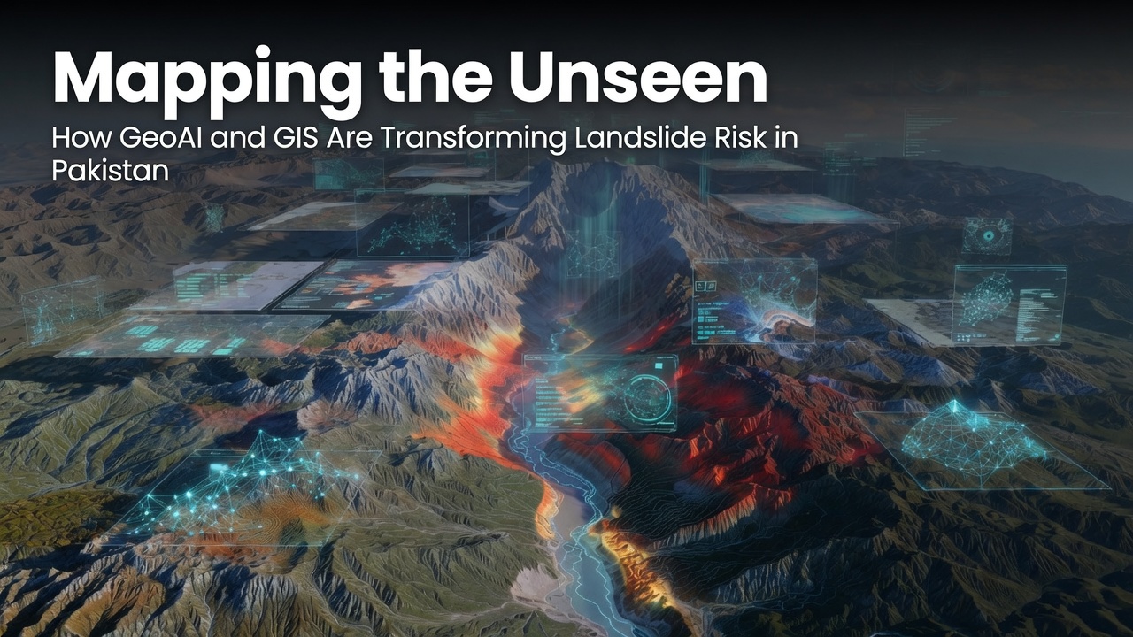
Today, a new generation of technologies changes the course of events in this area. Artificial Intelligence, Geographic Information System, and satellite remote sensing help scientists not just create hazard maps as before but perform more complex scientific analyses and better understand future landslide locations.
This change is especially important for Pakistan , where mountainous regions experience recurring landslides that disrupt transportation, damage ecosystems, and threaten vulnerable communities. Good forecasting doesn’t stop natural disasters from happening, but it provides governments, emergency responders, planners, and local communities with the information they need to make smarter and more timely decisions.
This article explores why landslides are becoming more challenging to predict, how GeoAI is reshaping environmental risk assessment, and why integrating artificial intelligence with geospatial technologies is becoming essential for building climate-resilient communities in Pakistan.
Pakistan’s Growing Landslide Challenge
Pakistan is home to some of the world’s most spectacular mountain landscapes. The Hindu Kush, Karakoram, and Himalayan ranges support unique ecosystems, provide freshwater resources, and sustain millions of people. However, these same landscapes are naturally prone to landslides because of their steep slopes, complex geology, and dynamic environmental conditions.
Among these regions, Chitral District stands out as one of Pakistan’s most environmentally sensitive mountain landscapes. Characterized by rugged terrain, deep valleys, active river systems, and significant elevation differences, the district experiences natural conditions that make it particularly vulnerable to slope instability. Seasonal snowfall, glacier melt, intense rainfall events, and changing land-cover patterns further increase this vulnerability.
Climate change is intensifying these threats and dangers. Scientific research shows that rising temperatures affect precipitation and increased frequency of extreme rainfall saturate the ground quickly and makes slopes unstable. Additionally, increasing population and building infrastructure like roads and settlement to include tourism infrastructure further raises the level of exposure.
In addition, the consequences are much worse than damaged infrastructure and disrupted transport. Landslides can remove agricultural lands, limit access to health and education services, and wreck important infrastructure.
Addressing these challenges requires more than identifying where disasters have occurred in the past. It requires understanding where they are most likely to occur in the future. That is where artificial intelligence, geospatial analysis, and satellite-based Earth observation are beginning to redefine disaster risk assessment.
Why Traditional Landslide Mapping Is No Longer Enough
For decades, scientists and disaster management agencies have relied on conventional methods to assess landslide hazards. Field surveys, geological investigations, historical landslide inventories, and topographic maps have all played an important role in understanding where slope failures have occurred. These approaches have significantly improved hazard assessment and remain valuable for environmental planning.
However, today’s environmental challenges are far more dynamic than they were a few decades ago.
Climate change is altering rainfall patterns, increasing the frequency of extreme weather events, and influencing soil moisture conditions in ways that were previously difficult to anticipate. At the same time, rapid land-use change, expanding infrastructure, deforestation, and growing human settlements continue to reshape mountain landscapes across Pakistan.
These constantly changing conditions make landslide predictions far more complex than simply analyzing one environmental factor at a time.
A landslide rarely occurs because of a single trigger. Instead, it is usually the result of multiple interconnected variables working together. Rainfall may saturate the soil, but slope steepness determines gravitational stress. Geological conditions influence soil strength, while vegetation cover affects slope stability. Elevation, drainage patterns, land use, and even proximity to rivers or human settlements can all contribute to increasing or reducing landslide susceptibility.
Traditional mapping techniques often struggle to analyze these complex relationships simultaneously. They are excellent at documenting the past, but they are less effective at revealing hidden patterns that indicate future risk.
This is where predictive geospatial intelligence becomes essential.
Rather than asking “Where have landslides already happened?”, today’s researchers are asking a more valuable question:
Where are landslides most likely to happen next?
Answering that question requires more than maps, it requires data-driven intelligence.
The Rise of GeoAI: Where Artificial Intelligence Meets Earth Observation
Artificial Intelligence is transforming many aspects of our daily lives, from healthcare and finance to transportation and communication. In environmental science, its impact is equally profound.
When combined with Geographic Information Systems (GIS) and satellite remote sensing, AI enables researchers to analyze enormous volumes of environmental information that would be impossible to process manually.
Every satellite image contains valuable information about Earth’s surface. Digital Elevation Models reveal terrain characteristics. Rainfall datasets monitor changing weather patterns. Land cover maps show vegetation and human activities, while hydrological layers describe drainage networks and water movement across landscapes.
Individually, each dataset tells only part of the story
When integrated within a GIS environment and analyzed using machine learning algorithms, these datasets begin to reveal relationships that are often invisible to the human eye. AI identifies patterns, learns from historical observations, and estimates the probability of future landslide occurrence based on how different environmental variables interact.
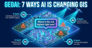
This emerging field, often referred to as GeoAI represents the convergence of geospatial science, remote sensing, and artificial intelligence. Instead of replacing scientific expertise, GeoAI enhances it by providing faster, more consistent, and more data-driven insights for environmental decision-making.
For countries like Pakistan, where vast mountainous regions are difficult to access through field surveys alone, GeoAI offers an efficient and scalable approach to hazard assessment. Satellite observations provide continuous environmental monitoring, GIS organizes and analyses spatial information, while machine learning converts these data into actionable intelligence that can support disaster preparedness, infrastructure planning, and climate adaptation.
In an era where climate risks are becoming increasingly uncertain, predictive intelligence is no longer a luxury, it is becoming a necessity.
A Case Study from Chitral District: Turning Data into Disaster Intelligence
To explore how artificial intelligence could improve landslide prediction, I conducted my research across Chitral District, Pakistan, a region renowned for its breathtaking mountain landscapes but equally recognized for its environmental vulnerability.
Located in the Hindu Kush mountain range, Chitral is characterized by rugged topography, steep slopes, active river systems, glaciers, and dramatic elevation gradients. While these features contribute to its natural beauty, they also make the district highly susceptible to landslides and soil erosion. Seasonal snowfall, glacier melt, intense rainfall, and changing land-use patterns further increase the instability of mountain slopes, creating significant challenges for local communities and infrastructure.
Studying such a vast and geographically complex region using conventional field investigations alone would be both time-consuming and resource intensive. This is where geospatial technologies offer a powerful alternative.
Rather than relying on a single source of information, the study integrated multiple environmental datasets derived from satellite observations and spatial analysis. Terrain characteristics, rainfall patterns, land use and land cover, topographic wetness, drainage density, proximity to rivers and settlements, curvature, elevation, slope, aspect, and population distribution were analyzed together to understand how different environmental conditions influence landslide occurrence.
However, collecting data is only the beginning. The real challenge lies in understanding how these variables interact.
This is where machine learning becomes invaluable.
Unlike traditional statistical methods that often assume simple relationships between variables, machine learning algorithms are designed to identify complex, non-linear patterns hidden within large datasets. They learn from historical observations and recognize combinations of environmental conditions that are more likely to result in landslides.
For this research, two widely recognized machine learning algorithms, Random Forest and Extreme Gradient Boosting (XGBoost) were employed to model landslide susceptibility. Both algorithms have demonstrated strong performance in environmental modelling because they can analyze multiple variables simultaneously while capturing intricate relationships that conventional approaches may overlook.
Another distinctive aspect of this research was the integration of the Universal Soil Loss Equation (USLE). While landslide susceptibility and soil erosion are often studied separately, they are closely interconnected processes within mountainous environments. Soil erosion weakens slope stability by removing protective surface material, making landscapes more vulnerable to failure under intense rainfall or other triggering conditions.
By combining AI-driven landslide susceptibility modelling with soil erosion assessment, the research provided a more comprehensive understanding of environmental risk across Chitral District. Instead of viewing hazards in isolation, this integrated approach examined how multiple environmental processes interact to shape the landscape.
The outcome was not merely a collection of maps or statistical outputs. It was a decision-support framework capable of identifying vulnerable areas before disasters occur ,providing valuable insights for planners, disaster management authorities, and environmental practitioners working to build safer and more resilient communities.
What the Models Revealed: Insights Hidden Within the Landscape
One of the most fascinating aspects of artificial intelligence is its ability to uncover patterns that are often impossible to detect through conventional analysis. Rather than examining environmental variables individually, machine learning evaluates how they interact as a complete system. This holistic perspective proved invaluable for understanding landslide susceptibility across Chitral District.
The analysis revealed that landslides are not triggered by a single environmental factor. Instead, they emerge from the combined influence of terrain, climate, hydrology, vegetation, and human activities. Among all the variables examined, rainfall consistently emerged as the most influential driver of landslide occurrence. This finding reinforces a growing body of scientific evidence suggesting that increasingly intense rainfall events, many of which are associated with climate change, are becoming a critical trigger for slope instability in mountainous regions.
However, rainfall alone does not determine whether a landslide will occur.
Topographic characteristics such as elevation, slope, and the Topographic Wetness Index (TWI) also played a major role. Steeper slopes naturally experience greater gravitational stress, while areas that accumulate water become more vulnerable as soil strength decreases during prolonged or intense rainfall. These physical characteristics create conditions where even moderate rainfall can trigger slope failure.
Land use and land cover further influenced the spatial distribution of landslide susceptibility. Vegetation acts as a natural stabilizer by strengthening soil through root systems and reducing the direct impact of rainfall on exposed surfaces. Conversely, disturbed landscapes ,whether due to deforestation, infrastructure development, or changing land-use practices ,often exhibit greater susceptibility to erosion and slope instability.
The machine learning models also highlighted the importance of distance from rivers and settlements. River erosion continuously reshapes valley slopes, while expanding human activities can alter natural drainage patterns and disturb fragile terrain. These findings demonstrate that landslide risk is shaped by both natural processes and human interventions, emphasizing the need for integrated environmental planning.
Beyond identifying individual factors, the models generated detailed susceptibility maps that classified the landscape into varying levels of landslide risk. Instead of treating the entire district as equally vulnerable, the maps revealed distinct spatial patterns, enabling the identification of areas where disaster preparedness and mitigation efforts should be prioritized. Such information can help authorities allocate resources more effectively, strengthen infrastructure planning, and improve emergency response strategies.
Another important outcome of the research was the integration of soil erosion assessment with landslide susceptibility modelling. Soil erosion gradually removes fertile topsoil and weakens slope integrity, often creating conditions that increase the likelihood of future landslides. By analyzing these hazards together, the study provided a more comprehensive understanding of environmental degradation across Chitral District rather than viewing each hazard independently.
Perhaps the most significant finding was not the performance of a particular algorithm, but the broader demonstration that AI-driven geospatial modelling can transform raw environmental data into actionable intelligence. Satellite observations, GIS analysis, and machine learning collectively created a decision-support framework capable of identifying vulnerable landscapes before disasters occur. This represents a shift from reactive disaster management toward proactive risk reduction, an approach that is becoming increasingly essential as climate-related hazards intensify.
Ultimately, the maps produced through this research are more than scientific outputs. They represent practical tools that can guide infrastructure development, support environmental conservation, improve disaster preparedness, and contribute to more resilient communities throughout Pakistan’s mountainous regions.
From Prediction to Protection: Why This Research Matters
Scientific research has little value if it remains confined to academic journals. Its true impact begins when knowledge is transformed into practical solutions that improve people’s lives. In the context of landslides, predictive mapping is not simply about producing colorful maps ,it is about protecting communities, strengthening infrastructure, and supporting informed decision-making before disasters occur.
The integration of AI, GIS, and satellite remote sensing offers a powerful opportunity for Pakistan to modernize disaster risk management. Instead of responding only after a landslide has blocked a highway or damaged a village, authorities can use predictive susceptibility maps to identify vulnerable areas, priorities mitigation efforts, and allocate resources more effectively. This proactive approach has the potential to reduce both economic losses and human suffering.
The applications extend far beyond emergency response. Government agencies can use geospatial intelligence to support safer road construction, climate-resilient infrastructure planning, watershed management, forest conservation, and sustainable land-use planning. Development organizations can identify communities facing the highest environmental risks, while researchers can continuously improve predictive models as new satellite observations and climate data become available.
As climate change continues to reshape mountain environments, the need for intelligent environmental monitoring will only grow stronger. Modern satellites now provide an unprecedented view of our planet, generating enormous volumes of environmental information every day. Artificial intelligence enables us to transform these data into meaningful insights, while GIS provides the spatial framework needed to understand where and why environmental changes occur.
This convergence of technologies is giving rise to a new era of Climate Intelligence, one where decisions are guided by data rather than assumptions. Instead of reacting to disasters after they happen, governments and organizations can anticipate risks, strengthen resilience, and develop long-term adaptation strategies based on scientific evidence.
For Pakistan, where climate-related hazards continue to intensify, investing in GeoAI is no longer simply a technological advancement, it is becoming a national necessity. From the mountains of Chitral to other environmentally sensitive regions, predictive geospatial intelligence can play a critical role in safeguarding both people and ecosystems.
Looking Ahead
Artificial intelligence will never replace environmental scientists, geographers, or disaster management professionals. Instead, it enhances their ability to analyze complex environmental systems, interpret vast amounts of spatial information, and make faster, evidence-based decisions.
The future of disaster risk reduction lies in collaboration, bringing together Earth observation, GIS, environmental science, climate research, and machine learning to better understand our changing planet. Every satellite image, every environmental dataset, and every predictive model contribute to a larger goal: building communities that are safer, more resilient, and better prepared for the challenges of tomorrow.
My research in Chitral District represents one small contribution to this broader vision. It demonstrates how integrating machine learning, GIS, satellite remote sensing, and soil erosion modelling can improve our understanding of landslide susceptibility and support more informed environmental decision-making.
As geospatial technologies continue to evolve, the question is no longer whether AI will become part of environmental science ,it already has. The real challenge is ensuring that these innovations are used responsibly, collaboratively, and effectively to create a more sustainable and climate-resilient future.
Key Takeaways
- Landslides are becoming increasingly complex due to climate change and changing land-use patterns.
- Traditional hazard mapping alone is no longer sufficient for effective disaster preparedness.
- AI, GIS, and satellite remote sensing enable predictive rather than reactive disaster management.
- Integrating multiple environmental datasets provides a more comprehensive understanding of landslide susceptibility.
- GeoAI can support governments, planners, and disaster management agencies in making smarter, data-driven decisions.
- Climate intelligence will play a central role in building resilient communities across Pakistan.
About the Author
Ayesha Mobeen is an MPhil scholar in Environmental Science at Quaid-i-Azam University, Islamabad. Her research focuses on integrating Artificial Intelligence, GIS, Remote Sensing, and geospatial analytics for landslide susceptibility assessment, soil erosion modelling, and climate risk mapping. She is passionate about applying emerging technologies to support disaster risk reduction, environmental sustainability, and climate resilience. Through research and science communication, she aims to bridge the gap between advanced geospatial technologies and real-world environmental decision-making.