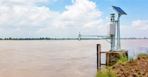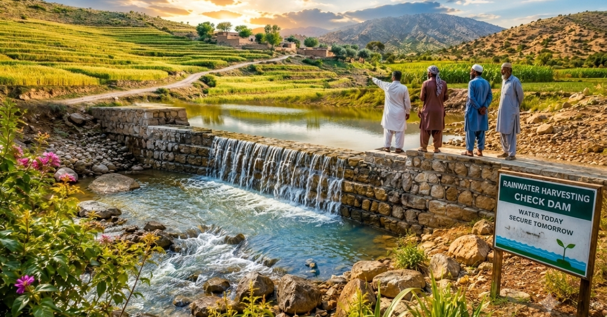
| Quick Answer: Rainwater harvesting for agriculture in Pakistan means capturing monsoon runoff and storing it for irrigation during dry periods. The main methods include check dams, farm ponds, rooftop harvesting, and traditional karez systems. In rainfed barani areas, which cover nearly 19 to 25 percent of cultivated land, these techniques are often the only reliable water source available to smallholder farmers. |
Rainwater harvesting for agriculture in Pakistan is becoming an essential solution as farmers face increasing water shortages and unpredictable rainfall. Pakistan’s farmers have always worked around the rain rather than with it. The monsoon season delivers most of the year’s water in a few intense weeks, then the country goes dry for months. For nearly a fifth of Pakistan’s cultivated land, there is no canal water and no reliable groundwater to fall back on when that dry stretch runs long.
This guide looks specifically at how rainwater harvesting works on Pakistani farmland, not in generic terms, but through the methods actually used here: check dams in the hills of Pothwar, farm ponds across Balochistan, and centuries-old karez systems that still deliver water without a single pump. It also looks at why so many of these structures fail within a few seasons, and what changes when site selection is based on real data rather than guesswork. If you are ready to move beyond planning and need practical setup guidance, our how to install a rainwater harvesting system guide covers components, sizing, and step-by-step installation
For the broader picture of why rainwater harvesting matters globally and how it fits into the wider water scarcity challenge, our rainwater harvesting pillar guide covers the full context.
Why Pakistan’s Farmers Cannot Wait for Rainfall to Fall Correctly
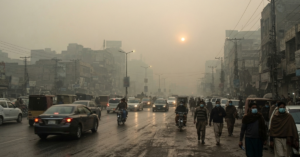
Pakistan gets rain. The problem is when it falls and where it goes.
Most of the country’s agricultural rainfall arrives in two short windows. The monsoon hits from July to September. Winter rains, locally called rabi, fall from December to February. Outside these windows, most of the country is dry for months at a stretch.
That timing mismatch is what breaks farming. Crops need water between these windows. Groundwater is being pumped faster than it recharges. Canals only reach certain regions. And climate change is making both the wet and dry periods more unpredictable every year.
Pakistan already faces severe water stress, and the pressure is growing. The Indus Water Treaty governs how river flows are shared between India and Pakistan. Any reduction in those flows hits agriculture first and hardest.
Rainwater harvesting does not solve all of this. But it gives farmers a buffer. It stores what falls and makes it available when it is needed, not just when it arrives.
How Much of Pakistan’s Agriculture Depends on Rain Alone?
Estimates of Pakistan’s rainfed cultivated area vary by source. Government figures typically place barani land at 19 to 22 percent of total cultivated area. A peer-reviewed review published in the Soil and Tillage Research journal puts the figure closer to 25 percent. The methodology differs, but the conclusion does not. A significant share of Pakistan’s farmland depends on rainfall alone, with no canal water and no reliable groundwater as a backup.
Barani land is concentrated in Khyber Pakhtunkhwa, Balochistan, Azad Kashmir, northern Punjab, and the Pothwar Plateau. Wheat, sorghum, pulses, and oilseeds are the main crops. Yields are consistently lower than irrigated land and drop sharply in dry years.
For the farmers working this land, rainwater harvesting is not an optional upgrade. It is the difference between a productive season and a failed one.
The connection between water access and food production is direct. See our analysis of climate change and food security in developing countries for a broader view of how water stress translates into hunger at the household level.
Main Methods of Rainwater Harvesting for Agriculture in Pakistan
Pakistan’s farmers have relied on locally adapted water collection techniques for generations, and the most effective ones share a single principle: capture what falls, store it where it is needed, and make it last until the next rain arrives.
Check Dams
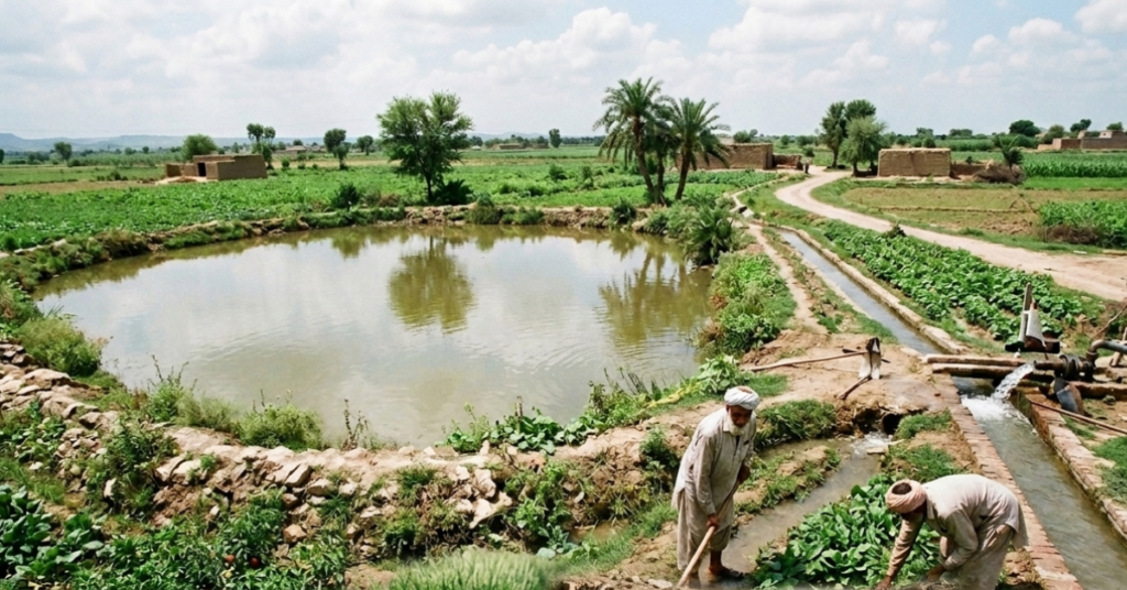
A check dam is a low barrier made of stone, concrete, or compacted earth, built across a seasonal stream or drainage channel to slow monsoon runoff. By reducing water flow, it increases soil infiltration, raises the local water table, and helps retain moisture for nearby farmland.
Check dams are especially effective in hilly areas where runoff is rapid, and water has little time to soak into the ground. The Pothwar Plateau in northern Punjab has one of Pakistan’s largest check dam programmes, where community-built structures have improved soil moisture and supported higher wheat yields during the post-monsoon dry season.
Farm Ponds
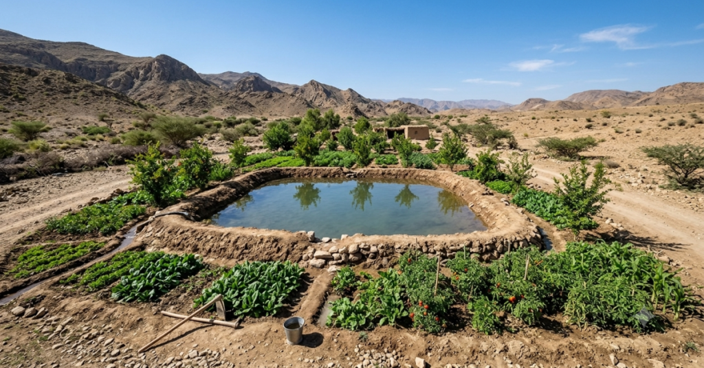
Farm ponds are excavated or embanked storage structures that collect surface runoff for irrigation during dry periods. Depending on soil conditions, they may be lined with plastic or compacted clay to reduce seepage or left unlined where short-term storage is sufficient.
Farm ponds are widely used in Balochistan and Khyber Pakhtunkhwa, where seasonal streams are common, but canal irrigation is limited. Even relatively small ponds can provide enough stored water to support vegetable gardens, orchards, and other crops between rainfall events.
Karez Systems
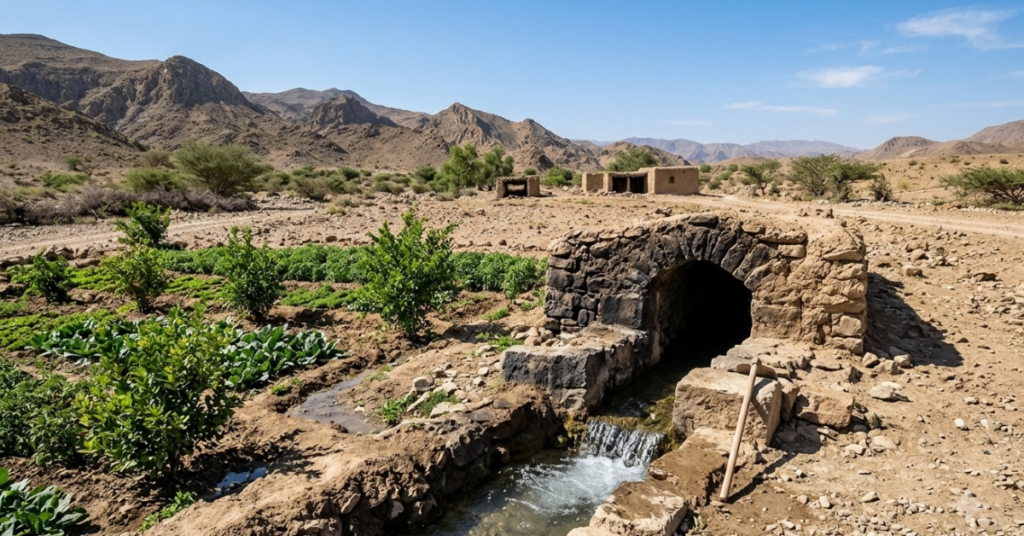
The karez, also known as a qanat in other parts of Central Asia, is a traditional underground channel that taps sloping aquifers and delivers gravity-fed water to agricultural land. Karez systems have supported farming in Balochistan for centuries and remain operational in many villages.
Unlike check dams or farm ponds, a karez provides a continuous water supply without pumping by using groundwater naturally recharged through monsoon infiltration. It is energy-efficient and performs well during dry periods when its recharge area is properly protected.
Many karez systems have deteriorated because of neglect, reduced vegetation, and increased groundwater extraction from nearby borewells. Rehabilitating these systems remains one of the most cost-effective ways to improve long-term water security in Balochistan.
Rooftop and Courtyard Collection for Farm Household Use
In rural areas without reliable piped water, rooftop rainwater harvesting supplies households with water for drinking and domestic use. This reduces pressure on groundwater and canal supplies, allowing more water to remain available for crop irrigation.
Although primarily designed for household use, rooftop collection indirectly strengthens agricultural water security, particularly in water-scarce farming communities. For a complete guide on setting up a rooftop system, see our how to install a rainwater harvesting system guide. If you are comparing storage options, our guide to rainwater harvesting water tanks explains how to choose the right tank size, material, and placement.
Why Getting the Location Right Matters More Than the Structure Itself
A check dam built in the wrong place silts up within one monsoon season and stops functioning. A farm pond dug where the soil permeability is too high drains in days. A karez intake positioned where upland recharge is insufficient runs dry in the first dry year.
Site selection is where most small-scale rainwater harvesting projects succeed or fail. And site selection requires accurate data on topography, soil type, rainfall distribution, and surface runoff patterns.
This is where GIS-based analysis changes what is possible.
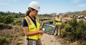
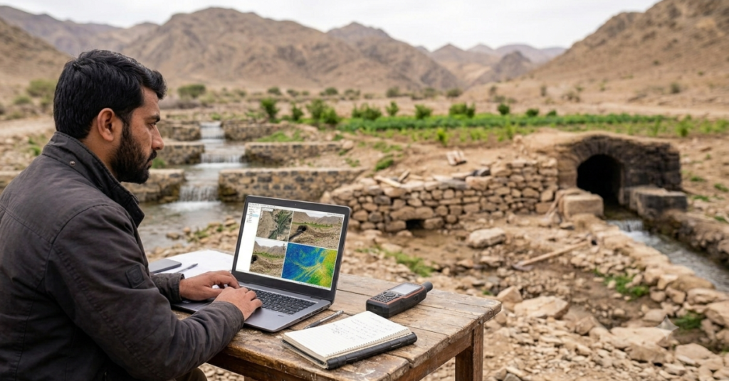
AI Geo Navigators’ Remote Sensing and Image Analytics service uses satellite imagery to map surface runoff pathways, identify optimal check dam locations, and assess watershed characteristics before any physical work begins. Structures placed using satellite-derived data consistently outperform those placed by field observation alone.
The Decision Support and Applied GIS Solutions service goes further, integrating soil permeability layers, slope data, and multi-year rainfall records to model how a proposed structure will perform across a range of rainfall years, including below-average ones. This is the difference between a structure that works in a good year and one that works reliably across the full range of conditions a farmer will face.
For a broader look at how GIS is being applied to water and environmental monitoring across Pakistan, see our article on GIS-based environmental monitoring.
What Stops More Pakistani Farmers from Using These Techniques?
The techniques are not new. Check dams in Balochistan predate modern engineering. Karez systems are centuries old. Farm ponds are simple to dig. So why are they not more widespread?
Upfront Cost Without Immediate Return
A check dam that silts up in year one because it was poorly sited, or a farm pond that drains in three days because the wrong soil was chosen, teaches farmers that the technology does not work. Bad early experiences spread faster than good ones.
Many farmers simply cannot afford to absorb a failed experiment. When the cost of getting it wrong is a season’s income, the rational choice is to stick with whatever works now, even if it is insufficient.
No Access to Reliable Local Data
A farmer deciding where to dig a pond or build a dam has access to their own experience and their neighbours’ opinions. They do not have access to satellite-derived rainfall records, soil permeability maps, or topographic models.
This data gap is solvable. It requires organisations with GIS capacity to translate technical analysis into practical siting recommendations at the farm level. That translation step, from satellite data to a marker in the ground saying dig here, is where technical expertise delivers its most direct value to smallholder agriculture.
Lack of Maintenance After Installation
Check dams silt up. Farm ponds require periodic sediment removal. Karez channels need regular clearing. Without a maintenance plan and the community organisation to execute it, structures that worked in year one are often non-functional by year three.
Programs that install structures without building maintenance capacity into the community consistently show declining performance within a few years of project completion.
What does the evidence say about what actually works?
Pakistan has decades of experience with check dam and farm pond programmes across government, NGO, and donor-funded initiatives. Over time, clear patterns have emerged in what improves long-term performance.
- Structures designed using watershed-level data consistently outperform those placed using field intuition, especially in terms of reduced silting and better dry-season water retention.
- Community-managed systems with maintenance committees remain functional much longer than externally managed projects that stop after installation.
- Combining check dams with upland reforestation enhances groundwater recharge by slowing runoff, increasing infiltration, and reducing sediment load.
- Karez rehabilitation in Balochistan is highly cost-effective because existing infrastructure can be restored through desilting, channel repair, and upland protection.
- Rooftop rainwater harvesting for domestic use indirectly improves agricultural water availability by reducing groundwater extraction pressure at a very low cost.
Where to Start with Rainwater Harvesting for Agriculture in Pakistan?
The starting point is not the structure. It is the data.
Before deciding whether to build a check dam, dig a farm pond, or rehabilitate a karez, you need to know three things about your site.
• Where does surface runoff go during and after monsoon rainfall? Topographic analysis identifies the drainage pathways and natural collection points that a structure can intercept.
• What is the soil permeability at the proposed site? Sandy soils drain too fast for unlined ponds. Highly compacted or clay-rich soils may restrict karez recharge. The right structure depends on what the ground will do with the water.
• What is the actual rainfall record for the site, not just the regional average? A structure sized on a national average will underperform in a below-average year, which is exactly when a farmer needs it most.
AI Geo Navigators’ GIS Consultancy service can provide site-specific analysis covering all three of these questions using satellite-derived data and field-validated models. Getting this right before construction begins is the single most cost-effective investment in any rainwater harvesting project.
For the complete picture of how rainwater harvesting fits into the global water security challenge, see the main rainwater harvesting pillar article. For practical guidance on system sizing, components, and installation steps, see the installation guide in this cluster.
Key Takeaways
- Nearly 19 to 25 percent of Pakistan’s cultivated land depends on rainfall.
- Check dams, farm ponds, karez systems, and rooftop harvesting are the main methods.
- Site selection is more important than the type of harvesting structure.
- GIS and satellite data improve planning accuracy.
- Community maintenance is essential for long-term success.
- Karez rehabilitation is a cost-effective solution in Balochistan.
- Watershed management increases groundwater recharge.
Conclusion
Pakistan’s farmers have been collecting and storing rainwater for centuries. Traditional knowledge exists. The need is urgent and growing. What has changed is the availability of data tools that can make those traditional practices significantly more effective.
In rainwater harvesting for agriculture in Pakistan, a check dam in the right place can significantly improve water security on surrounding farmland. When it is correctly sized for its watershed and maintained by a community that understands its function, it can deliver long-term benefits. The right location requires accurate data. Proper system sizing depends on local rainfall records rather than national averages. Long-term success also depends on community engagement, not just construction contracts.
If you are planning a water harvesting project for Pakistani farmland, start with the data, not the structure. Once the site has been selected, choosing the right rainwater storage tank is equally important for long-term performance. Site-specific GIS analysis, covering runoff pathways, soil permeability, and actual local rainfall records, is what separates a structure that works for one season from one that works for decades.
FAQs
What is the most common method of rainwater harvesting for agriculture in Pakistan?
Check dams are the most widely used structure across rainfed areas of Punjab, KPK, and Balochistan. Farm ponds are common in Balochistan and southern KPK. The traditional karez system remains important in Balochistan but requires rehabilitation in many areas where maintenance has lapsed.
Which parts of Pakistan benefit most from agricultural rainwater harvesting?
Rainfed barani areas benefit most. This includes the Pothwar Plateau in northern Punjab, most of Balochistan, large parts of KPK, and Azad Kashmir. These regions receive insufficient canal water and face groundwater depletion, making stored rainwater the most accessible supplementary irrigation source available.
How Does GIS Help in Planning Rainwater Harvesting for Agriculture in Pakistan?
GIS allows planners to map runoff pathways, identify optimal dam and pond locations, assess soil permeability, and model performance across variable rainfall years using satellite data. Structures sited using GIS-based analysis show significantly better long-term performance compared to those placed by field observation alone.
Can small farmers afford rainwater harvesting structures?
Basic structures are within reach for many smallholders, particularly when community groups share construction costs. Government and NGO subsidy programmes in Balochistan and KPK have made check dams and farm ponds accessible at low cost. The bigger barrier is often access to accurate siting data rather than construction cost.
What makes a check dam fail?
Poor siting is the most common cause. A check dam placed where sediment load is too high silts up within one or two monsoon seasons. Incorrect sizing for the watershed’s runoff volume either overflows destructively or fills incompletely. Both failures are preventable with watershed-level data before construction begins.