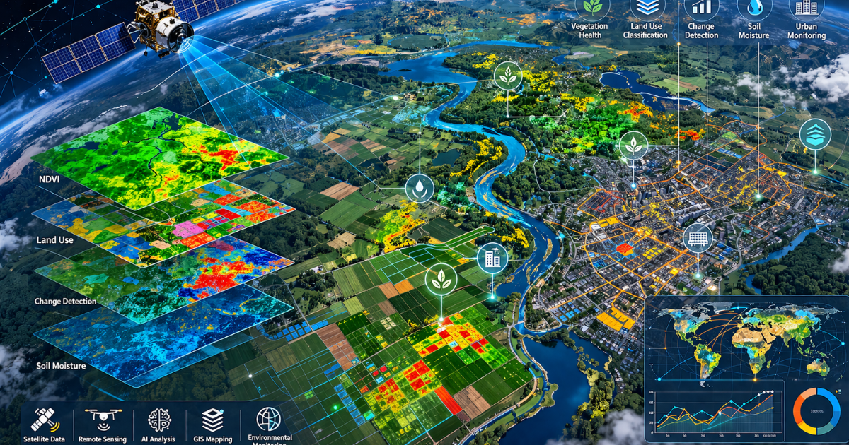
Remote sensing is the science of collecting data about the Earth’s surface from a distance, using satellites, drones, and aircraft. No field team required. No physical contact needed. Just data, faster, wider, and deeper than any ground survey can deliver.
Today, remote sensing services go far beyond basic satellite images. They detect ground movement at millimeter scale, map flood extents through dense cloud cover, identify crop stress weeks before it becomes visible, and track glacier loss in near real time. These are not experimental capabilities. They are operational tools that governments, scientists, and organizations deploy every day.
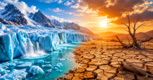
Pakistan sits at the center of some of the most urgent applications for this technology. A country managing 7,000 glaciers, recurring monsoon floods, rapidly expanding cities, and severe agricultural water stress cannot afford decisions based on outdated field data. Remote sensing changes that. It delivers the spatial intelligence needed to act early, allocate resources correctly, and plan for a climate that is no longer predictable.
In this guide, you will discover the 10 most powerful remote sensing techniques in active use today, what each one does, and why it matters more than ever.
What Are Remote Sensing Services?
Before exploring the techniques, it is essential to understand what remote sensing services actually cover. At their core, these offerings involve:
- Capturing electromagnetic radiation (light, heat, radar waves) reflected or emitted by the Earth’s surface
- Processing this data using GIS (Geographic Information Systems) software
- Delivering actionable insights for agriculture, environment, urban planning, and more
Remote sensing can be passive, using sunlight as the energy source, which includes optical satellites) or active, emitting their own energy, including radar or LiDAR. Both types are important to understand how GIS and remote sensing work together as a unified system. Explore our detailed guide on GIS mapping services and spatial data analysis.
Key Fact: According to a 2025 ScienceDirect review, over 1,500 peer-reviewed remote sensing studies have been conducted in ecosystem monitoring alone since 1985, confirming how central this technology has become to Earth observation.
Comparison Table
| Technique | Best For | Works at Night? | Works Through Cloud? | Cost Level |
| Multispectral | Agriculture, land cover | No | No | Low |
| SAR | Flood mapping, deformation | Yes | Yes | Moderate |
| LiDAR | 3D terrain, forestry | Yes | Partial | High |
| Hyperspectral | Minerals, crop disease | No | No | High |
| Thermal IR | Heat mapping, wildfire | Yes | No | Moderate |
| UAV/Drone | Precision agriculture | No | No | Low-Moderate |
| InSAR | Ground subsidence | Yes | Yes | High |
| AI Analysis | Change detection, scale | Yes | Yes | Moderate |
The 10 Best Powerful Remote Sensing Services & Techniques
Remote sensing isn’t always a single device; it is an entire family of effective techniques, each designed to expose something special about our world. From shooting crop health in invisible light to measuring ground movement at the millimeter scale, these 10 techniques represent the very best of what cutting-edge Earth observation can provide. Whether you’re new to the sector or trying to deepen your knowledge, this section breaks down each method clearly, explains how it works, and suggests to you precisely why these topics, specifically in a country like Pakistan, where the need for smart, data-driven decisions has never been greater.
1. Multispectral Imaging, the Backbone of Modern Remote Sensing
Multispectral imaging captures data across multiple wavelength bands, which include visible light, near-infrared (NIR), and shortwave infrared (SWIR). It is the most widely used technique in remote sensing services nowadays.
How it really works: Satellites like Landsat-8 and Sentinel-2 bring multispectral sensors with thirteen or more bands. Each band shows different surface properties, vegetation fitness, water content, soil type, and urban materials.
Real-world use:
- NDVI (Normalized Difference Vegetation Index) maps help Pakistani farmers identify stressed crops before visible damage appears
- Urban planners use band ratios to map impervious surfaces and track city expansion
Why it ranks: Multispectral imaging is affordable, widely available, and supported by free open-access archives such as USGS and ESA. It is the gateway technique for most remote sensing services.

2. Hyperspectral Imaging, Seeing What the Eye Cannot
While multispectral sensors capture a few broad bands, hyperspectral sensors capture hundreds of narrow, contiguous spectral bands. This offers scientists an in-depth “spectral fingerprint” of each surface fabric.
Why it matters: Hyperspectral imaging can distinguish between mineral sorts, detect soil contamination, identify invasive plant species, or even reveal early signs and symptoms of sickness in plants, all from the air.
Notable utility: In Pakistan’s Indus Delta and coastal zones, hyperspectral analysis is being used to screen mangrove fitness and detect oil contamination in waterways.
Gap it fills: Most articles point out this technique; however pass its developing function in environmental compliance tracking, a quick-developing use case for industries and regulators.
.3. Synthetic Aperture Radar (SAR), Seeing Through Clouds and Darkness
SAR is an active remote sensing technique that emits microwave pulses toward the Earth and measures the backscattered signal. Because it uses its own energy source, SAR works day and night, in any weather condition.
Why SAR is a game-changer:
- Penetrates dense cloud cover, critical during monsoon seasons in Pakistan and South Asia
- Detects surface deformation with millimeter-level precision
- Maps flooded areas even under vegetation cover
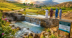
Real-world impact: During Pakistan’s 2022 mega-floods, SAR data from Sentinel-1 satellites was used by disaster response teams to map inundated areas in Sindh and Balochistan in near-real time, saving critical response hours.
For professional SAR analysis and flood mapping services, AIGeo360 offers expert GIS and remote sensing solutions tailored to South Asian needs.
4. LiDAR (Light Detection and Ranging)
LiDAR works by emitting laser pulses and measuring the time they take to return. The result is an extraordinarily precise 3D point cloud of the Earth’s surface, accurate to centimeters.
Key strengths:
- Creates Digital Elevation Models (DEMs) with unmatched accuracy
- Penetrates tree canopy to map the ground below, essential for forestry and archaeology
- Ideal for infrastructure inspection, landslide risk mapping, and flood modeling
In Pakistan, LiDAR is being adopted for mapping landslide-prone areas in Gilgit-Baltistan and Azad Kashmir, regions where traditional surveys are dangerous and slow. Our GIS specialists at AIGeo360 have outlined how geospatial data like LiDAR is actively saving lives in vulnerable communities.
Transition: Now that we have covered passive and active imaging, let us move to the emerging world of AI-powered and thermal analysis.
5. Thermal Infrared Remote Sensing
Thermal infrared (TIR) sensors detect heat energy emitted from the Earth’s surface. Every object has a thermal signature, and TIR remote sensing reads those signatures from orbit.
Powerful applications:
- Urban heat island detection, identifying which city neighborhoods are dangerously hot
- Monitoring industrial facilities and power plants for energy waste or illegal activity
- Wildfire detection and tracking (critical in Balochistan and KPK regions)
- Irrigation efficiency analysis for large-scale farms
Why most articles miss this: TIR remote sensing is often lumped with basic thermal photography. In reality, it is a sophisticated science now combined with AI to predict drought stress and energy consumption at the city scale.
6. AI-Powered Satellite Image Analysis
Artificial intelligence, specifically deep learning, has transformed what remote sensing services can deliver. AI algorithms now analyze satellite imagery at scale, automatically detecting objects, changes, and anomalies that might take human analysts months to identify.
What AI adds to remote sensing:
- Automated change detection (deforestation, construction, crop damage)
- Object recognition (counting vehicles, identifying building types)
- Predictive modeling for disaster risk and agricultural yield
Stat to know: A 2025 peer-reviewed study published on NCBI confirmed that AI-driven remote sensing now powers applications from environmental monitoring to urban planning, with machine learning dominating land cover mapping globally.
This intersection of AI and geospatial intelligence is exactly what sets modern providers apart. Our deep dive into AI GIS mapping services explains how these powerful tools are already delivering real, measurable results for organizations across Pakistan and the region.
Providers like AIGeo360 integrate AI analysis into their remote sensing workflows, delivering faster and more accurate outputs to clients across Pakistan and beyond. AI Geo Navigators applies these same AI-powered workflows through its remote sensing and image analytics service, delivering faster and more accurate outputs for agriculture, flood mapping, and environmental monitoring projects across Pakistan.
7. UAV/Drone-Based Remote Sensing
Unmanned Aerial Vehicles (UAVs) bring remote sensing down to the field level. Flying at low altitude, they capture ultra-high-resolution imagery and sensor data unavailable from orbital satellites.
Why drones are powerful:
- Capture sub-centimeter resolution imagery, ideal for precision agriculture
- Deploy multiple sensors: optical, multispectral, thermal, LiDAR
- Operate on demand, without waiting for satellite overpasses
- Cost-effective for small to medium areas
Growing use in Pakistan: Pakistani agricultural tech companies are deploying drones for crop scouting, pest detection, and irrigation mapping in Punjab and Sindh, dramatically reducing input costs for farmers.
Gap in competitor articles: Most guides treat drones as a separate topic. In reality, drone-based remote sensing is now fully integrated with satellite data pipelines, forming a multi-scale monitoring system.
8. InSAR (Interferometric SAR), Measuring Ground Movement
InSAR is an advanced SAR method that compares two or more radar images of the same area taken at different times. The difference in surface movement among the images is sometimes as small as a few millimeters.
Extraordinary applications:
- Monitoring subsidence in cities built on soft soils (e.g., Karachi, Lahore)
- Detecting pre-earthquake ground deformation for early warning
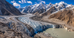
- Tracking glacier movement and ice loss in the Himalayas and Karakoram
- Monitoring dam integrity and reservoir-induced seismicity
This capability is central to Pakistan’s disaster preparedness work, as explored in our analysis of why GIS-based environmental monitoring has become essential across the country’s most vulnerable regions.
Why it matters for Pakistan: With 7,000+ glaciers, active fault lines, and rapidly subsiding coastal cities, InSAR is a critical remote sensing tool for Pakistan’s disaster preparedness agencies and infrastructure developers.
9. Ocean and Water Body Monitoring via Remote Sensing
Remote sensing offerings for water include sea surface temperature (SST) mapping, fine-scale water tracking, algal bloom detection, and ocean current assessment.
Techniques involved:
- Thermal infrared for SST
- Multispectral for water clarity and chlorophyll concentration
- SAR for ocean surface roughness and oil spill detection
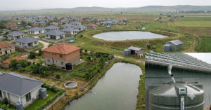
Pakistan context: The Arabian Sea coastline, Mangla and Tarbela reservoirs, and the Indus River system all benefit from satellite-based water monitoring. Sedimentation, pollution, and water level changes are tracked continuously.
Transition: Beyond natural systems, remote sensing is becoming essential to how cities are built and governed.
10. Urban and Land Use Mapping, Planning Smarter Cities
Remote sensing services for urban areas include mapping land cover change, monitoring urban sprawl, assessing green space, and supporting infrastructure planning.
Key techniques used:
- High-resolution optical imagery (Worldview, SPOT)
- Change detection algorithms comparing multi-year satellite time series
- AI-powered classification to separate buildings, roads, vegetation, and water
Why it is on this list: Pakistan’s cities are among the fastest-growing in the world. Lahore, Karachi, and Islamabad are expanding rapidly, and remote sensing provides the spatial intelligence that city planners, developers, and governments need to make smart decisions.
For urban mapping and land-use analysis in Pakistan, AIGeo360 provides professional GIS and remote sensing services built for local conditions and data requirements.
Benefits of Remote Sensing Services
Whether you are a farmer, a city planner, a researcher, or a business owner, remote sensing services deliver real value:
- Save money and time by replacing expensive field surveys with satellite data
- Make faster selections using real-time or near-real-time spatial data and spatial information
- Reduce risk by monitoring dangers, floods, droughts, and landslides before they strike
- Improve sustainability via precise aid management and environmental tracking
- Scale your insight from a single field to an entire country, all from one data platform

Conclusion
Remote sensing services are no longer tools only for scientists and space agencies. They are practical, increasingly accessible technologies that are reshaping how we farm, plan cities, respond to disasters, and protect our environment.
The 10 strategies included in this guide, from multispectral imaging to AI-powered satellite analysis, represent the best of what modern-day Earth observation can provide. Each one fills a real gap: tracking what we cannot see, measuring what we can’t reach, and revealing patterns that stay invisible to the naked eye.
As Pakistan faces the growing challenges of climate change, rapid urbanization, water pressure, and catastrophe, remote sensing isn’t just beneficial; it’s critical.
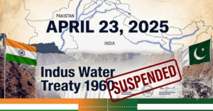
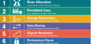
Ready to explore what remote sensing can do for your project, farm, or organization? Visit AIGeo360.com to learn more about professional GIS and satellite analysis services designed for Pakistan and the region. For a deeper look at how satellite data intersects with Pakistan’s most critical water policy decisions, read our full analysis of the Indus Water Treaty and its implications for Pakistan’s water future.
(FAQs)
Q1. What are remote sensing services used for?
Remote sensing services are used for agricultural tracking, flood mapping, urban planning, catastrophe control, environmental analysis, forestry, ocean monitoring, and land-use mapping. They provide spatial facts from satellites, drones, and aircraft to assist decision-making in authorities, enterprise, and research.
Q2. What is the most powerful remote sensing technique?
There isn’t any single “most powerful” approach; the best method depends on the application. SAR excels in all-climate conditions and flood mapping. LiDAR promises unequalled three-D accuracy. AI-powered evaluation scales throughout large datasets. Many expert services integrate a couple of techniques for the first-rate outcomes.
Q3. How is remote sensing used in agriculture in Pakistan?
In Pakistan, remote sensing is used for NDVI-based crop health monitoring, irrigation mapping, drought detection, and yield prediction. Drones and satellites like Sentinel-2 and Landsat are extensively utilized by agricultural groups and agri-tech corporations in Punjab and Sindh.
Q4. What is the difference between active and passive remote sensing?
Passive remote sensing (such as optical satellites) makes use of the Sun as its power source and captures reflected light. Active remote sensing (like SAR and LiDAR) emits its own energy and measures the return signal. Active techniques work at night and through clouds, making them critical for catastrophe monitoring.
Q5. Are remote sensing services affordable for small businesses?
Yes, an increasing number of so. Free facts from Sentinel and Landsat missions, plus cloud structures like Google Earth Engine, have dramatically reduced the fee of entry. Professional services like AIGeo360 provide scalable programs desirable to small and medium businesses.
Q6. How accurate is remote sensing data?
Accuracy depends on the sensor, resolution, and processing approach. LiDAR may be accurate to centimeters. Multispectral classification generally achieves 85–95% accuracy with the right ground truthing. SAR-based displacement measurements (InSAR) can detect motion on the millimeter scale.
Q7. What companies provide remote sensing services in Pakistan?
Several GIS and remote sensing firms operate in Pakistan, including SUPARCO (Pakistan’s national space agency) and private providers such as AIGeo360, which offers satellite data analysis, GIS services, flood mapping, and agricultural monitoring for clients across the country.