| Quick Answer: GLOF Gilgit-Baltistan risk is among the highest in Pakistan. The region has over 7,000 glaciers. Across Gilgit-Baltistan and Khyber Pakhtunkhwa, more than 3,000 glacial lakes have formed. Of these, 33 are rated hazardous by Pakistan’s Ministry of Climate Change and the UNDP GLOF-II project. About 7.1 million people live in areas these lakes could reach. |
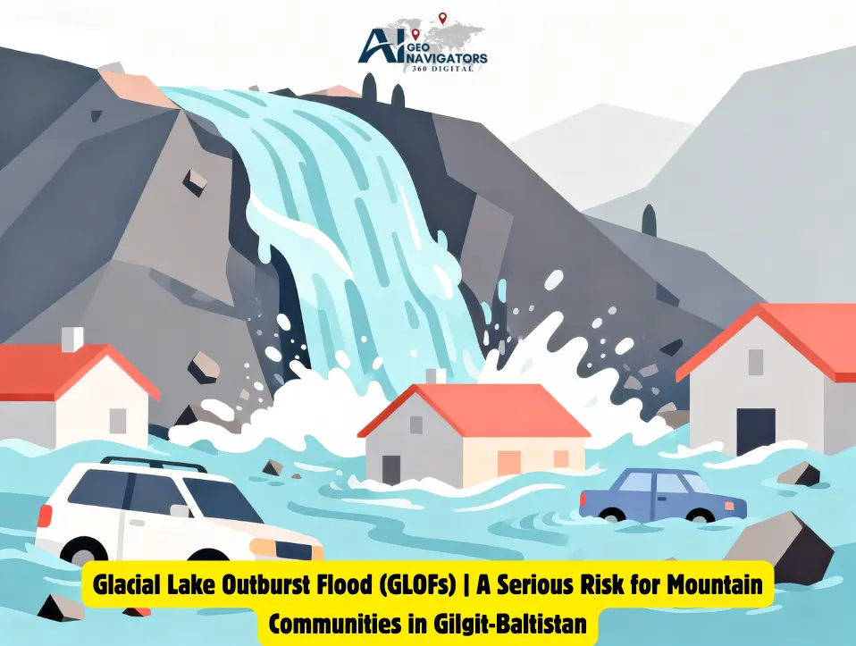
A sudden flood caused by the bursting of a glacial lake is called a GLOF, short for glacial lake outburst flood. GLOF Gilgit-Baltistan risk comes from the region’s geography. It sits where the Hindu Kush, Karakoram, and Himalayan ranges meet. That makes it one of the most heavily glaciated areas outside the polar ice caps.
New to the topic? Start with our GLOF causes and GIS monitoring guide. It explains how these floods form and how satellites track them. This page looks at GLOF Gilgit-Baltistan in detail. It covers the most exposed valleys, past events, the impact on communities, and the early warning work underway.
GLOF in Pakistan: Key Facts at a Glance
GLOF in Pakistan is most serious in the glaciated north. These numbers show the scale of the GLOF Gilgit-Baltistan hazard.
| Fact | Detail |
|---|---|
| Glaciers in Gilgit-Baltistan | More than 7,000 |
| Glacial lakes in Gilgit-Baltistan and Khyber Pakhtunkhwa | More than 3,000 (about 3,044) |
| Lakes rated hazardous | 33 |
| People living in areas these lakes could reach | About 7.1 million |
| Valleys covered by the GLOF-II project | 24 (16 in Gilgit-Baltistan and 8 in Khyber Pakhtunkhwa) |
| GLOF-II funding | About US$37 million from the Green Climate Fund |
Source: Pakistan’s Ministry of Climate Change and UNDP GLOF-II project data; Senate committee briefing reported by Minute Mirror (22 September 2026).
Why Is GLOF Risk So High in Gilgit-Baltistan?
GLOF Gilgit-Baltistan exposure comes from geography and climate working together. As glaciers retreat, meltwater collects and forms lakes. Those lakes keep growing as more ice melts. Many sit behind loose moraine dams that can fail with little warning.
Most communities live close to glacier-fed valleys. This is the only flat land that can be farmed or built on. A single failed dam can send water to homes, roads, and fields downstream within hours.
How Is GLOF Risk Rated?
Experts usually look at lake size, dam strength, glacier and slope activity, and the number of people downstream. Pakistan’s Ministry of Climate Change has rated 33 lakes as hazardous.
What Causes GLOF in Gilgit-Baltistan?
GLOF Gilgit-Baltistan events have five main causes: rapid glacier melt, weak moraine dams, ice avalanches and landslides, overtopping and internal erosion, and earthquakes. A lake can stay stable for years. It becomes dangerous when its natural dam weakens, or something disturbs it.
Rapid Glacier Melting and Lake Formation
Rising temperatures are speeding up glacier melt across much of Gilgit-Baltistan. Meltwater collects in hollows near glacier fronts. It forms new lakes or makes existing ones larger. Bigger lakes hold more water, so a dam failure does more harm.
Weak and Unstable Moraine Dams
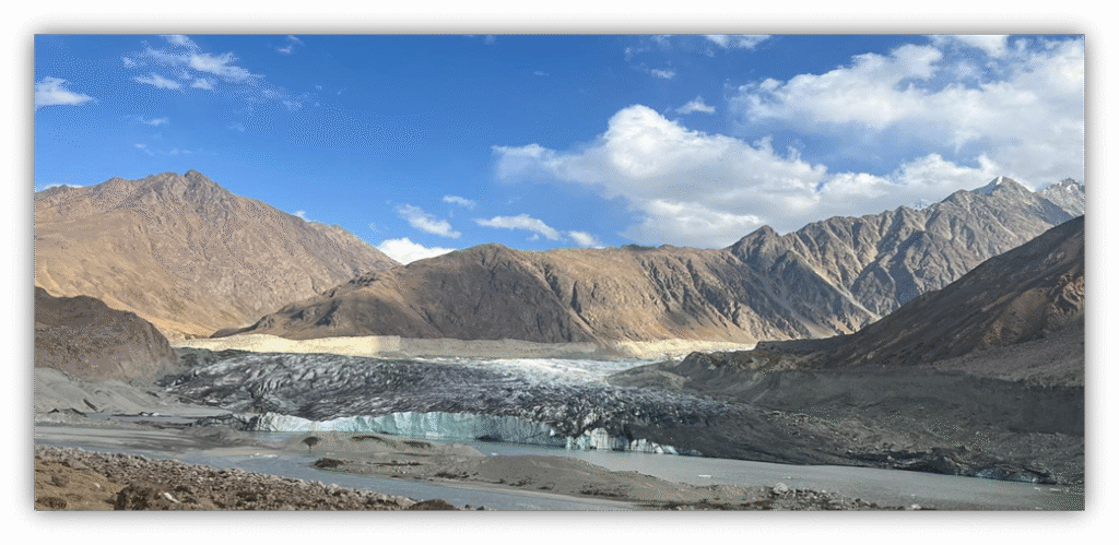
Many glacial lakes sit behind natural dams of loose rock, soil, and sediment called moraines. Unlike engineered dams, these can weaken as water levels rise or as meltwater wears away the material. If the dam collapses, a huge volume of water rushes downstream as a GLOF.
Ice Avalanches and Landslides
Ice avalanches and landslides from steep slopes can fall straight into a lake. The sudden push of water can create large waves that overtop or damage the dam. Gilgit-Baltistan is steep and geologically active, so these triggers are common.
Overtopping and Internal Erosion
A dam can fail when rising water spills over its crest and slowly wears it away. Water can also seep through weak spots inside the dam. This is called piping. The channels grow over time, and the dam can collapse.
Earthquakes and Other Natural Triggers
Gilgit-Baltistan lies in a region with frequent earthquakes. Quakes can shake slopes loose, set off landslides or rockfalls, and weaken moraine dams. Any of these can release lake water downstream.
Climate Change as an Overarching Driver
Climate change does not cause every GLOF. But it builds the conditions that make lakes more dangerous. Rising temperatures, changing snowfall, and glacier retreat help lakes form and grow. Extreme weather and other triggers then raise the chance of sudden drainage. These linked factors make continuous monitoring and early warning systems essential for reducing GLOF risk in the region.
GLOF-Prone Areas in Pakistan: High-Risk Valleys of Gilgit-Baltistan
The main GLOF-prone areas in Pakistan are the glaciated valleys of Gilgit-Baltistan and parts of Khyber Pakhtunkhwa, such as Chitral and Swat. The GLOF-II project covers 24 of the most vulnerable valleys: 16 in Gilgit-Baltistan and 8 in Khyber Pakhtunkhwa. Basins named in the project include:
- Hunza: Gulkhin
- Nagar: Hisper and Hopar
- Ghizer: Badswat and Darkut
- Shigar: Ghundus and Arindu
- Chitral (Khyber Pakhtunkhwa): Arkari
- Swat (Khyber Pakhtunkhwa): Matiltan and Mankiyal
A 2026 alert from the Pakistan Meteorological Department named these Gilgit-Baltistan districts as likely to be affected: Ghizer, Hunza, Nagar, Astore, Ghanche, Diamer, Kharmang, Skardu, and Shigar.
A SUPARCO study in August 2026 examined 115 glacial lakes in Gilgit-Baltistan and Khyber Pakhtunkhwa. It identified 24 of them and rated 5 as great danger, 10 as medium, and 9 as low. The five high-danger lakes are in Astore, Ghizer, and Hunza. This is a separate study from the national count of 33 dangerous lakes.
The Gilgit and Indus river basins hold the largest concentration of glacial lakes in the region. Pakistan’s national space agency, SUPARCO, watches potentially dangerous lakes by satellite. It works for the Ministry of Climate Change’s GLOF Technical Committee, together with the Gilgit-Baltistan Disaster Management Authority (GBDMA) and WAPDA’s Glacier Monitoring and Research Centre.
This list changes as lakes grow or new ones form. GLOF risk is an active hazard, not a fixed count. In short, GLOF Gilgit-Baltistan hotspots sit in the glaciated valleys of Hunza, Nagar, Ghizer, and Shigar.
GLOF Events in Pakistan: Recent Examples from Gilgit-Baltistan
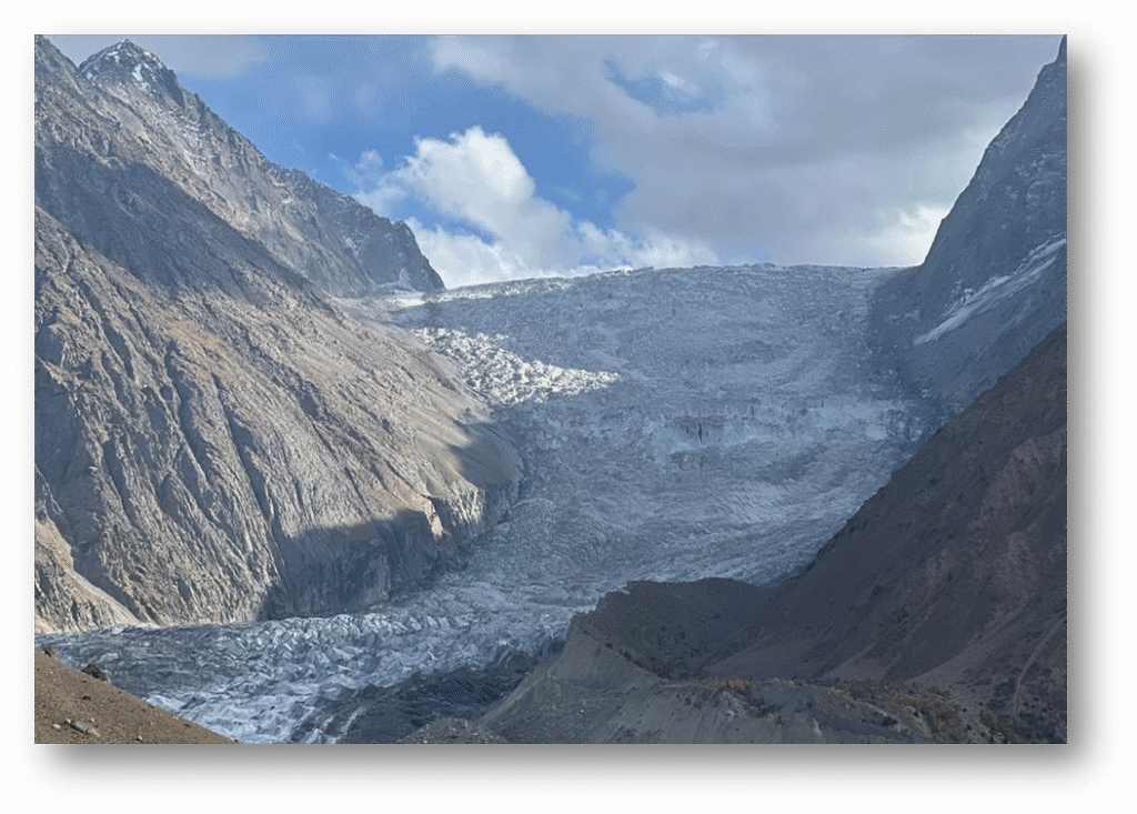
The Shisper glacier in Hunza is the best-known source of GLOF Gilgit-Baltistan. It began to surge in 2018 and blocked a stream. This formed an ice-dammed lake, and that lake has burst more than once.
| Year | Place | Trigger | Impact | Source |
|---|---|---|---|---|
| 2019 to 2021 | Shisper glacier, Hassanabad, Hunza | The surging glacier blocked a stream, and the ice-dammed lake burst | Reports list outbursts in June 2019, May 2020, and May 2021. The 2021 flood displaced about 20 of 170 households | Pamir Times, Dialogue Earth |
| 2022 (7 May) | Hassanabad, Hunza | A heatwave sped up melting, and the lake beside the glacier burst | Hassanabad Bridge on the Karakoram Highway swept away. Homes, farmland, and two hydropower plants damaged. No deaths reported | Dawn, Dialogue Earth |
These events show a pattern. Floods build up and travel downstream within hours. Without automated monitoring, people have little time for manual warnings or evacuation. The 2022 flood also shows that early warnings work: people moved in time, and no deaths were reported.
Impact of GLOF on Mountain Communities
GLOF Gilgit-Baltistan floods can destroy crops, irrigation channels, roads, bridges, homes, and power plants within minutes. In Gilgit-Baltistan, most households depend on farming, livestock, and seasonal tourism. A single flood can wipe out a season’s crops and grazing land. Families may then face food shortages for years.
Infrastructure damage makes it worse. Many villages rely on one road or bridge. When a GLOF takes it out, people can lose access to healthcare, supplies, and rescue services for a long time. Hydropower plants, a key part of green energy in Gilgit-Baltistan, can be hit too, as the 2022 Hassanabad flood showed. Homes built from local stone and mud offer little protection against fast debris flows. Better flood forecasting and early warnings give communities more time to react.
Climate Change and Glacier Retreat in GB
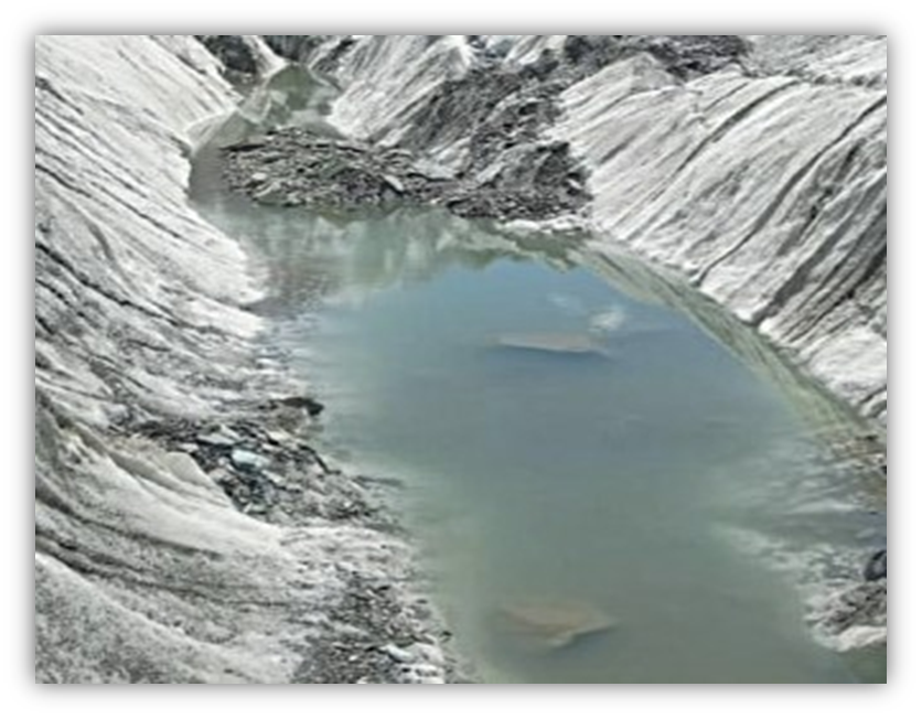
Rising temperatures, less winter snowfall, and more frequent heatwaves are speeding up glacier melt across most of Gilgit-Baltistan. These trends are part of wider climate change in Pakistan. One exception is the so-called “Karakoram Anomaly”. A group of Karakoram glaciers has stayed stable or even gained a little mass while nearby ranges lose ice. Researchers do not fully agree on why. Outside this anomaly, most small and medium glaciers in GB are retreating, which feeds the growth of glacial lakes.
GLOF Monitoring and Early Warning in Gilgit-Baltistan
GLOF Gilgit-Baltistan early warning combines three layers. SUPARCO monitors lakes by satellite. GBDMA and WAPDA assess hazards on the ground. International programs, such as GLOF-II, target the most exposed valleys directly.
Satellite remote sensing tracks lake growth. Risk analytics and decision intelligence turn that data into hazard maps for planners. AI tools are also joining this work, as we explain in AI in disaster management. For the wider picture, see our guide to disaster risk management with GeoAI.
How a GLOF Early Warning System Works
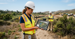
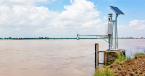
Most GLOF early warning systems follow three steps. Sensors and weather stations track rainfall, temperature, and water levels near a lake. When readings pass a danger level, the system alerts authorities and local people. Residents then move to higher ground or to a safe haven. GLOF-II has installed automated systems of this kind in high-risk valleys.
The GLOF-II Project: How Gilgit-Baltistan Is Being Protected
GLOF-II is the largest on-the-ground effort to cut GLOF risk in Pakistan. Its full name is Scaling-Up of Glacial Lake Outburst Floods Risk Reduction in Northern Pakistan. The Ministry of Climate Change leads it with UNDP support and about US$37 million from the Green Climate Fund. The GLOF-II project targets 24 of the most climate-vulnerable valleys: 16 in Gilgit-Baltistan and 8 in Khyber Pakhtunkhwa.
GLOF-II builds on lessons from the first phase, GLOF-I. It focuses on three things. It gives communities the tools to find and manage their own GLOF risk. It strengthens the public services that respond when a flood hits. And it builds physical protection that reduces damage before it happens.
On the ground, the project has installed automated early warning systems and weather stations built for high-mountain terrain. It has trained Pakistan Meteorological Department and disaster-management staff to run them. It has set up 23 Community-Based Disaster Risk Management Centres, which act as local hubs for preparedness planning. It has built 60 evacuation shelters, called “safe havens”, in high-risk valleys. Bio-engineering work has stabilized slopes across roughly 760 hectares to cut landslide and erosion risk around unstable lakes.
Livelihood support runs alongside the engineering. The project offers training and water-efficient farming support to households in flood-exposed valleys. It pays special attention to women’s participation in food-security and livelihood programs. Together, these measures make GLOF-II one of the largest coordinated GLOF risk-reduction efforts in the Hindu Kush-Karakoram-Himalaya region.
What Can Be Done to Reduce GLOF Risk
To lower GLOF Gilgit-Baltistan risk, authorities and communities can take these steps:
- Expand satellite and ground-sensor monitoring, and early warning coverage, to all 33 hazard-rated lakes. GLOF-II covers 24 valleys, so there is room to go further.
- Grow the Community-Based Disaster Risk Management Centre model beyond its current 23 sites.
- Build climate-resilient roads and bridges that can survive debris-flow impact, especially along the Karakoram Highway.
- Support livelihood diversification, so one flood does not wipe out a household’s only income.
- Continue slope stabilization and lake-lowering work at the most unstable sites.
Conclusion
GLOF Gilgit-Baltistan risk comes down to three things: dense glaciers, unstable moraine-dammed lakes, and communities living directly downstream. That makes the region one of Pakistan’s highest-risk areas for glacial lake outburst floods. The early warning systems and community risk-management centres under GLOF-II are the clearest progress so far. But 33 lakes are rated hazardous, and GLOF-II covers 24 valleys, so wider coverage remains the priority.
For the broader mechanics of how GLOFs form and are tracked with GIS, read our complete GLOF guide. To see how satellite data and AI support early warning, explore our GIS and remote sensing services and our work on climate intelligence.
FAQs
How many glacial lakes are at risk of GLOF in Pakistan?
Gilgit-Baltistan and Khyber Pakhtunkhwa together have more than 3,000 glacial lakes (about 3,044, per UNDP GLOF-II project data). Pakistan’s Ministry of Climate Change rates 33 of them as hazardous.
What are the GLOF-prone areas in Pakistan?
GLOF-prone areas include the glaciated valleys of Gilgit-Baltistan, such as Hunza, Nagar, Ghizer, and Shigar, and parts of Khyber Pakhtunkhwa, such as Chitral and Swat. The GLOF-II project covers 24 of the most vulnerable valleys: 16 in Gilgit-Baltistan and 8 in Khyber Pakhtunkhwa.
What are examples of GLOF events in Pakistan?
The best-known example is the Shisper glacier in Hunza. Its ice-dammed lake burst several times between 2019 and 2022. The 7 May 2022 flood swept away Hassanabad Bridge on the Karakoram Highway.
What was the Hassanabad GLOF?
On 7 May 2022, a lake beside the surging Shisper glacier burst after a heatwave sped up melting. The flood swept away Hassanabad Bridge on the Karakoram Highway and damaged homes, farmland, and two hydropower plants. Early warnings helped people move in time, and no deaths were reported.
What is the impact of GLOF on mountain regions?
A GLOF can destroy homes, farmland, roads, bridges, and power plants within minutes. It can cut villages off from healthcare and supplies. It can also push families into long-term food insecurity. Rivers can change course, and sediment can bury fertile land.
Who monitors GLOF Gilgit-Baltistan risk?
SUPARCO, Pakistan’s national space agency, monitors potentially dangerous glacial lakes by satellite. It works with the Gilgit-Baltistan Disaster Management Authority and WAPDA’s Glacier Monitoring and Research Centre, alongside the UNDP-backed GLOF-II early warning project.
What is the GLOF-II project?
GLOF-II is a Ministry of Climate Change and UNDP initiative, funded with about US$37 million from the Green Climate Fund. It installs early warning systems and builds disaster-preparedness infrastructure across 24 of the most GLOF-vulnerable valleys in Gilgit-Baltistan and Khyber Pakhtunkhwa.
Why is Gilgit-Baltistan more at risk than other regions?
Gilgit-Baltistan holds over 7,000 glaciers and has a very high density of glacial lakes. Its communities and roads are packed into narrow downstream valleys. The same terrain that makes farming possible also puts settlements in the path of floods.
What is a sudden flood caused by a glacial lake burst called?
It is called a glacial lake outburst flood, or GLOF.
Sources
UNDP Pakistan, GLOF-II Project overview and press releases (2018 to 2026); UNDP GLOF-II flood situation report (2022); Pakistan Ministry of Climate Change figures as reported by UNDP and Pamir Times (August 2026); SUPARCO satellite monitoring updates (2026); Dawn (May 2022); Dialogue Earth (2022); Pamir Times (2022); Arab News (2025); Pakistan Meteorological Department GLOF alert (April 2026, as reported by ProPakistani); Senate committee briefing on GLOFs, as reported by Minute Mirror (22 September 2026).