We develop machine learning and deep learning models that estimate what rivers, rainfall and drought will do next, using satellite, gauge and sensor records. Each model is tested on past events before you rely on it, then monitored once it is in use.
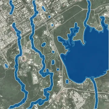
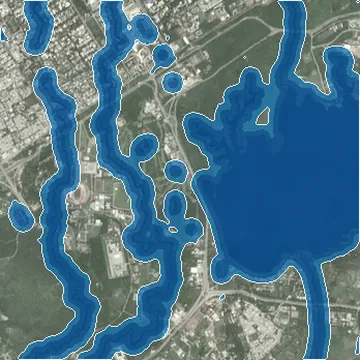
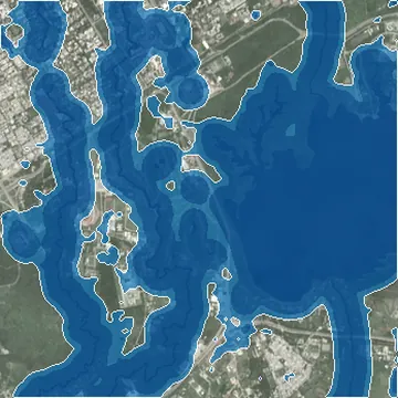
Imagery: Sentinel-2 cloudless 2023 by EOX IT Services, modified Copernicus Sentinel data (CC BY 4.0). Terrain: SRTM via AWS Terrain Tiles. Roads and buildings: © OpenStreetMap contributors (ODbL).
1,045km²
of August 2025 flooding mapped from Sentinel-1 radar
3
multi-hazard risk assessments, from district to site scale
30+
projects delivered across climate, GIS, AI and ESG
17
alliances and university partners, AI for Good by ITU among them
We build models for questions that repeat: how high will the river rise, where will drought bite, which slopes will fail. Each one is trained and tested on data from your own area.
Models that link rainfall forecasts and river telemetry to expected flood extent, so warnings name places, not just basins.
Near real time drought tracking with SPI and SPEI, extended into outlooks for farms, reservoirs and water supply.
Multi-model forecasts translated into operational thresholds, the approach behind our MIRSAD platform for Saudi Arabia.
Machine learning that maps where landslides, floods or glacial lake outbursts are most likely, from terrain, climate and past events.
Neural networks trained on Sentinel, Landsat and MODIS time series, plus ground sensors, to spot trends and anomalies early.
Every model tested on held back data and past events, then tracked in use and retrained when accuracy slips.
A forecast is worth most when there is still time to move people, water or equipment. These are the settings where that window matters.
Flood forecasts that turn river readings and rainfall outlooks into maps of where water is likely to spread next.
Drought outlooks that help agriculture departments time advice, irrigation and relief before crops fail.
Climate forecasts linked to operational decisions on site, the purpose behind MIRSAD, our platform built for operations in Saudi Arabia.
Inflow and flood forecasts that help operators plan releases, maintenance and site safety ahead of high water.
Most of the work happens before training starts. Getting the target, the data and the test right is what makes a forecast worth trusting.
We define what to predict, for which area, how far ahead and how accurately.
Target and accuracy goals
Satellite archives, rainfall, river gauges and your own event records joined into one training set.
Clean training dataset
Several model types trained side by side, from statistical baselines to deep learning.
Shortlist of candidate models
The best model is tested on events it never saw, with errors reported openly.
Validation report
Forecasts go live in your dashboard or system, with accuracy tracked and retraining scheduled.
Live forecasts and monitoring
Name the hazard, the area and how far ahead you need to see. We will review your data and propose a modeling plan.
