We plan, install and connect automatic weather stations and industrial sensors. Your team receives checked field data through dashboards, APIs and alerts, with a clear plan for calibration and maintenance.
Illustrative data, not a live feed or forecast.
AWS
automatic weather stations
Industrial sensors
matched to the site and parameter
Live telemetry
from the field to your dashboard
Maintained
calibration and support plans
A monitoring network is only useful if its data stays reliable. We cover the full system, from site selection and installation to quality control and long-term support.
A monitoring plan based on your risks, terrain and data needs.
Stations configured for the conditions you need to measure.
Sensors for operational, environmental and water monitoring.
Field installation, testing and handover of each station.
Reliable links from the field to your systems.
Routines that keep data trustworthy over time.
Five stages, from defining the objective to a network your team can rely on.
We define parameters, data frequency, sites and operating conditions.
Requirements and site list
We select sensors, power, communications and data standards.
System design and BOQ
We install, configure and test the stations and sensors.
Commissioned network
We connect telemetry, dashboards, APIs and alerts.
Live data platform
We monitor data quality and carry out planned maintenance.
Support and QC reports
Platforms and field projects related to monitoring and environmental data.
Platform · Live
Climate intelligence platform with a hazard map, live and forecast views, GLOF screening and weather stations.
Live platform
Platform · Upcoming
Flood intelligence with river telemetry from 20+ stations, flood alerts and predictive flood maps.
Upcoming platform
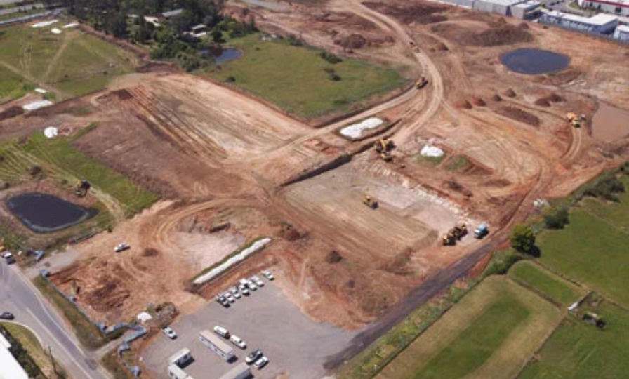
Al Jubail, Saudi Arabia · Ongoing
Topographic survey, drone mapping, site monitoring and environmental observation for Desert Line International.
Deliverables verified and accepted to date
Saudi Arabia · Ongoing
Environmental monitoring and data collection with CPECC and Shine Technical Support, to Aramco EHS standards.
Client recommendation on file
Saudi Arabia · Completed
Procurement, configuration and supply of equipment and software for Shine Technical Support (STS GCC).
Client recommendation on file
The team that plans the network also connects its data to GIS, dashboards and forecasts.
Our field work includes survey and environmental projects in Pakistan and Saudi Arabia.
Our information security management is certified to ISO/IEC 27001.
Readings can feed weather intelligence, hazard models and early warning systems.
We select equipment and communications for the site, the climate and your data needs.
Tell us the problem and the area. We will suggest the simplest way to solve it.
Common measurements include temperature, humidity, rainfall, wind and pressure. Solar radiation, soil and water sensors can be added.
Each site should provide measurements that represent the surrounding area over time. We review terrain, nearby obstacles, access, power, communications and security during a site survey.
For meteorological stations, we use World Meteorological Organization guidance on siting, measurements and quality as our reference. Project requirements or client standards may add further controls.
Stations send readings through cellular, radio or satellite links to a dashboard, an API or your own system.
Yes. We can design solar and battery power with suitable communications. A site survey confirms what will work.
We can provide calibration and maintenance, or train your team. We agree the schedule and responsibilities before handover.
Climate Tech Services
Site-level forecasts, alerts and weather data built for one location or network.
Climate Tech Services
Flood, GLOF, landslide, heat and drought models that show where a hazard can reach.
Climate Tech Services
What each hazard scenario means for people, assets, services and budgets.
Tell us the sites, the parameters and the deadline. We will reply with a clear plan and a quote.
