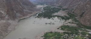
In an era where data-driven planning is at the core of national development, geospatial technology and land surveying services are playing a pivotal role in Pakistan transformation.
From urban planning and real estate development to environmental conservation and infrastructure design, the demand for accurate geospatial data and precise land surveying has never been higher.
This blog highlights the Top 10 Geospatial and Land Surveying Companies in Pakistan, providing a snapshot of the companies shaping the future of spatial intelligence and land data management across the country.
Whether you are a government agency, developer, or tech investor, these companies represent the vanguard of precision mapping, digital surveying, and geospatial innovation in Pakistan.
Table of Contents
ToggleAI Geo Navigator
Ai Geo Navigator has rapidly gained attention for its precision GPS/GNSS surveying, drone photogrammetry, and UAV-based terrain modeling. Based in Islamabad, Ai Geo Navigator focuses on providing private developers and municipalities with fast, accurate and cost-effective geospatial services.
From smart city development to environmental risk assessments, their technology drastically reduces time and cost while enhancing precision. AI Geo Navigator is widely recognized for helping government departments, construction firms, and large-scale developers eliminate manual inefficiencies and make data-informed decisions.
Their signature tools include:
- AI-powered cadastral mapping
- Carbon footprint analytics
- Change detection mapping
- Land encroachment alerts via remote sensing
With a strong commitment to transparency, innovation, and environmental sustainability, AI Geo Navigator is redefining the future of geospatial intelligence in Pakistan.
Survey of Pakistan
The Survey of Pakistan is the country’s national mapping organization and has played a central role in topographical and cadastral surveys since independence. Operating under the Ministry of Defence, this governmental institution provides:
- National base maps
- GIS database development
- Survey control networks
- Digital elevation models
While traditional in its origins, the Survey of Pakistan is gradually adopting digital tools and collaborating with private-sector firms to improve accessibility and accuracy of geographic data for national planning.
NESPAK (National Engineering Services Pakistan)
NESPAK is one of the most respected engineering consultancy firms in the region, and its GIS and Surveying Division has delivered landmark projects across Pakistan and abroad. Their geospatial services support:
- Mega infrastructure projects
- Hydrological mapping
- Transportation planning
- Geo-database development
They use a mix of satellite imagery, drone-based mapping, and total station surveying to offer integrated land development solutions. NESPAK’s strength lies in their vast multidisciplinary expertise, allowing them to manage complex survey tasks in tandem with engineering, urban design, and environment-related services.
Rehman Geo Spatial Technologies
Rehman Geo Spatial Technologies (RGST) a cutting-edge platform that blends AI-powered geospatial analysis with traditional land surveying techniques. As one of the most innovative players in the sector, RGST offers automated mapping, real-time data visualization, AI-driven land classification, and predictive analytics to streamline land use planning and infrastructure development.
Their client portfolio includes:
- Commercial real estate developers
- Urban municipalities
- Civil engineering consultants
RGST also develops training programs and workshops to support the next generation of Pakistani geospatial professionals.
Pakistan Space and Upper Atmosphere Research Commission (SUPARCO)
While primarily known for its space research, SUPARCO is also a major player in remote sensing and geospatial data analysis in Pakistan. Their Remote Sensing & GIS Division supports:
- Agricultural monitoring
- Disaster response
- Climate change research
Satellite-based urban sprawl analysis
SUPARCO’s satellite data is also a crucial input for other GIS firms and government agencies. It has collaborated on several national-level projects including forest cover mapping and flood risk modeling.
Spatial Logics
Spatial Logics is a Karachi-based geospatial firm offering high-end GIS, 3D modeling, LIDAR, and BIM integration services. They work on smart infrastructure projects, especially in the construction and utilities sector. Their work with telecom operators and smart grid designers highlights how spatial data is increasingly intersecting with digital infrastructure.
Spatial Logics stands out for:
- Smart grid spatial planning
- BIM-GIS integrations for construction
- Automated utility mapping
- Custom GIS software development
Their work is essential in helping cities transition into smart, energy-efficient urban hubs.
Geovision Pvt Ltd
Geovision Pvt Ltd has been offering comprehensive land surveying, GIS consulting, and remote sensing services for over a decade. Headquartered in Islamabad, the company specializes in:
- Land acquisition surveys
- Satellite image processing
- Topographic and boundary surveys
- GIS portal development
They are recognized for their accurate reporting, field data integrity, and client-centric solutions across multiple sectors including energy, telecom, and construction.
Orion Engineering Services
Founded by surveying professionals and GIS experts, Orion Engineering Services provides UAV-based surveying, geodetic control networks, and mobile mapping. They’re known for their work in:
- Road alignment surveys
- Railway corridor planning
- Water resource management
Their technical expertise in working in difficult terrains and remote areas makes them a preferred choice for infrastructure development in challenging environments like Balochistan and Gilgit-Baltistan.
GeoTech Surveys
GeoTech Surveys specializes in ground-based land surveying and spatial data acquisition. Their key services include:
- Topographic surveys
- Route alignment
- Construction staking
- Earthwork volume calculations
Known for their precision, GeoTech Surveys serves infrastructure projects, industrial zoning, and road construction projects. Their extensive use of Total Stations, RTK GPS, and UAVs has gained them a solid reputation.
Pak Surveyors and Engineering Consultants
With over 15 years in the field, Pak Surveyors and Engineering Consultants are known for their ground surveying, DGPS/GNSS services, and road alignment planning. They have completed hundreds of topographic and land parcel surveys for both public and private sector clients.
Services include:
- Construction site layout
- Utility mapping
- Contour and profile surveys
- Boundary demarcation
Their team includes licensed surveyors and GIS engineers working across Pakistan, making them a reliable partner for medium and large-scale projects.
EcoSurvey Pakistan
EcoSurvey is a geospatial solutions provider focusing on environmental and ecological mapping. Their services are tailored for sustainable development projects, NGOs, and governmental agencies.
Core services include:
- Biodiversity and habitat mapping
- Forest and wetland surveys
- GIS-based Environmental Impact Assessments (EIAs)
- Satellite imagery for land degradation and deforestation analysis
EcoSurvey is unique for integrating ecological science with spatial data, playing a crucial role in climate resilience and conservation planning in Pakistan.
GeoMapping Solutions
GeoMapping Solutions offers customized land surveying, GIS, and geodatabase development services to construction firms, land developers, and energy companies. Their strengths lie in:
- Land subdivision mapping
- Urban master planning support
- Topographic and bathymetric surveys
- 2D and 3D site models for real estate marketing
With a team skilled in the latest CAD, GIS, and drone-based technologies, they help clients visualize and manage large land assets effectively.
Terraview Technologies
Terraview Technologies is a rising geospatial startup known for its drone imaging and AI-enhanced mapping. They support clients in the agriculture, mining, and logistics industries.
Their standout offerings include:
- Crop health monitoring using NDVI
- UAV-based mining surveys
- Real-time geospatial analytics dashboards
- AI models for soil erosion and yield forecasting
Their solutions help improve operational efficiency in agriculture and extractive industries—sectors vital to Pakistan’s economy.
Urban GIS Consultants
Focused on urban development and infrastructure projects, Urban GIS Consultants provides high-resolution mapping services for smart cities and civic projects.
Services include:
- 3D cityscape modeling
- Transport route optimization
- Smart building integration with GIS
- Utility asset management
They have contributed to various municipal GIS projects, bringing intelligent planning tools to urban governance across cities like Lahore, Islamabad, and Karachi.
Geodetic Engineering Solutions
Geodetic Engineering Solutions (GES) specializes in survey-grade accuracy and supports large-scale engineering projects. Known for their fieldwork expertise and ISO-certified quality standards, they serve:
- Oil and gas pipeline surveys
- High-voltage transmission line mapping
- Precision GNSS control network establishment
- Hydrographic and geodetic surveys
GES combines traditional surveying principles with modern satellite-based systems to deliver reliable, regulatory-compliant results across Pakistan.
Conclusion
From foundational mapping to AI-powered geospatial insights, these Top 10 Geospatial and Land Surveying Companies in Pakistan are redefining how we interact with land, resources, and planning systems. Whether you’re developing a smart city, managing land records, or responding to environmental challenges, the right geospatial partner can make a world of difference.
As Pakistan moves toward a data-driven, sustainable future, the contributions of these companies will only grow in importance. Whether you’re a policymaker or project manager, this is the best time to align with leaders like AI Geo Navigator and others who are driving geospatial excellence in the region.