We are an dedicated surveyors, GIS consultants and 3D modelers, who can transform and optimize field data. With such broad capabilities, our team can bring efficiency to your projects, minimizing time and costs.
Our team are award-winning specialists in spatial and data management, establishing and maintaining clean, reliable data throughout any project, minimizing the risks of spatial inaccuracies. We achieve this through our depth of experience in survey design, field and data methodologies, and our proficiency with many spatial tools and technologies.
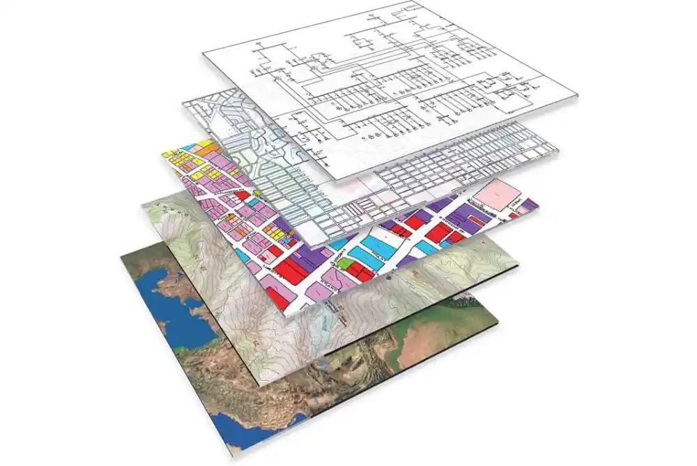
Our analysis tools uncover patterns, trends, and insights, helping you make faster, smarter decisions backed by reliable data. we enable our clients to visualize and analyze vast amounts of raw data and uncover trends and relationships among them.
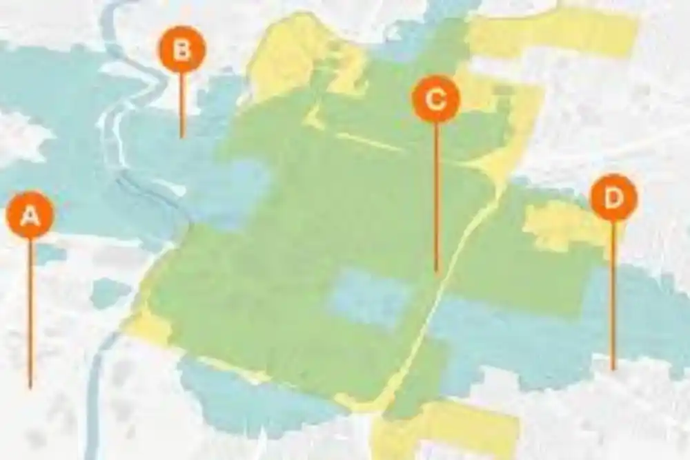
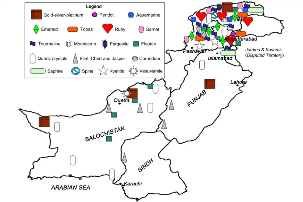
We help you find the best locations for your projects using advanced spatial data, GIS tools, and custom criteria. By analyzing factors like accessibility, demographics, environmental impact, and zoning, we support smarter, data-driven decisions for optimal site placement
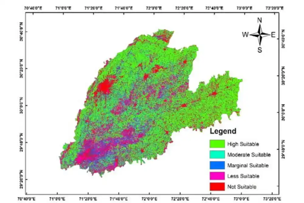
We provide detailed insights into current land use patterns and zoning regulations to support planning, development, and compliance. Our spatial analysis tools help identify suitable land uses, assess regulatory constraints, and guide informed decisions for urban growth.
We specialize in accurately identifying and mapping underground utilities and infrastructure, such as pipes, cables, and conduits. Using advanced geospatial tools and technologies.
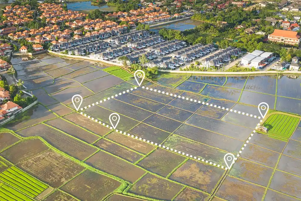
Our services support legal land registration, property subdivision, dispute resolution, and land development planning. Using advanced surveying tools and GIS technology, we ensure accuracy, compliance, and clarity in land records.
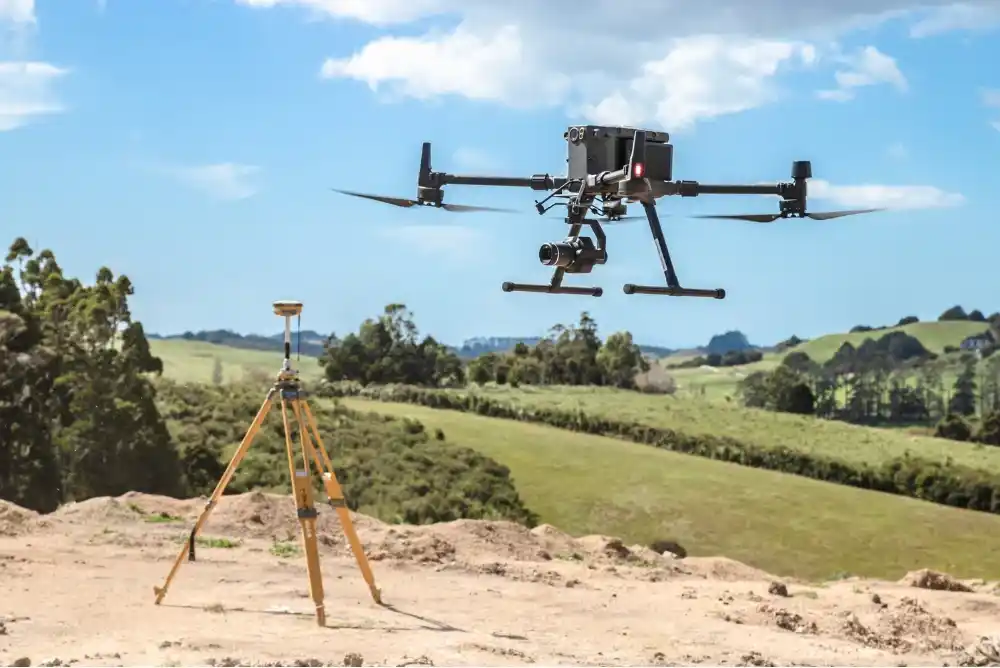
Ideal for mapping, monitoring, and inspection, our drone surveys provide fast, cost-effective solutions for terrain modeling, infrastructure assessment, land use analysis, and more—across even the most challenging landscapes.
We help several industries with our expert cadastral mapping solutions, allowing stakeholders to stay ahead in the game through informed decision-making.
Our highly accurate cadastral maps will help streamline land management and property transactions like never before. Our services are specially designed to help real estate professionals track ownership details, visualize boundaries efficiently. This also enables all stakeholders to reduce costly property-related disputes.
Building the future starts with accurate planning. Our 3D cadastral models and digital mapping solutions provide construction professionals with precise land boundaries and topographical data. From site analysis to project development, we help streamline the entire construction process, ensuring that every step is backed by accurate, real-time data.
Navigate land disputes with ease using our expert land ownership verification and cadastral mapping services. Our precise land records and data visualization tools are designed to assist legal professionals in resolving property-related disputes, ensuring accurate evidence and reducing legal risks for all parties involved.
Take your real estate development projects to the next level with our advanced GIS mapping solutions. We provide real estate developers with tools to accurately assess land, manage zoning regulations, and plan property layouts. Our solutions minimize risks and maximize profitability in every development phase.
Building the future starts with accurate planning. Our 3D cadastral models and digital mapping solutions provide construction professionals with precise land boundaries and topographical data. From site analysis to project development, we help streamline the entire construction process, ensuring that every step is backed by accurate, real-time data.
Our GIS Services are designed to assist environmental experts in monitoring and conserving natural resources. By visualizing land boundaries, zoning, and environmental data, we help in sustainable land management, conservation efforts, and environmental impact assessments. Protect the environment with accurate and efficient mapping tools.
Street 92, Building no. 63 Service road I-8/4 near Dar-e-Arqam school, Islamabad