Ongoing Projects

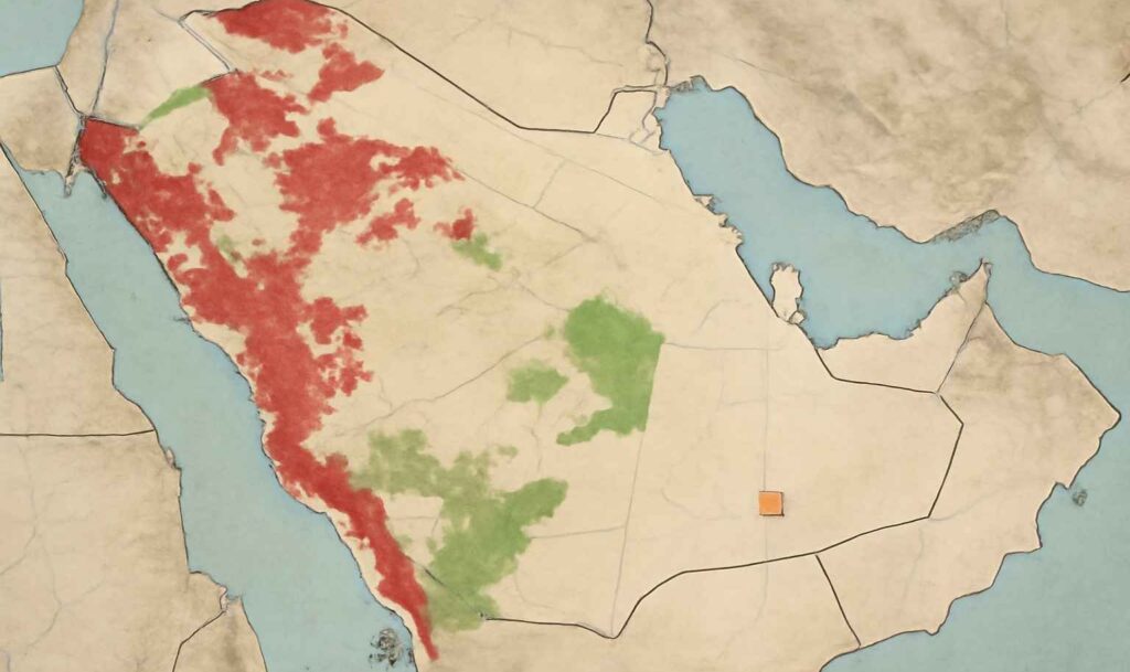
EMP - MGS Expansion Phase-III (PKG1)

Environment Management Plan (MGSP Phase-III)
EMP – MGS Expansion Phase-III (PKG1) | CPECC / Aramco
China Petroleum Engineering & Construction Corporation (CPECC) / Aramco

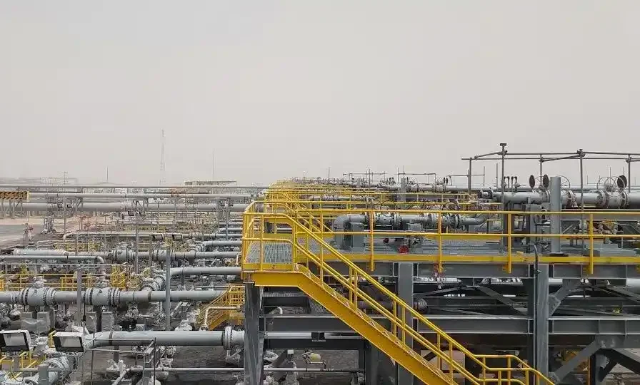
Environment Management Plan – Master Gas System Expansion Phase-III

PKG1: Upgrade Existing BGCS1, 3 & 5 · Environmental planning, compliance, and monitoring support.

Client: Aramco (via CPECC) Timeline: April – Ongoing Multiple review stages

Role of AI Geo Navigators collaboration with Shine Technical Support (STS) Trading Est.

  • Environmental expertise in Environmental Management Plan (EMP) preparation and review process.
  • Leading comprehensive EIAs to ensure compliance with Saudi Aramco's environmental, health, and safety standards.
  • Identifying environmental risks and developing effective strategies to mitigate them.
  • Ensuring the project minimizes environmental impact while maintaining operational efficiency and adhering to regulations.
Partners
CPECC Aramco
© AI Geo Navigators · EMP · MGS Expansion Phase-III (PKG1)
Cpecc

Desert Line International

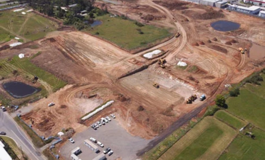
Topographic Survey, Drone-Based Aerial Mapping and Environmental Observation Project
Ongoing Project Acknowledgement | Desert Line International × AI Geo Navigators
Desert Line International / AI Geo Navigators (Private) Limited

Ongoing Project Acknowledgement – Topographic Survey, Drone-Based Aerial Mapping & Environmental Observation

Al Jubail, Kingdom of Saudi Arabia · Certification of performance, compliance, and deliverables to date

Client: Desert Line InternationalStatus: OngoingDocument Type: Acknowledgement

Certification Statement

This is to certify that AI Geo Navigators (Private) Limited, Islamabad, Pakistan, is successfully executing the above-mentioned project for Desert Line International, being carried out at Al Jubail, Kingdom of Saudi Arabia.

Project Scope & Objectives

  • Comprehensive topographic land surveying to establish accurate spatial baselines.
  • High-resolution drone-based aerial mapping for orthomosaics and terrain models.
  • Continuous site monitoring to track progress, safety, and performance.
  • Detailed environmental observation supporting regulatory compliance and reporting.

The objective is to ensure accurate spatial data collection, effective environmental compliance, and site performance assessment to support sustainable infrastructure development.

Performance & Compliance
  • Demonstrated strong technical expertise and advanced operational capability.
  • Full adherence to safety, environmental, and quality standards.
  • Efficient utilization of cutting-edge geospatial & UAV technologies.
  • Accurate capture, processing, and analysis of critical site and environmental data.
Deliverables Status

A significant portion of deliverables has been submitted within the agreed timeframe, thoroughly verified, and accepted by Desert Line International. Performance has been highly professional, result-oriented, and consistent with international standards of excellence.

Partners
Desert Line InternationalAI Geo Navigators

Appreciation & Future Collaboration

Desert Line International acknowledges and appreciates the professional contribution of AI Geo Navigators (Private) Limited and looks forward to future collaborations on geospatial, environmental, and sustainability-focused projects within the Kingdom.

© Desert Line International · Ongoing Project Acknowledgement · Al Jubail, KSA
Desert Line International

Completed Projects

DEV~CONSULT (with WWF-Pakistan)

mangroves
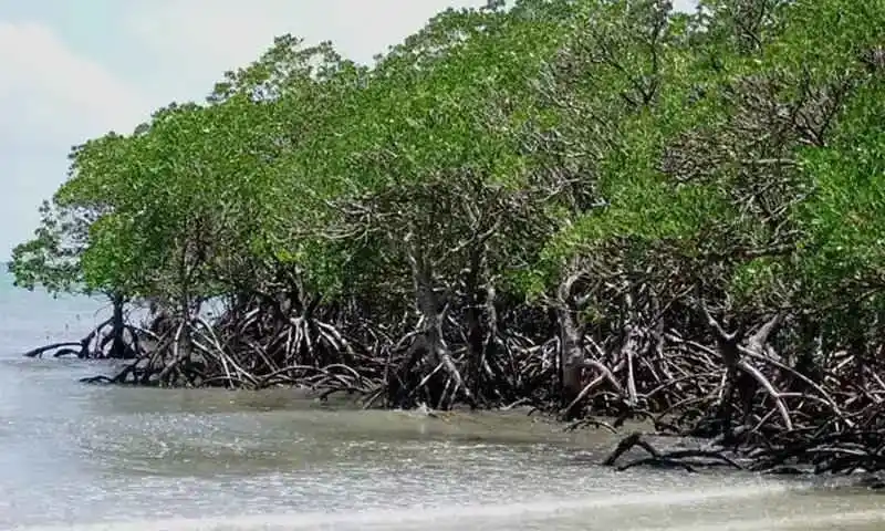
Evaluation of Different Approaches to Mangrove Reforestation and Rehabilitation in the Indus Delta
Mangrove Reforestation – Project Summary

Evaluation of Different Approaches to Mangrove Reforestation and Rehabilitation in the Indus Delta

Science-based assessment to guide restoration in the Indus Delta, Sindh, Pakistan.
Project Completion: September 2025 Location: Indus Delta, Sindh, Pakistan
Consultant
Dr. Hammad Gilani
Partners
DEV~CONSULT WWF-Pakistan

Role of AI Geo Navigators

  • Provided geospatial and ecological expertise.
  • Supported conservation and rehabilitation of mangroves.
  • Ensured scientific understanding and practical solutions.
© AI Geo Navigators · Indus Delta Project
Cpecc

Cadastral Mapping (Geoinformatic Services)

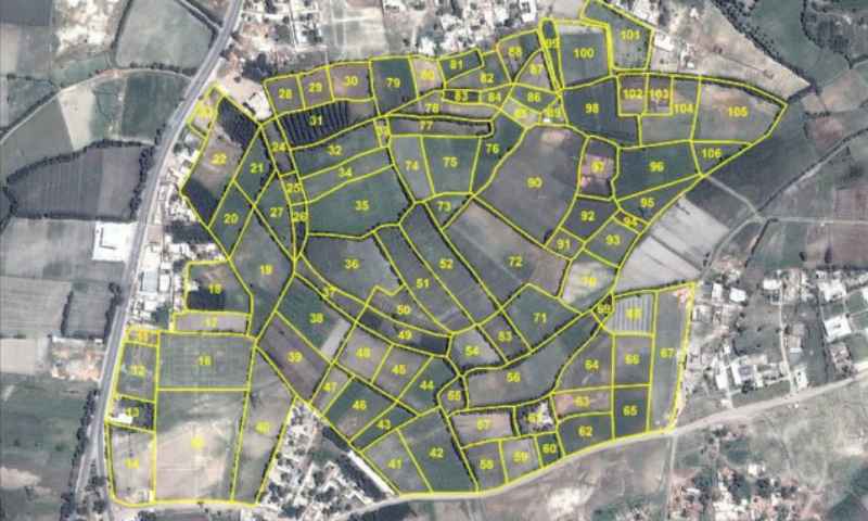
Cadastral Mapping of Tehsil Yazman, Bahawalpur
Cadastral Mapping – Tehsil Yazman, Bahawalpur

Project: Cadastral Mapping of Tehsil Yazman, Bahawalpur

High-accuracy cadastral mapping to strengthen land records and planning.

Location: Yazman Tehsil, District Bahawalpur Timeline: Dec 2024 – Apr 2025

Scope of Work

  • High-accuracy cadastral mapping.
  • Spatial data collection and georeferencing.
  • Boundary demarcation for land records and planning.
Partner
Geoinformatic Services
© AI Geo Navigators · Cadastral Mapping · Yazman
Geo Informatics

Cadastral Mapping (Accountancy Outsourcing Services Ltd)

Cadastral Mapping of Gujranwala District
Cadastral Mapping – Gujranwala District (AOS)
AOS (Accountancy Outsourcing Services Ltd.)

Project: Cadastral Mapping of Gujranwala District

Comprehensive cadastral mapping to support accurate land records and planning in Gujranwala.

Location: Gujranwala District Timeline: Jan 23, 2025 – Mar 16, 2025
Parcels Mapped
41,368
Mouzas Covered
60

Scope of Work

  • Mapping of 41,368 parcels across 60 mouzas.
  • Applied advanced geospatial techniques.
Partner
AOS Lahore
© AI Geo Navigators · Cadastral Mapping · Gujranwala
AOS

Shine Technical Support (STS GCC)

GIS, Remote Sensing, and Surveying Equipment Supply Project
Project Completion Acknowledgement: GIS, Remote Sensing, and Surveying Equipment Supply Project

Project Completion Acknowledgement: GIS, Remote Sensing, and Surveying Equipment Supply Project

AI Geo Navigators (Pvt.) Ltd., Islamabad, Pakistan has successfully completed the trading and supply project executed for Shine Technical Support (STS GCC), Al Jubail, Saudi Arabia.

Supplied Equipment

S. No.Equipment DescriptionSpecification / ModelQuantityRemarks
1GNSS / GPS Survey Receiver SetTrimble R12i / Enfield Reach RS2+40 UnitsPrecision land and infrastructure surveying
2Total StationTopcon ES-105 / Leica TS0312 UnitsCadastral, topographic, and engineering surveys
3UAV Drone for Aerial MappingDJI Phantom 4 RTK / Mavic02 UnitsHigh-resolution aerial mapping and environmental analysis
© AI Geo Navigators · GIS, Remote Sensing, and Surveying Equipment Supply Project

Shine Technical Support

Al-Waleed Talal Harbi Al-Jashaam General Contracting.

GIS-Driven Environmental Impact Assessment
Project Completion Acknowledgement – GIS-Driven Environmental Impact Assessment

Project Completion Acknowledgement – GIS-Driven Environmental Impact Assessment

GIS-Driven Environmental Impact Assessment Project conducted by AI Geo Navigators (Private) Limited

Location: Saudi Arabia Timeline: Completed

This letter serves as formal confirmation of the successful completion of the GIS-Driven Environmental Impact Assessment Project conducted by AI Geo Navigators (Private) Limited. The project has been completed in full accordance with the outlined scope, objectives, and specifications, delivering all expected outcomes to the highest standards.

The deliverables of the project include:

  • Comprehensive environmental assessments for the site.
  • Geospatial data solutions for enhanced decision-making.
  • Detailed impact analysis of potential environmental risks.
  • Geospatial modeling and mapping solutions.
  • Recommendations for long-term environmental strategies and management.
  • Support for environmental policy development and regulatory compliance.

We appreciate the high-quality work your team has provided, which has played a critical role in enhancing our environmental decision-making processes and long-term planning.

Throughout the project, your team exhibited exceptional professionalism and technical expertise, ensuring that the project was completed efficiently and within the agreed parameters. The insights and solutions provided have already begun to support our strategic goals, and we are confident in the lasting value of this collaboration.

We look forward to the opportunity to collaborate on future projects and to further building on the strong relationship established during this engagement.

© AI Geo Navigators · GIS-Driven Environmental Impact Assessment Project
Al Waleed

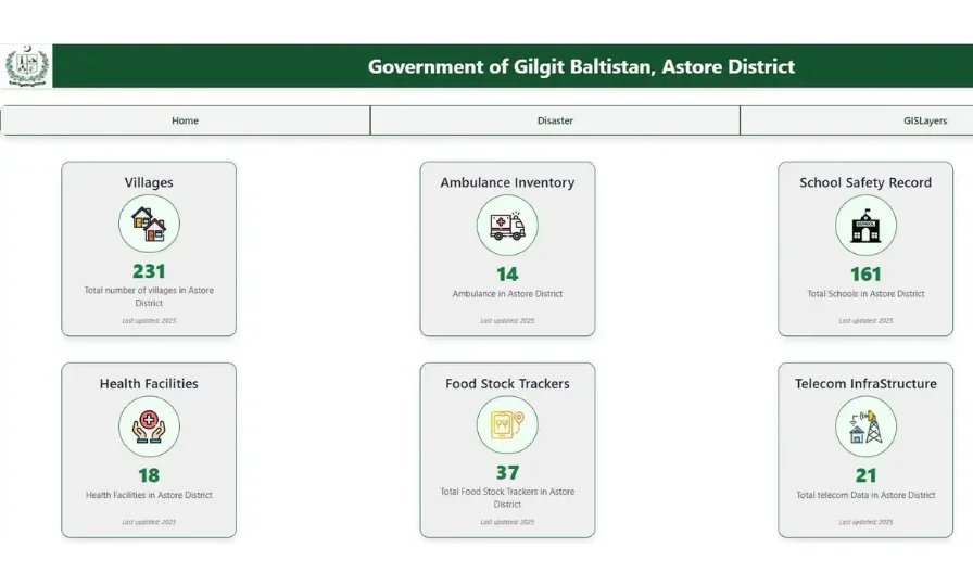
District Administration Astore, Gilgit-Baltistan

MHVRA Web Portal Completion
Multi-Hazard Vulnerability and Risk Assessment (MHVRA) Web Portal
MHVRA Web Portal Completion – Certificate of Appreciation
Deputy Commissioner Astore, Government of Gilgit-Baltistan

MHVRA Web Portal Completion

Awarded to AI Geo Navigators (Pvt.) Ltd. for exemplary contribution in disaster risk reduction

The Certificate recognizes the successful completion of the MHVRA Web Portal project with the following key contributions:

  • Design and development of an interactive GIS-based web platform integrating multi-hazard data, vulnerability indicators, and risk assessment layers.
  • Application of geospatial analysis and AI-driven risk modeling for accurate hazard visualization.
  • Creation of dynamic dashboards to provide real-time hazard information for data-driven decision-making.
  • Enhancement of early warning capabilities and support for long-term resilience planning across the district.
  • Exemplary professionalism, technical expertise, and innovation recognized by the Deputy Commissioner Astore.
© AI Geo Navigators · MHVRA Web Portal · District Administration Astore

National Disaster Management Authority (NDMA)

MHVRA – District Nushki (NDMA)
MHVRA District Nushki – Project Completion
National Disaster Management Authority (NDMA)

MHVRA District Nushki Completion

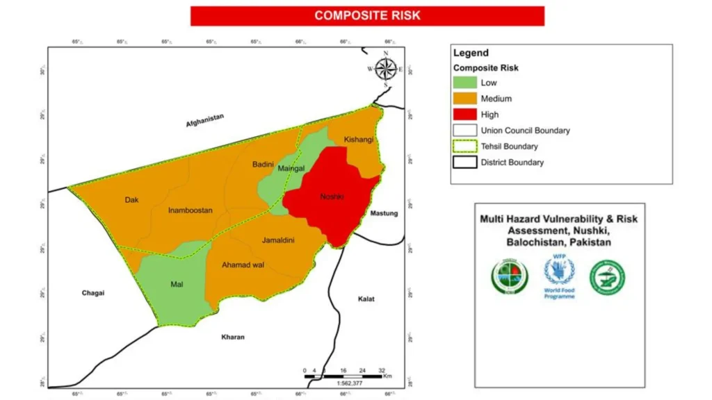
AI Geo Navigators proudly contributed to the successful completion of the Multi-Hazard Vulnerability and Risk Assessment (MHVRA) for District Nushki.

This initiative focused on hazard and exposure assessment to build a stronger understanding of disaster risks across District Nushki and support resilient development planning.

  • Comprehensive assessment of multi-hazard exposure and district-level vulnerabilities.
  • Geospatial mapping of risk-prone zones, communities, assets, and infrastructure.
  • Evidence-based insights for disaster preparedness and emergency response planning.
  • Support for risk reduction strategies and long-term resilience investments.
  • Technical contribution by AI Geo Navigators in hazard analytics and decision-support systems.
  • Strengthened institutional planning capacity through reliable spatial risk intelligence.
© AI Geo Navigators · MHVRA Project · District Nushki

National Disaster Management Authority (NDMA)

MHVRA – District Nushki (NDMA)
MHVRA District Nushki – Project Completion
National Disaster Management Authority (NDMA)

MHVRA District Nushki Completion

AI Geo Navigators proudly contributed to the successful completion of the Multi-Hazard Vulnerability and Risk Assessment (MHVRA) for District Nushki.

This initiative focused on hazard and exposure assessment to build a stronger understanding of disaster risks across District Nushki and support resilient development planning.

  • Comprehensive assessment of multi-hazard exposure and district-level vulnerabilities.
  • Geospatial mapping of risk-prone zones, communities, assets, and infrastructure.
  • Evidence-based insights for disaster preparedness and emergency response planning.
  • Support for risk reduction strategies and long-term resilience investments.
  • Technical contribution by AI Geo Navigators in hazard analytics and decision-support systems.
  • Strengthened institutional planning capacity through reliable spatial risk intelligence.
© AI Geo Navigators · MHVRA Project · District Nushki

Hydropower Facility at Budalas Nagar, Gilgit-Baltistan

MHVRA of 1.5 MW Hydropower Facility at Budalas Nagar, Gilgit-Baltistan
MHVRA Budalas Nagar Hydropower Facility – Project Completion
Public Works Department — PWD Gilgit

MHVRA of 1.5 MW Hydropower Facility at Budalas Nagar, Gilgit-Baltistan

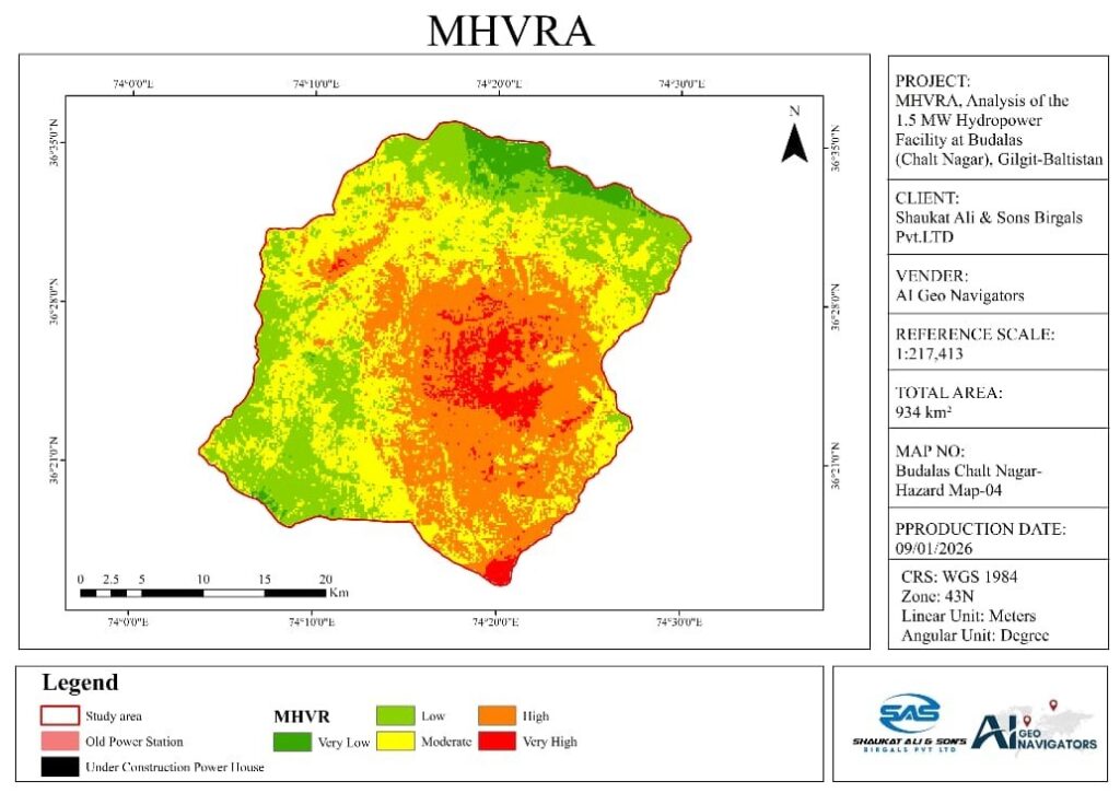
AI Geo Navigators contributed to the Multi-Hazard Vulnerability and Risk Assessment (MHVRA) of the 1.5 MW Hydropower Facility at Budalas Nagar, Gilgit-Baltistan, supporting risk-informed infrastructure planning and resilience.

This project focused on assessing potential hazards, exposure, and vulnerability around the hydropower facility to support safer infrastructure management, emergency preparedness, and climate-resilient development.

  • Assessment of multi-hazard risks affecting the 1.5 MW hydropower facility and surrounding area.
  • Geospatial mapping of hazard-prone zones, infrastructure exposure, and vulnerable assets.
  • Identification of potential risks linked to floods, slope instability, seismic exposure, and climate-related hazards.
  • Evidence-based inputs for infrastructure safety, maintenance planning, and emergency response.
  • Technical support by AI Geo Navigators in hazard analytics, GIS mapping, and decision-support systems.
  • Strengthened planning capacity for resilient hydropower infrastructure in Gilgit-Baltistan.
© AI Geo Navigators · MHVRA Project · Budalas Nagar Hydropower Facility · PWD Gilgit