Geo-Spatial Solutions for Safe Housing in the Hindu Kush Himalaya (HKH) Pakistan Terrain
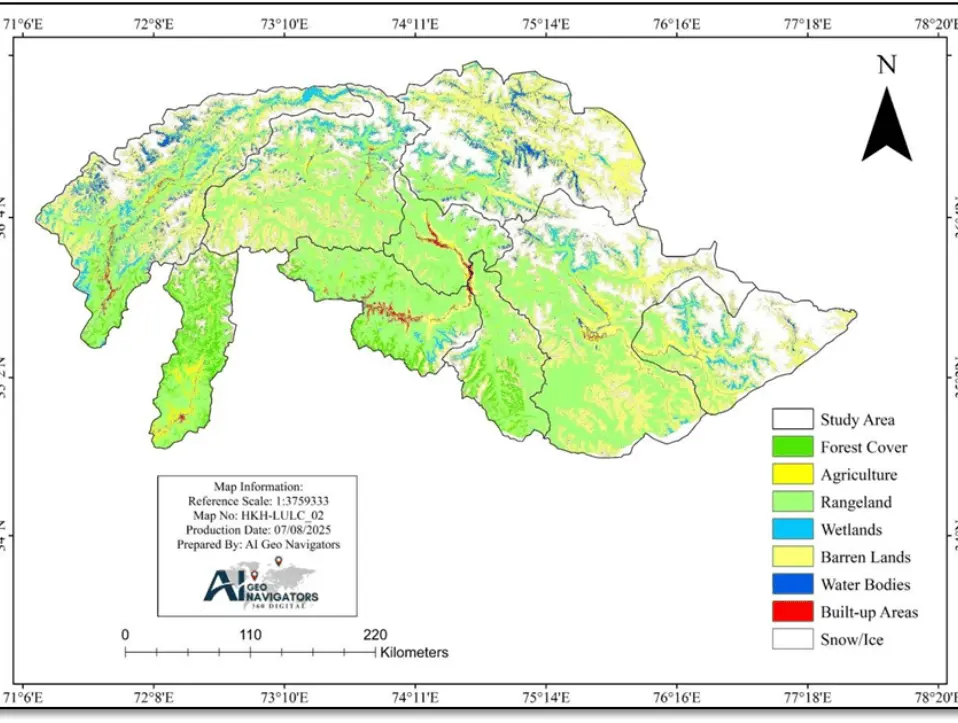
1. Background: The Hindu Kush Himalaya (HKH) region of Pakistan is highly vulnerable to natural hazards including landslides, flash floods, and seismic activity due to its rugged terrain, fragile geology, and changing climate. As communities continue to expand in these high-risk zones, the need for safe, sustainable housing has become increasingly urgent. This case study […]
Monitoring the 2025 Monsoon Floods in Pakistan Using GIS and Remote Sensing
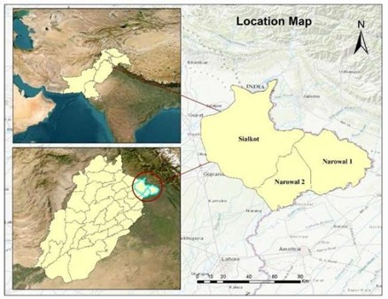
Abstract The monsoon in August 2025 brought severe flooding in the Sialkot and Narowal districts of Punjab, Pakistan, affecting about 1,045 km² of land. This research combines Sentinel-1 Synthetic Aperture Radar (SAR), and CHIRPS daily rainfall data to map flood extent and evaluate hydrological drivers. Sentinel-1 SAR data facilitated accurate flood delineation even in cloudy […]
AI Geo Navigators Meeting With CPECC Discuss Ongoing Projects and Collaboration
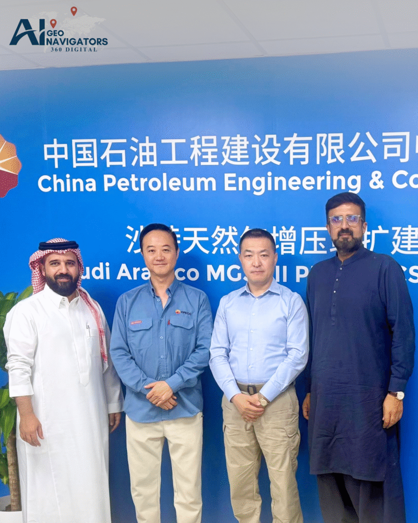
Asim Javid, CEO of AI Geo Navigators and STS, had a meeting with the CPECC team to discuss Ongoing Projects and Future Collaboration. During the meeting, key topics included exploring further collaboration opportunities between the teams, focusing on how both organizations can work together to achieve shared goals. There was an emphasis on the importance […]
Understanding ESG Compliance: Key Terms, Risks, and Opportunities

Environmental, Social, and Governance (ESG) compliance has become one of the most important business priorities in recent years. Companies across industries are now being evaluated not only for their financial performance but also for how they manage environmental responsibilities, social impact, and governance structures. Investors, regulators, and consumers increasingly expect businesses to follow ESG frameworks […]
Applications of GIS and Remote Sensing in Geology, Rock Mechanics, and Rock Classification
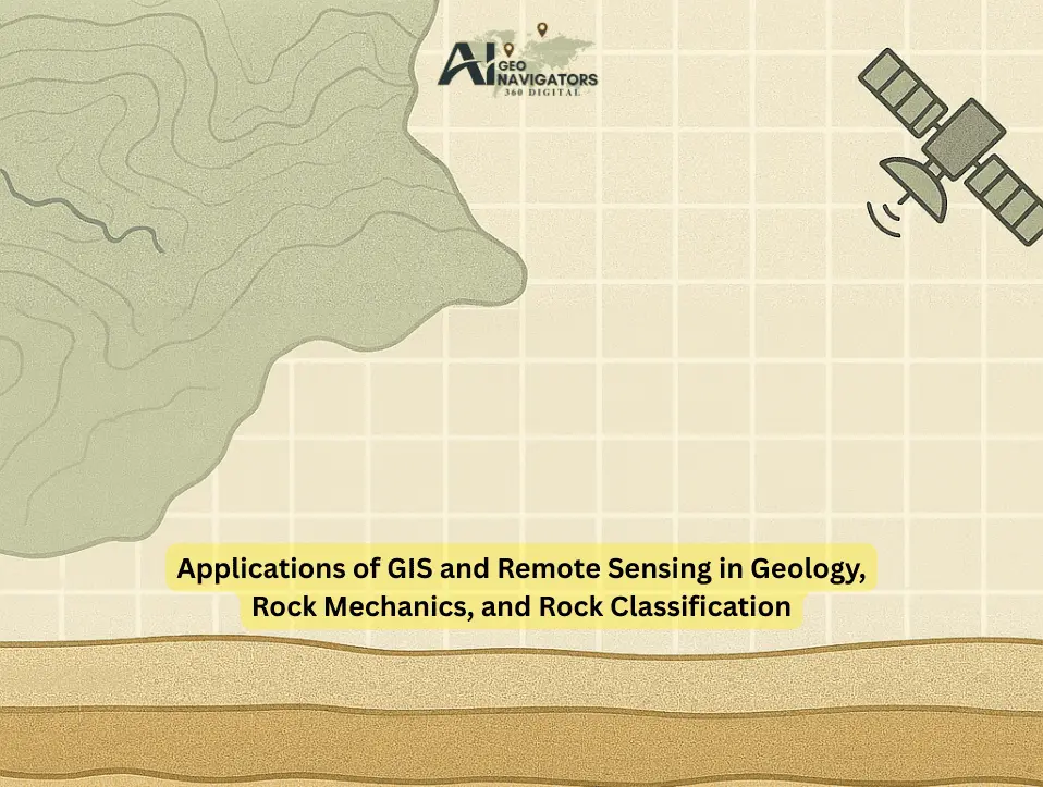
Geology plays a vital role in understanding Earth structure, resources, and hazards. Within this domain, rock mechanics and rock classification are essential for civil engineering, mining, natural hazard management, and environmental sustainability. With the advancement of technology, Geographic Information Systems (GIS) and Remote Sensing (RS) have become powerful tools that complement traditional field methods, providing […]
A Day in the Life of a GIS Specialist

A day in the life of a GIS specialist involves more than just mapping; it’s about solving real-world problems using spatial analysis, advanced software and a keen eye for detail. From field data collection to creating dynamic dashboards, Gis professionals bridge the gap between data and decision-making. GIS Specialists: Who Are They? The job of […]