The Iran-Israel Conflict: Environmental and Climate Implications of a Regional Power Struggle
Iran and Israel’s long-running geopolitical rivalry is fueled by deep-rooted ideological disagreements, strategic objectives, and regional power struggles. The two countries have been engaged in a shadow war that includes cyber operations, proxy conflicts, and regional influence campaigns, despite the fact that the conflict has not resulted in direct combat (Fulton, 2019; Litvak, 2021). Mainstream […]
How GIS and Climate Resilience are Shaping the Future of Climate Adaptation
In a world where climate extremes are becoming a bigger concern, the combination of GIS and climate resilience offers not only data but also a lifeline. This enables communities to plan, prepare, and adapt for a future that is safer and more sustainable. Over the past century, the average temperature of our globe has increased […]
Community-Based Glacier Grafting in Pakistan: Integrating Indigenous Practices with GIS for Climate Adaptation
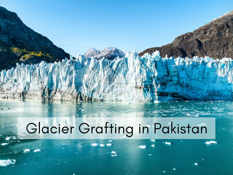
Glacier Grafting, a local mythological method and ancient practices of developing a glacier. In local folklores and uttered history about the glaciers located at various places where the glaciers exist as snow-patches or small glaciers. The local historians state that the local people argue about the grafting of the glaciers by indigenous wisdom and experiences. […]
Benefits of GIS Mapping (Geographic Information System)
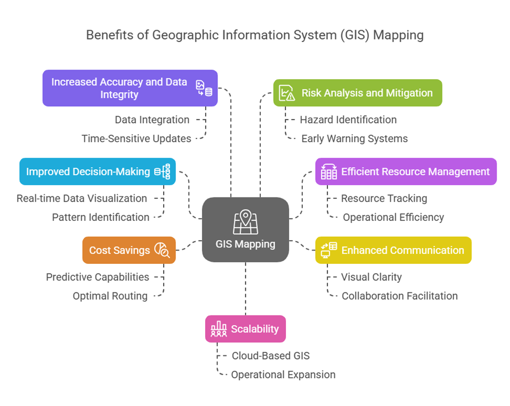
Global decision-making now depends on GIS (Geographic Information System) mapping as one of the most efficient strategies, which transforms raw geographic data into significant information. GIS mapping is a crucial technology component needed by modern businesses to carry out their activities in the commercial development, agriculture, urban development, and emergency management sectors. Understanding the GIS […]
Land Use Mapping and the Role of GIS
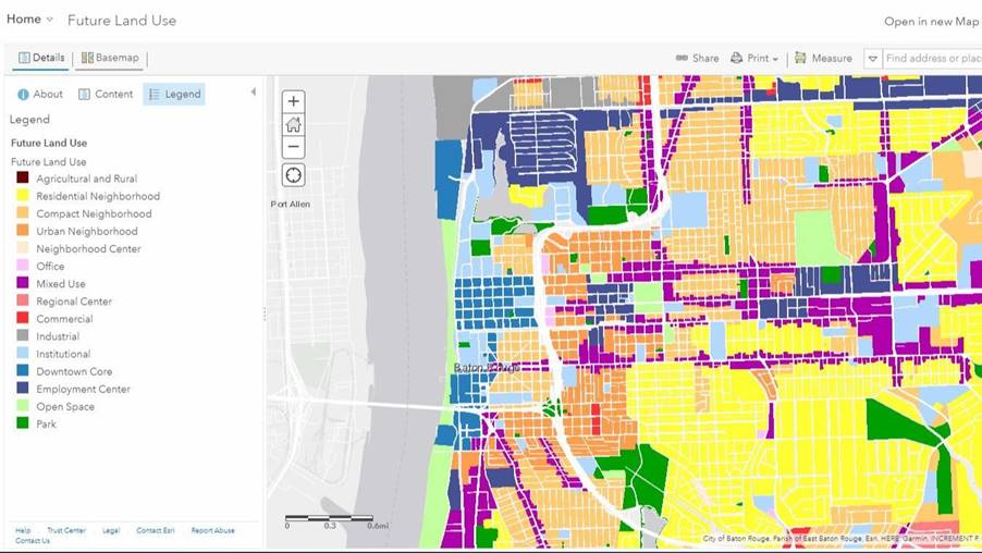
What is Land Use Mapping? The process of determining and classifying the many uses of a given piece of land is known as land use mapping. Residential, commercial, transportation, and agricultural development are some examples of these activities. Topographic maps, land allocation plans, aerial photographs and statistical data are typically used to construct land use […]
Geographic Information System | What is Gis
Geographic Information System | What is Gis A computer program called a Geographic Information System (GIS) links data and maps, It enables users to record, store, examine, and display geographic data. To put it simply, GIS aids in our comprehension of the location and characteristics of objects. GIS is a potent decision-making tool that may […]