Land Use Mapping and the Role of GIS
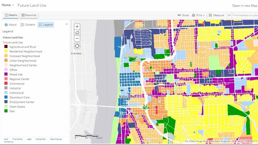
What is Land Use Mapping? The process of determining and classifying the many uses of a given piece of land is known as land use mapping. Residential, commercial, transportation, and agricultural development are some examples of these activities. Topographic maps, land allocation plans, aerial photographs and statistical data are typically used to construct land use […]