Hydrometeorological Assessment of Water Budget Components in Rawalpindi Division, Pakistan: An ERA5 Reanalysis and Machine Learning Approach
Background: Water scarcity and hydrological variability are increasing globally due to climate change, rising temperatures, and changing precipitation patterns. These changes disturb the natural water cycle by increasing evaporation, altering rainfall distribution, and reducing surface runoff and soil moisture. In semi arid regions such as northern Pakistan, water availability depends heavily on seasonal monsoon rainfall, […]
Building for climate resilience: Cases of good practices and solutions for safe and resilient settlements in the Hindu Kush Himalaya
Background: The mountainous regions of Pakistan, particularly Gilgit-Baltistan, Swat, and Chitral, are highly vulnerable to landslides, flash floods, seismic activity, glacial lake outburst floods (GLOF), and other climaterelated hazards. Rugged terrain, fragile geology, and increasing climate variability amplify risks to lives, infrastructure, and ecosystems. Unplanned housing expansion on steep slopes, riverbanks, or high-risk areas further […]
GIS-Based Case Study on Climate Influences and Disease Spread Among Nomadic Populations in Balochistan, Pakistan
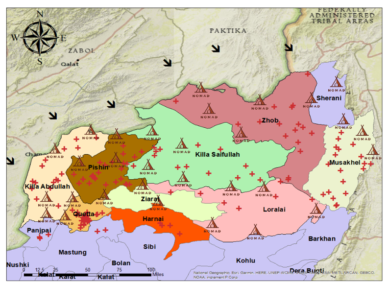
ABSTRACT Management of infectious diseases in remote nomadic communities is a problematic affair because these people are mobile, geographically isolated, and have limited access to health facilities. This review will address diagnostic and predictive disease modeling systems among people on the move using Geographic Information Systems (GIS). It analyses how GIS has been used in […]
Geo-Spatial Solutions for Safe Housing in the Hindu Kush Himalaya (HKH) Pakistan Terrain
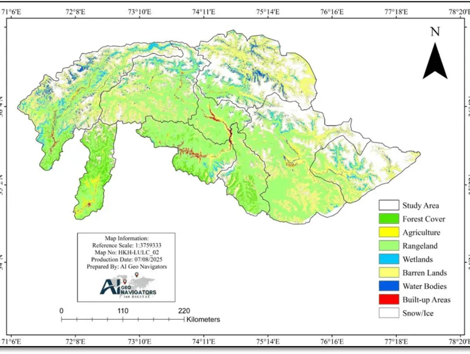
1. Background: The Hindu Kush Himalaya (HKH) region of Pakistan is highly vulnerable to natural hazards including landslides, flash floods, and seismic activity due to its rugged terrain, fragile geology, and changing climate. As communities continue to expand in these high-risk zones, the need for safe, sustainable housing has become increasingly urgent. This case study […]
Monitoring the 2025 Monsoon Floods in Pakistan Using GIS and Remote Sensing
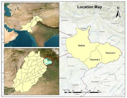
Abstract The monsoon in August 2025 brought severe flooding in the Sialkot and Narowal districts of Punjab, Pakistan, affecting about 1,045 km² of land. This research combines Sentinel-1 Synthetic Aperture Radar (SAR), and CHIRPS daily rainfall data to map flood extent and evaluate hydrological drivers. Sentinel-1 SAR data facilitated accurate flood delineation even in cloudy […]