Difference Between GIS and GPS | Everything You Need to Know
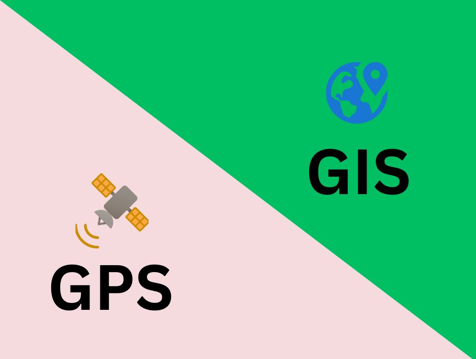
Difference between GIS and GPS lies in their core functionalities, GPS is about pinpointing location, while GIS is about understanding spatial relationships. However, when used together, they form a robust geospatial solution that enhances decision-making in numerous industries. From urban planning and transportation to environmental management and public safety, the synergy of GIS and GPS […]
A Day in the Life of a GIS Specialist

A day in the life of a GIS specialist involves more than just mapping; it’s about solving real-world problems using spatial analysis, advanced software and a keen eye for detail. From field data collection to creating dynamic dashboards, Gis professionals bridge the gap between data and decision-making. GIS Specialists: Who Are They? The job of […]
Benefits of GIS Mapping (Geographic Information System)
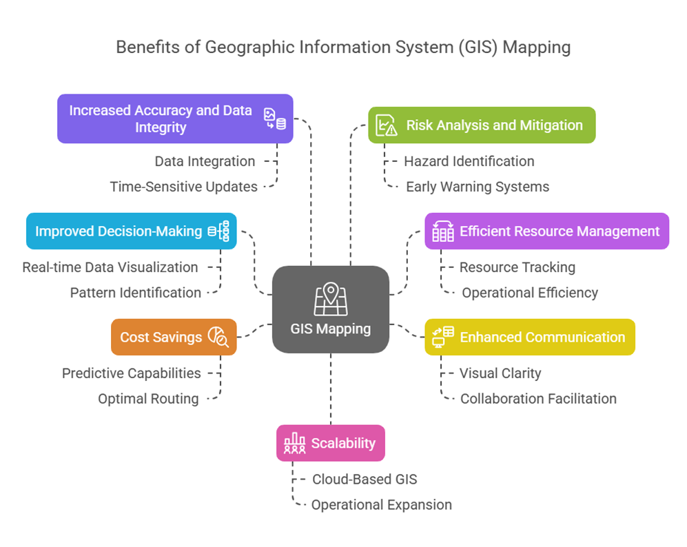
Global decision-making now depends on GIS (Geographic Information System) mapping as one of the most efficient strategies, which transforms raw geographic data into significant information. GIS mapping is a crucial technology component needed by modern businesses to carry out their activities in the commercial development, agriculture, urban development, and emergency management sectors. Understanding the GIS […]
Applications of GIS | Geographic Information System
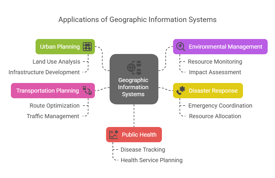
Geographic Information Systems (GIS) are powerful tools that help us understand patterns, relationships, and trends based on location. From mapping city infrastructure to managing natural resources, application of GIS plays an important role in solving real-world problems across industries. In this article, we explore 10 of the most impactful applications of GIS across diverse domains. […]
Climate Advocacy and Action in Pakistan: Bridging Gaps Through Communication
Pakistan stands at the frontline of the global climate crisis. Ranked consistently among the top ten most climate-vulnerable countries by the Global Climate Risk Index (Germanwatch, 2021), it faces mounting environmental challenges, from glacial melt in the north to flooding in Sindh and Balochistan. In 2022 alone, Pakistan witnessed devastating monsoon floods that displaced over […]
Land Use Mapping and the Role of GIS
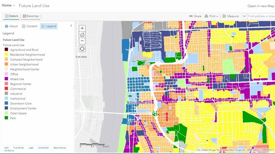
What is Land Use Mapping? The process of determining and classifying the many uses of a given piece of land is known as land use mapping. Residential, commercial, transportation, and agricultural development are some examples of these activities. Topographic maps, land allocation plans, aerial photographs and statistical data are typically used to construct land use […]
How to Become a UI/UX Designer | Complete Roadmap

Why do some apps feel so natural to use? That smooth flow, those satisfying clicks, it’s not magic, it’s UI/UX design. In a world where everything’s digital and attention is gold, companies are going all-in on user experience. And guess what? 2025 is blowing up with opportunities for designers who can make things not just […]
Geographic Information System | What is Gis
Geographic Information System | What is Gis A computer program called a Geographic Information System (GIS) links data and maps, It enables users to record, store, examine, and display geographic data. To put it simply, GIS aids in our comprehension of the location and characteristics of objects. GIS is a potent decision-making tool that may […]