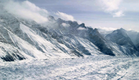
In the majestic mountains of Gilgit Baltistan, glaciers are not just symbols of beauty they are lifelines of Pakistan’s river systems, sustaining agriculture, hydropower, and ecosystems downstream. But these glaciers are under threat. Rising global temperatures, changing precipitation patterns, and human-induced climate change are accelerating glaciers melting at an alarming rate.
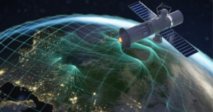
To understand and respond to these alarming trends, scientists are increasingly relying on glacier monitoring and advanced technologies such as GIS for glacier monitoring and remote sensing. These tools allow for accurate glacier change detection, helping researchers and policymakers observe transformations in ice cover, detect emerging glacial lake outburst flood (GLOF) risks, and perform detailed glacier change analysis in Pakistan.
As glacier retreat continues, glacier monitoring Pakistan initiatives have become essential for environmental management, disaster preparedness, and water resource planning. The region’s glaciers are now the focus of extensive glaciers study efforts combining field observations, satellite imagery, and geospatial analysis to track ice dynamics and their cascading effects on local ecosystems.
Through these efforts, organizations like AI Geo Navigators are at the forefront of turning data into action using geospatial innovation to map, analyze, and safeguard the “melting mountains” of Gilgit-Baltistan for more sustainable future.
Melting mountains: A warning from Gilgit-Baltistan
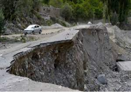
The alarming rate of glaciers melting in Gilgit-Baltistan has reached a critical point, posing a significant threat to the region’s ecosystem and inhabitants. The ticking time bomb of climate change is starting to burst, and the consequences are devastating. Rising temperatures are causing glaciers to melt rapidly, leading to flash floods, landslides, and other climate-related disasters.
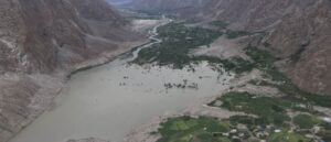
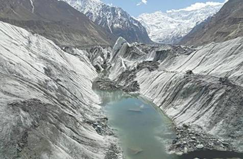
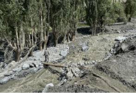
The phenomenon of glacier melting impact is now evident across Gilgit-Baltistan. Seasonal patterns have shifted, summer snowmelts start earlier and last longer, altering river flow regimes and increasing downstream flood risks. The formation of unstable glacial lake outburst floods (GLOFs), destroying homes, roads, and agricultural lands in vulnerable valley like Hasanabad and Hoper.
Through glacier monitoring and glacier change detection using satellite-based systems such as Landsat, sentinel-2, and MODIS, researchers are now able to identify and track the evolution of these glacial lakes in near-real time. Advanced GIS for glacier monitoring tools allow analysts to model outburst flood pathways, estimate flood intensity and pinpoint high-risk zones. This data-driven approach is a critical part of glacier change analysis in Pakistan, enabling local authorities and environmental organizations to develop early warning systems and adaptation measures.
If urgent action is not taken, the continued retreat of these mountain glaciers could have far-reaching consequences from reduced freshwater supply and increased flood hazards to loss of cultural heritage and biodiversity. The “melting mountains” of Gilgit-Baltistan stands as a stark reminder that glacier monitoring is not just about scientific observation it is about securing Pakistan’s environmental and economic future.
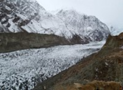
Glaciers in Gilgit-Baltistan
How satellites detect Glacier change
Traditional glacier study involved challenging field expeditions across rugged terrains. Today, advancements in remote sensing and GIS for glacier monitoring have scientists observe glacier behavior in real time.
Satellites such as Landsat 8, sentinel-2, and MODIS capture high-resolution, multi-temporal imagery that enables accurate glaciers change detection. By comparing images overtime, experts can track glacier retreat or advance, monitor glacier melting impact, and identify newly formed glacial lakes crucial for predicting glacial lake outburst flood (GLOF) risks.
Through continuous analysis, these datasets support glacier change analysis in Pakistan, allowing researchers and policymakers to understand trends, assess vulnerabilities, and plan adaptive strategies for mountain communities in Gilgit-Baltistan.
Role of Remote Sensing in Glacier Monitoring
Remote sensing plays a transformative role in glacier monitoring in Pakistan, offering reliable, repeatable, and large-scale observation of mountain ice dynamics. Using automated and semi-automated methods, researchers can now assess glacier changes even in the most remote parts of Gilgit-Baltistan.
When integrated with GIS for glacier monitoring, satellite-derived data becomes a powerful analytical tool turning raw imagery into actionable information. This combination allows experts to map glacier boundaries, monitor glacial lake outburst flood (GLOF) risk zones, and detect early warning signs of potential disasters caused by rapid glacier retreat or melting.
Key applications include:
- Mapping glacier boundaries and snowlines using optical imagery from Landsat and sentinel satellites.
- Estimating glacier mass balance through surface temperature and albedo indices, which indicate melting intensity and snow cover variation.
- Detecting and monitoring glacial lakes to track their expansion and predict GLOFs before they threaten communities.
By applying glacier change detection and glacier change analysis in Pakistan, remote sensing helps scientists visualize long-term glacier trends and assess the glacier melting impact on ecosystems, water resources, and local livelihoods. This data-driven approach forms the foundation of sustainable mountain management a key focus area for AI Geo Navigators.
Glacier change trends in Gilgit-Baltistan
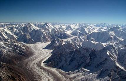
Gilgit-Baltistan, located in the northernmost region of Pakistan, is home to some of the world’s most significant glaciers, these glaciers serve as vital water sources for the region, supporting agriculture, hydropower, and local ecosystems.
However, in recent decades, the region has witnessed alarming glacier retreat due to rising temperatures and climate change. The accelerated melting poses severe threats to the local population, including the risk of glacial lake outburst floods (GLOFs), reduced freshwater availability, and increased environmental degradation.
Observed Trends (1990-2024)
Accelerated Glacier Retreat:
Remote sensing observations from Landsat and Sentinel imagery indicated that many glaciers in Hunza and Skardu are retreating by 10-20 meters per year. This retreat reflects the intensifying glacier melting impact linked to rising temperatures and decreased snow accumulation.
Karakorum Anomaly stable or Advancing Glaciers:
Some glaciers in the Karakorum range show stability or slight advancement, a unique feature known as the Karakorum Anomaly. This is attributed to regional climate variations and winter snowfall increases detected through MODIS snow cover data.
Expansion of Glacial Lakes:
Through glacier change detection and GIS for glacier monitoring, over 3,000 glacial lakes have been mapped in Gilgit-Baltistan, with Sentinel-2 imagery identifying more than 30 potentially dangerous lakes. The shisper glacier in Hasanabad, Hunza, is a prime example where advancing ice caused repeated GLOF events.
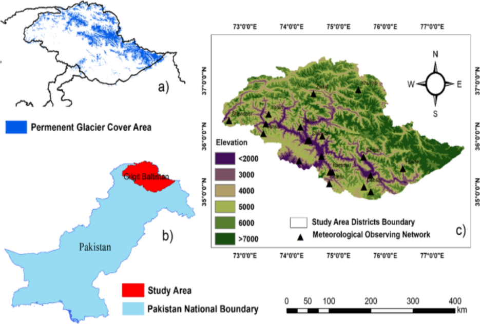
Figure 1. Map showing glacier elevation zones of Gilgit-Baltistan.
Figure source: Adapted from “Effects of climate change on vegetation and snow cover area in Gilgit-Baltistan using MODIS data” (Satti et al., 2022). Use for educational purposes only.
Techniques and tools used for monitoring the melting mountains
Modern glacier monitoring relies on a powerful combination of remote sensing, GIS, and AI-driven technologies to track and understand glacier dynamics across Gilgit-Baltistan and the greater Karakorum region. These tools allow experts to observe, quantify, and predict changes with accuracy even in areas that are otherwise inaccessible.
By integrating multi-source satellite data, GIS for glacier monitoring transforms raw imagery into actionable spatial intelligence. This supports glacier change analysis in Pakistan, enabling researchers and policymakers to plan more effectively for climate adaptation and disaster preparedness.
Key Techniques and Tools
Digital Elevation Models (DEMs):
DEMs such as SRTM, ASTER, AND Copernicus provide elevation data used to estimate glacier volume, slope, and topographic change. These models are vital for understanding ice loss and terrain deformation caused by glacier retreat.
Remote Sensing Time-Series Analysis:
Long-term satellite observations from Landsat, Sentinel, and MODIS enable glacier change detection across decades. Time-series analysis helps identify trends in glacier advance or retreat, snow cover variability and glacial lake expansion.
Cloud-Based Geospatial Platforms:
Tools like Google Earth Engine (GEE), QGIS, ArcGIS pro, enable advanced glacier change analysis in Pakistan by integrating multi-temporal satellite imagery and automated processing workflow.
AI-Based Image classification:
Machine learning and deep learnings are now revolutionizing glacier monitoring Pakistan. By training models on labeled datasets, AI can automatically classify glacier zones, detect boundaries, and map glacier melting impact with greater precision.
These methods provide foundations for glacier monitoring Pakistan, allowing experts to visualize how glaciers evolve under climate stress. The insights gained help share early warning systems, guide infrastructure planning, and protect vulnerable mountain communities from the effects of glacial lake outburst floods (GLOFs).
Impact of Glacier Melting on Local Communities and Ecosystem
The glacier melting impact in Gilgit-Baltistan extends far beyond the mountains. These glaciers are lifelines of the Indus River system regulate water flow for millions across Pakistan. But as temperature rises, the accelerated glacier retreat observed through glacier change detection threatens both ecosystems and human livelihoods.
The effects of global warming and the melting of glaciers in Gilgit-Baltistan extend far beyond environmental degradation. One of the most immediate consequences is the disruption of the region’s water supply. The glaciers in this area are critical source of fresh water for millions of people, sustaining agriculture, livestock, and daily life. As glaciers continue to shrink, river systems experience unpredictable fluctuations in water flow, often leading to water shortages during the summer months when demand is highest.
Community vulnerability and Displacement:
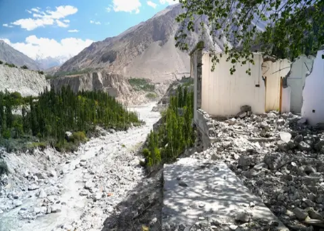
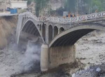
Frequent glacial lake outburst floods (GLOFs) have become a major hazard in valleys such as Hunza, Ghizer, and skardu. Villages like Hasanabad have faced repeated GLOF events triggered by advancing or collapsing of glaciers, damaging homes, bridges, and roads.
Through glacier monitoring Pakistan initiatives, scientists use remote sensing and GIS to identify risk zones and support early warning systems helping communities prepare and adapt to risk changing environmental conditions.
Impacts on Agriculture and water Resources:
Melting glaciers initially increase river discharge, but as ice reserves shrink, water availability declines, directly affecting irrigation systems and hydropower generation.
This imbalance threatens agricultural sustainability, especially in mountain farming communities that depend on glacier-fed streams.
Ecosystem shifts and Biodiversity Loss:
The glacier melting impact alters the delicate balance of alpine and subalpine ecosystems. As snowlines shift upward, many cold-adapted species face habitat loss. Increased sedimentation and changing water temperatures disrupt aquatic life in glacier-fed rivers and lakes, leading to biodiversity decline.
GIS for glacier monitoring helps visualize these ecological transformations, allowing conservationists to plan adaptive strategies.
AI Geo Navigators: Mapping a sustainable Future through GIS and Remote Sensing
AI Geo Navigators leverages remote sensing and GIS for glacier monitoring in Pakistan, focusing on glacier change detection and GLOF risk mapping in Gilgit-Baltistan. By integrating Landsat, Sentinel imagery, and AI-based analysis, the team transforms geospatial data into actionable insights. Our mission is to support sustainable mountain management and enhance community resilience against the glacier melting impact through science-driven decision making.
Conclusion:
The melting mountains of Gilgit-Baltistan are more than a warning they are a call to action. Harnessing the power of remote sensing, GIS, and AI-driven glacier change detection. Pakistan can transform data into defense against climate threats. Strengthening glacier monitoring in Pakistan and uniting science with local wisdom are vital to safeguard water security, biodiversity, and livelihoods. With innovation and commitment, we can turn the story of our glaciers from one of crisis into one of resilience, sustainability, and Hope.