Difference between GIS and GPS lies in their core functionalities, GPS is about pinpointing location, while GIS is about understanding spatial relationships. However, when used together, they form a robust geospatial solution that enhances decision-making in numerous industries. From urban planning and transportation to environmental management and public safety, the synergy of GIS and GPS powers innovation and efficiency.
GPS (Global Positioning System) is primarily used for determining precise location coordinates, whereas GIS (Geographic Information Systems) is designed to store, analyze, and visualize spatial data.
Understanding how these systems differ and work together is essential, especially in industries like urban planning, logistics, environmental monitoring, and navigation.
In this comprehensive guide, we will delve into the key differences between GIS and GPS, exploring their individual functions, features, applications, and how they can be integrated for more advanced geospatial analysis.
Whether you’re a student, a GIS professional, or just curious about how location-based technologies work, this article will provide valuable insights.
What is GPS?
The Global Positioning System, or GPS, is a satellite-based navigation system that gives accurate time and location data anywhere on the planet. Developed by the U.S. Department of Defense, GPS is now widely used in civilian applications, from personal navigation to commercial logistics.
GPS operates through a network of at least 24 satellites orbiting the earth. These satellites transmit signals that are received by GPS devices, which calculate the user’s location using a process called trilateration.
Features of GPS:
GPS is known for its accuracy, real-time capabilities, and global reach. Here are some of its features:
Accurate Positioning
One of the most significant features of GPS is its ability to provide accurate location data, typically within a few meters. In advanced GPS systems, such as Differential GPS (DGPS) or Real-Time Kinematic (RTK) GPS, accuracy can reach centimeter levels. Gps calculates position by measuring the time it takes for signals to travel from satellites to the receiver. This allows for pinpoint accuracy essential in surveying, aviation, and autonomous vehicles.
Global Coverage
GPS is designed to work anywhere on Earth, regardless of weather conditions. Its global satellite network ensures that users receive consistent signals whether they are in urban environments, remote locations, or on open seas. This makes it ideal for navigation in vehicles, aircraft, and maritime applications.
Real-Time Tracking
GPS is essential for real-time tracking and navigation as it continuously refreshes position data. Whether used in personal mobile devices or fleet management systems, GPS ensures that users can track movements instantly. Real-time data also aids in logistics, emergency services, and personal navigation applications.
Time Synchronization
Apart from location, GPS also provides highly accurate time data, synchronized with atomic clocks on satellites. This feature is crucial for applications that require precise timing, such as telecommunications, financial transactions, and data networks.
Low Power Consumption
GPS devices are designed to consume minimal power, which makes them suitable for portable applications. Whether embedded in smartphones or wearable devices, GPS can operate for extended periods without draining battery life significantly.
Applications of GPS
Navigation and Route Planning
GPS is widely used in navigation for personal, commercial, and industrial applications. In daily life, people use GPS on smartphones and car navigation systems to find directions and plan routes. GPS-enabled apps like Google Maps not only provide location tracking but also real-time traffic updates, helping users avoid congested areas.
Commercial logistics companies use GPS to monitor fleet movements and optimize delivery routes. By integrating GPS with logistics management software, companies can minimize fuel consumption, reduce transit times, and improve customer satisfaction. Aviation and maritime sectors also heavily rely on GPS for navigation and tracking aircraft and ships.
Emergency and Disaster Response
In emergencies, GPS is a lifesaver. Rescue teams use GPS to locate individuals in distress, such as stranded hikers or victims of natural disasters. Real-time location data enables quicker response times and more coordinated efforts.
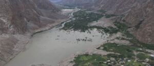
During natural disasters like floods or earthquakes, GPS devices help track the movement of people and aid distribution. Emergency responders use GPS data to map affected areas, plan evacuation routes, and coordinate rescue operations efficiently.
Geofencing and Asset Tracking
GPS is extensively used in creating virtual boundaries known as geofences. These boundaries trigger automatic responses when a GPS-enabled device enters or exits a predefined area. This technology is vital for fleet management, where companies track their vehicles’ movements to enhance logistics and safety.
Warehouses and logistics firms use this application to prevent theft and ensure inventory management. GPS data integrated with management software allows businesses to receive alerts if an asset moves out of its designated area, optimizing security and operational efficiency.
Wildlife and Environmental Monitoring
GPS is a critical tool in wildlife conservation. By attaching GPS collars to animals, researchers can track movement patterns, migration routes, and habitat usage. This real-time data helps in formulating effective conservation strategies and understanding the impact of human activities on wildlife.
Environmental agencies also use GPS to monitor natural changes such as glacier movement, river course shifts, and vegetation coverage. The data gathered aids in assessing climate change effects and planning environmental protection measures.
Military and Defense Applications
GPS has its origins in military applications, where it remains indispensable. Armed forces use GPS for navigation, reconnaissance and coordinating troop movements. Precision-guided munitions rely on GPS to hit specific targets with high accuracy.
Military drones and surveillance systems also utilize GPS for real-time location tracking. These applications enhance situational awareness and help execute strategic operations with precision. Furthermore, secure GPS channels are designed to resist jamming and spoofing during combat situations.
Autonomous Vehicles
GPS technology is fundamental in the development and operation of autonomous vehicles. Self-driving cars use GPS along with other sensors to navigate city streets and highways. Real-time GPS data helps these vehicles make informed decisions regarding speed, route optimization, and obstacle avoidance.
Integrating GPS with LiDAR and computer vision technologies allows for high-precision navigation, even in complex environments. This application is crucial for the advancement of autonomous public transport and commercial delivery systems.
Did you know that more than 4 billion GPS-enabled devices are in use worldwide, while GIS technology powers critical decision-making in over 80% of government agencies
What is GIS?
GIS (Geographic Information Systems) is an advanced tool for collecting, storing, manipulating, analyzing, and visualizing geographic data. Unlike GPS, which only provides location coordinates, GIS integrates various data types (spatial and non-spatial) to generate comprehensive maps and analytical models. GIS is widely utilized in areas such as urban planning, environmental management, and disaster response.
GIS helps users visualize spatial relationships and patterns, providing insights that can influence planning and decision-making. By integrating data from multiple sources—such as satellite imagery, demographic data, and topographical maps—GIS delivers multidimensional insights that go far beyond simple location tracking.
Features of GIS
Spatial Analysis
GIS excels at spatial analysis, allowing users to examine geographic data to identify patterns and correlations. For instance, urban planners can analyze traffic flow patterns to optimize public transport routes. Environmental scientists can study the spread of pollutants by analyzing spatial data from different regions.
Spatial analysis in GIS involves various techniques like buffering, overlay analysis, and spatial interpolation. These methods enable users to predict future scenarios, optimize resource allocation, and assess potential environmental impacts.
Data Integration
GIS integrates multiple data sources, including vector data (points, lines, polygons), raster data (satellite images), and tabular data (demographic statistics).
For example, combining satellite imagery with soil quality data can help agricultural planners identify the best areas for crop cultivation. GIS also integrates real-time data, such as weather updates and sensor readings, making it highly adaptive to changing conditions.
Visualization
One of GIS’s most valuable features is its ability to present complex data in a visual format. Interactive maps, heat maps, 3D models and data dashboards enable users to visualize spatial data effectively.
For instance, a GIS dashboard for urban planning may show real-time traffic conditions, demographic distribution, and infrastructure layouts. These visualizations aid in communicating insights to stakeholders clearly and efficiently.
Data Management
GIS serves as a central repository for geographic data, storing large volumes of spatial and attribute data. It enables data cataloging, retrieval, and updating, which is crucial for maintaining accurate and up-to-date geographic databases.
Organizations and governments use GIS data management to maintain land records, environmental data and infrastructure inventories. Advanced database systems like PostGIS and GeoServer integrate seamlessly with GIS applications to handle large geospatial datasets.
Applications of GIS
Water Resource Management
GIS supports efficient management of water resources by mapping watersheds, aquifers, and river systems. Hydrologists use GIS to analyze rainfall patterns, predict flood risks, and manage irrigation networks. This data-driven approach is crucial in water-scarce regions where optimal resource utilization is vital.
By overlaying topographical data with water distribution networks, planners can identify leakage points and areas with inadequate supply. Additionally, GIS helps monitor water quality by integrating data on pollutants, land use, and industrial discharge, ensuring sustainable water management practices.
Public Safety and Crime Mapping
Law enforcement agencies utilize GIS to map crime hotspots and analyze spatial crime patterns. By integrating incident data with demographic and geographical information, authorities can predict crime trends and allocate resources more effectively.
In emergency management, GIS aids in identifying vulnerable areas prone to natural disasters or human-made hazards. Real-time data visualization enables quicker responses to emergencies, reducing loss of life and property. This proactive approach significantly improves community safety and crisis management.
Health and Epidemiology
Epidemiologists use GIS to map infection spread, identify high-risk areas, and predict future hotspots. This spatial analysis guides targeted vaccination drives and public health interventions.
During pandemics, GIS dashboards provide real-time updates on infection rates, hospital capacity, and mortality trends. Health authorities use this data to allocate medical supplies efficiently and implement containment measures. GIS’s ability to integrate demographic data helps identify communities most vulnerable to health crises.
Transportation Planning and Traffic Management
Urban planners use GIS to model traffic flow and identify congestion points. By analyzing real-time data from traffic sensors, GIS helps optimize signal timings and design better road networks. This application is crucial for minimizing travel delays and improving public transit efficiency.
Logistics companies also benefit from GIS by planning the most fuel-efficient delivery routes. Analyzing road conditions, traffic density, and route alternatives reduces operational costs and enhances delivery times. This data-driven approach makes urban mobility more sustainable.
GIS vs. GPS: What’s the Difference
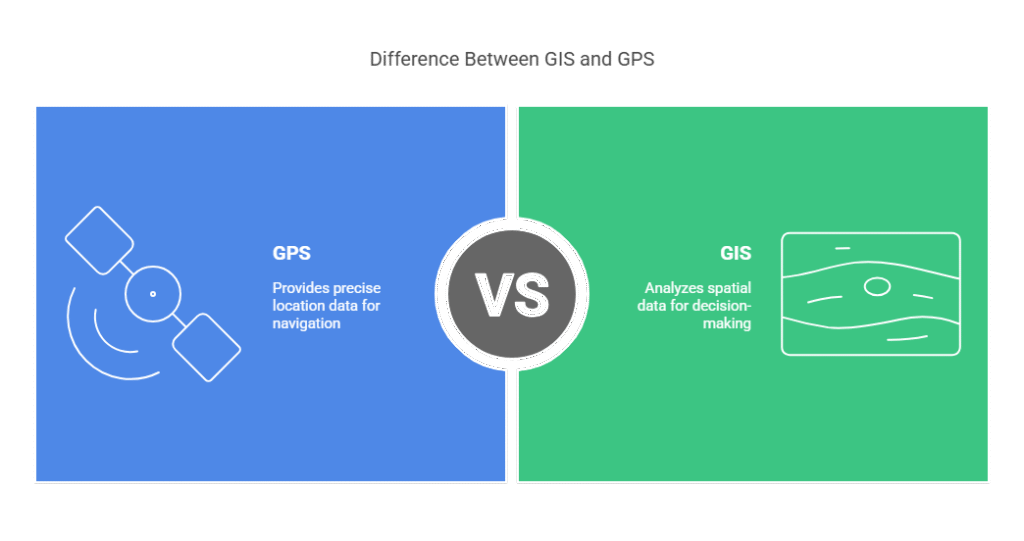
While both GIS and GPS are integral to geospatial technology, they serve different functions. Here’s a breakdown of their differences:
| Aspect | GPS | GIS |
| Purpose | Finding precise locations | Analyzing and visualizing spatial data |
| Data Type | Coordinates (latitude, longitude) | Spatial and attribute data |
| Core Function | Navigation and positioning | Data management and spatial analysis |
| Accuracy | Typically a few meters | Depends on data resolution and analysis |
| Primary Use Case | Navigation, tracking, timing | Mapping, planning, spatial decision-making |
How Does GPS Work?
GPS works on the principle of trilateration. Each satellite continuously broadcasts its position and time. A GPS receiver picks up these signals and calculates its distance from each satellite. By combining data from at least four satellites, the device can pinpoint its exact location on Earth.
GPS receivers require unobstructed views of the sky to receive signals accurately. This means that dense forests, tall buildings, or tunnels can disrupt connectivity and reduce accuracy.
How GIS and GPS Work Together
GPS gives precise position information, which GIS utilizes to produce insightful visuals. For instance, in logistics, GPS tracks vehicle positions in real-time, while GIS visualizes these movements on a map to analyze route efficiency. Combining both technologies results in dynamic mapping applications that are crucial for navigation, asset tracking, and spatial analysis.
How is GPS Technology Used for GIS?
GPS data is crucial for data collection and field mapping within GIS projects. Surveyors use GPS devices to collect location points, which are then imported into a GIS database to create accurate maps. This integration allows for real-time data updates, critical for applications such as disaster management or utility maintenance.
For instance, during a natural disaster, GPS coordinates of affected areas are fed into a GIS system to map damage extent and plan rescue operations. Similarly, in environmental studies, GPS trackers on wildlife generate movement data that GIS analyzes to understand migration patterns.