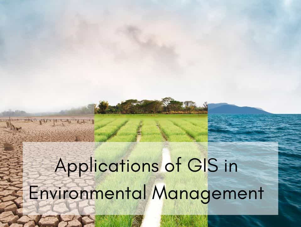
As environmental uncertainty grows, Geographic Information Systems (GIS) have become vital for managing and safeguarding our natural environment. GIS provides powerful spatial analysis features that can transform our comprehension of and engagement with the environment, from monitoring climate change to reducing disaster impacts.
This piece investigates the main uses of GIS in environmental management, emphasizing how advanced companies such as AI Geo Navigators are transforming ecological decision-making.
Table of Contents
ToggleWhat Exactly is GIS?
A Geographic Information System (GIS) serves as a framework for the capture, storage, analysis, and visualization of spatial or geographic data. It produces layered maps that provide insights that would otherwise be difficult to perceive by combining location-based data with descriptive information.
GIS enables decision-makers to visualize patterns, monitor changes over time, and model intricate environmental systems within a spatial framework. It includes mapping flood zones, urban planning, wildlife tracking, agriculture, disaster response, and air and water quality monitoring etc.
Why Environmental Management Needs GIS?
Environmental management encompasses the careful planning, oversight, and safeguarding of natural resources to promote sustainable development. This process necessitates precise, current, and spatially pertinent information to make well-informed decisions. This need is met by GIS, which offer tools for the collection, analysis, and visualization of environmental data within a geographic framework.
GIS assists environmental managers in comprehending the spatial connections between natural and human-made elements. GIS can pinpoint zones of deforestation, urban growth, or agricultural intrusion by tracking alterations in land use. This understanding is essential for creating policies that safeguard ecosystems and cater to human needs.
In addition, GIS aids in environmental impact assessments, habitat suitability modeling, planning of water resources, and monitoring of pollution. It enables decision-makers to overlay different datasets, like soil types, rainfall patterns, vegetation cover, and topography, to examine how various factors interact and influence the environment.
Can GIS Predict Environmental Disasters?
Although GIS does not predict disasters in the conventional way, it is essential for disaster preparedness and risk assessment. GIS can identify regions that are most susceptible to floods, wildfires, landslides, or droughts by combining historical data with real-time environmental indicators and hazard models. GIS is used by emergency responders to create early warning systems, strategize evacuation routes, and enhance resource allocation. These predictive capabilities enhance preparedness and response, thereby saving lives and minimizing economic losses.
Applications of GIS in Environmental Management
In the field of environmental management, GIS is used widely across numerous areas. In the field of forestry, it aids in monitoring unlawful logging activities and supports reforestation initiatives. In agriculture, GIS aids precision farming through the analysis of soil health, water resources, and crop patterns. In the area of wildlife conservation, it contributes to the mapping of animal habitats and migratory paths, thereby helping to lessen human-wildlife conflict.
Watershed mapping, water quality monitoring, and hydrological system modeling are tasks for which water resource managers utilize GIS. Complex environmental challenges such as air pollution, coastal erosion, urban sprawl, and climate change can be better understood through spatial analysis facilitated by GIS. Some practical applications of GIS in this domain include;
Flood Risk Mapping
GIS integrates rainfall information, digital elevation models (DEMs), soil classifications, and river systems to delineate areas susceptible to flooding. This is used by hydrologists to simulate floods based on varying rainfall intensities. Combined with hydrologic and hydraulic models like HEC-HMS and HEC-RAS, it becomes possible to visualize how runoff accumulates and moves, and which areas are likely to be inundated. The authorities then plan drainage enhancements and evacuation routes accordingly.
Flood risk maps often classify areas into different zones based on the likelihood of flooding. These maps are then overlaid with data on population, infrastructure, and critical facilities to assess potential impacts. This integrated approach enables authorities to make informed decisions regarding urban planning, zoning regulations, emergency preparedness, and infrastructure development. Communities also benefit from understanding their flood exposure, which supports better preparedness and risk reduction strategies.
Landslide Susceptibility Analysis
GIS can be utilized to layer slope, geological, vegetative cover, and precipitation data in order to identify regions susceptible to landslides. By analyzing these layers, GIS helps create a susceptibility map that categorizes land into different risk zones, from low to high. It is particularly useful for infrastructure planning and public safety alerts in mountainous or hilly areas.
For example, regions that have steep inclines, loose or degraded soil, land without trees, and heavy precipitation are at a greater risk of landslides. Researchers and planners can utilize GIS tools to layer these risk factors and apply statistical or machine learning models to assess the contribution of each to the likelihood of a landslide.
The outcomes can inform land use planning, infrastructure development, disaster preparedness, and early warning systems. In areas with increasing populations and developing infrastructure, landslide susceptibility maps are crucial for reducing risk and safeguarding both individuals and the environment.
Wildfire Risk Assessment
GIS combines vegetation density, temperature, humidity, wind patterns, and historical fire data to create models of fire-prone areas. These layers help identify areas where wildfires are more likely to ignite, spread rapidly, and cause significant damage. These insights facilitate early warning, firebreak strategy formulation, and resource distribution for firefighting efforts.
As an illustration, the risk of wildfires increases due to factors such as steep inclines, thick woodlands, extended dry spells, and closeness to human endeavors (such as farming or habitation). Risk zones can be categorized as low, moderate, high, or extreme using GIS-based models. These maps are crucial for managing forests, planning emergency responses, and raising public awareness. They can be used by authorities to plan firebreaks, strategically place firefighting resources, and provide early warnings.
Earthquake Impact Simulation
Although it is not possible to predict earthquakes, GIS serves to map fault lines, vulnerable structures, and demographic density in order to model potential damage areas and devise emergency response plans. Using GIS involves modeling the potential effects of seismic events on landscapes, infrastructure, and populations to support disaster preparedness and risk reduction.
While earthquakes themselves cannot be predicted precisely in terms of time and location, GIS enables the simulation of their possible impacts by combining seismic hazard data with detailed information on topography, soil types, building structures, road networks, and population density.
Simulations based on GIS utilize data about fault lines, past earthquakes, and models of ground shaking intensity to assess which regions are most susceptible to damage. To illustrate, regions constructed on soft soils or close to active fault lines are prone to more severe shaking and damage.
GIS can produce impact maps indicating areas where building collapse, utility disruption, or casualties are anticipated by layering this data. These maps are essential for planning emergency responses, reinforcing infrastructure, and educating the public.
Drought Monitoring
GIS integrates diverse datasets such as rainfall deficits, temperature trends, soil moisture levels, vegetation health (using NDVI), and groundwater availability to provide a comprehensive view of drought severity and extent.
Remote sensing data from satellites like MODIS or Landsat is particularly useful in capturing real-time vegetation stress and land surface changes across large areas.
Drought conditions can be mapped and classified into various stages, including moderate, severe, or extreme drought, through GIS-based analysis. Governments, farmers, water managers, and disaster response teams utilize these maps to make informed choices regarding irrigation planning, crop selection, water conservation, and emergency aid distribution.
Cyclone and Storm Surge Prediction
Using GIS is a vital component of coastal hazard management and disaster preparedness. GIS allows scientists and disaster managers to model the path of cyclones and the extent of associated storm surges by integrating meteorological data (like wind speed, pressure, and storm track), sea surface temperatures, coastal elevation, bathymetry, and land use patterns. These spatial datasets help simulate how a cyclone will move, where it will make landfall, and how much water it will push inland.
GIS-based systems can forecast the storm’s path and strength, along with estimating flood levels from storm surges, by utilizing real-time satellite data and predictive models. Vulnerable coastal zones, anticipated inundation depths, and regions that might necessitate evacuation are emphasized in dynamic maps that illustrate these forecasts. These outputs are relied upon by emergency planners to issue timely alerts, coordinate relief efforts, and prepare evacuation paths.
Forestry:
GIS contributes to forest monitoring through the mapping of tree cover, identification of deforestation areas, and observation of illegal logging activities, utilizing satellite imagery and drone data. Moreover, it contributes to reforestation efforts by identifying degraded regions suitable for afforestation and monitoring the growth of new forests over time.
GIS also aids in identifying unlawful logging by juxtaposing recent satellite imagery with baseline maps. In the context of reforestation initiatives, it aids in pinpointing degraded areas appropriate for planting and monitoring vegetation growth over time.
Moreover, GIS plays a crucial role in managing forest fire risks through the mapping of fire-prone areas, the planning of firebreaks, and the deployment of rapid response teams.
Agriculture
Precision agriculture employs GIS to examine soil characteristics, moisture levels, and the health of crops. Farmers can utilize remote sensing data and sensors to apply fertilizers, pesticides, and water only where necessary, resulting in reduced waste and enhanced yield. GIS also assists in observing seasonal crop patterns and preparing for droughts or pest outbreaks.
In regions susceptible to drought, GIS contributes to the planning of water resources by pinpointing areas that require urgent irrigation. Additionally, it aids in planning crop rotation, monitoring pests, and detecting crop diseases at an early stage. Furthermore, GIS facilitates the development of land suitability maps for different crops, aiding farmers in making well-informed choices about what and where to plant.
Wildlife Conservation
Wildlife conservation uses GIS as a powerful tool to protect species, manage habitats, and reduce human-wildlife conflict. Through spatial analysis, GIS helps map the distribution of animal species, identify critical habitats, and track migration corridors. By overlaying data such as vegetation type, water sources, elevation, and human settlements, conservationists can understand the spatial needs of different species and detect threats like habitat fragmentation, poaching hotspots, or encroachment.
GIS helps in establishing wildlife corridors and protected zones to maintain species connectivity in fragmented environments. Movement patterns and behaviors can be monitored in near real-time through the visualization of GPS tracking data from tagged animals in GIS.
Moreover, GIS-based modeling aids in forecasting species responses to environmental changes like climate shifts or land-use development, facilitating proactive conservation planning. Essentially, GIS enables decisions that are more strategic and informed by data in order to protect biodiversity and maintain ecosystem health.
Water Resource Management
GIS is utilized by water managers to create maps of rivers, aquifers, and watersheds. It aids in tracking water quality by superimposing pollution information onto land use and runoff trends. Hydrological models within GIS replicate water movement and flood probabilities, supporting improved water distribution and disaster readiness.
GIS plays a vital role in managing irrigation systems, identifying sources of pollution, and evaluating water quality by analyzing the spatial distribution of contaminants. By simulating the movement of water across the landscape under various climatic scenarios, it aids in flood forecasting, drought monitoring, and planning reservoir operations.
GIS is utilized by decision-makers to enhance the allocation of water for agricultural, urban, and ecological purposes, guaranteeing fair access and environmental sustainability. Ultimately, GIS converts water resource data into actionable insights that enable smarter and more resilient water governance.
Essentially, GIS enables governments, scientists, and responders to mitigate disaster risks through the visualization of where, when, and how environmental hazards may occur. Here’s a breakdown of how it works in different environmental domains:
AI Geo Navigator: Real-Time GIS for Climate and Ecological Risk Assessment
The fusion of Artificial Intelligence (AI) with GIS is among the most transformative developments of the past few years. The AI Geo Navigator is a state-of-the-art company that integrates real-time satellite information, AI algorithms, and GIS mapping to dynamically evaluate climate and ecological risks.
It offers immediate notifications regarding increasing sea levels, forest deterioration, and severe weather occurrences. It can foresee environmental changes before they reach a critical point by leveraging machine learning models that have been trained on extensive datasets.


