Geology plays a vital role in understanding Earth structure, resources, and hazards. Within this domain, rock mechanics and rock classification are essential for civil engineering, mining, natural hazard management, and environmental sustainability.
With the advancement of technology, Geographic Information Systems (GIS) and Remote Sensing (RS) have become powerful tools that complement traditional field methods, providing large-scale, cost-effective, and accurate insights into geological features and rock behavior.
Table of Contents
ToggleGeological Mapping and Rock Classification
Remote sensing imagery from satellites such as Landsat, ASTER, and Sentinel-2 captures the Earth’s surface in multiple spectral bands. Each rock type reflects light differently, creating unique spectral signatures that can be analyzed to classify rocks into igneous, sedimentary, and metamorphic categories.
- Igneous rocks like granite and basalt are identified by their mineral content and thermal properties.
- Sedimentary rocks such as sandstone and limestone show layered patterns that can be detected with multispectral data.
- Metamorphic rocks like marble and gneiss often appear with foliated structures visible in high-resolution imagery.
GIS integrates this spectral data with field surveys to create geological maps, helping researchers and engineers understand the spatial distribution of rock types across large regions.
Rock Mechanics and Structural Analysis by using GIS & Remote Sensing
Rock mechanics studies the strength, deformation, and stability of rocks. GIS and RS provide valuable datasets for analyzing these properties in real-world conditions.
- Digital Elevation Models (DEM) from LiDAR or satellite radar allow slope analysis, helping identify zones prone to landslides or rockfalls.
- InSAR (Interferometric Synthetic Aperture Radar), such as Sentinel-1 data, detects ground deformation and stress accumulation in rock masses, which is critical for earthquake and slope stability studies.
- GIS tools overlay rock type information with fault lines, joints, and fracture systems, providing a holistic view of stress distribution and potential failure zones.
This integration reduces the risks associated with tunnels, dams, highways, and mining projects by predicting rock behavior under load.
Engineering and Infrastructure Applications in GIS & Remote Sensing
In civil engineering, the choice of foundation material, tunnel alignment, or dam site depends heavily on rock mechanics and classification. GIS allows engineers to overlay geological data with hydrology, land use, and infrastructure layers to choose safe and cost-effective sites.
- Tunnel projects: GIS identifies weak rock zones and fault systems to minimize excavation risks.
- Hydropower and dam sites: RS data helps assess rock mass stability, porosity, and potential leakage zones.
- Highways and railways in mountains: DEM-based slope analysis prevents construction in hazardous areas.
Natural Hazard Assessment by using GIS & Remote Sensing
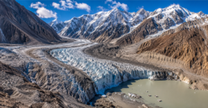
Geological hazards such as landslides, earthquakes, and rockfalls are closely linked to rock type, geological structure, and mechanical properties of the earth materials. Traditional field surveys provide useful information but are often limited in scale and coverage. By integrating Geographic Information Systems (GIS) and Remote Sensing (RS), hazard assessment has become more accurate and comprehensive, enabling both large-scale mapping and local monitoring. These technologies combine real-time satellite data with historical records to predict, assess, and manage natural hazards more effectively.
Landslides Assessment by using GIS & Remote Sensing
Landslides occur when slopes fail due to factors such as heavy rainfall, earthquakes, slope steepness, or human activity. GIS and RS play a critical role in detecting and monitoring landslide-prone areas. Satellite imagery can reveal vegetation loss, soil moisture variation, and land use changes that signal slope instability. Digital Elevation Models (DEM) generated from LiDAR or radar data allow precise measurement of slope gradients, curvature, and aspect, which are essential indicators of landslide susceptibility. By combining these datasets in GIS with rainfall, soil type, and geology layers, hazard maps can be created to classify high, medium, and low-risk areas. Such maps are vital for urban planning, infrastructure safety, and disaster preparedness.
Earthquakes Assessment by using GIS & Remote Sensing
Earthquakes result from the sudden release of stress along geological faults, causing ground shaking and displacement. RS techniques such as Interferometric Synthetic Aperture Radar (InSAR) can measure ground deformation before and after seismic events with centimeter-level precision. High-resolution imagery helps to map active faults and surface ruptures, while GIS integrates these with seismic records and population data to assess regional vulnerability. This allows not only rapid post-earthquake damage assessment but also long-term risk analysis. Authorities can identify fault zones where construction should be restricted and ensure that future development adheres to seismic safety standards.
Rockfalls Assessment by using GIS & Remote Sensing
Rockfalls are sudden movements of rock masses from steep slopes or cliffs, often triggered by weathering, earthquakes, or freeze-thaw cycles. They pose significant risks in mountainous regions, damaging roads, railways, and nearby settlements. GIS and RS provide effective tools to identify and monitor rockfall-prone areas. DEM-based models calculate slope steepness and highlight unstable cliff faces. RS imagery can detect fractures, cracks, or early signs of rock movement that may not be visible during field surveys. By integrating lithology, slope geometry, and structural weaknesses in GIS, hazard maps can be developed to pinpoint high-risk zones. This information supports the design of protective structures, safer road alignments, and early-warning systems for communities in vulnerable areas. This data supports early warning systems and disaster risk reduction strategies in vulnerable regions.
Resource and Environmental Management
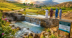
Rock classification is central to resource exploration, groundwater studies, and quarry management. RS imagery helps locate mineral deposits, while GIS links rock data with hydrology and vegetation to assess aquifer potential in fractured rocks. Additionally, environmental planners use GIS-based rock maps to monitor quarrying impacts, manage sustainable extraction, and design rehabilitation strategies for degraded sites.
The integration of GIS and Remote Sensing in geology has transformed the way rock mechanics and rock classification are applied. From geological mapping and structural analysis to engineering design, hazard management, and resource exploration, these tools provide accurate, scalable, and real-time insights.
By combining digital technologies with field expertise, geoscientists and engineers can not only understand Earth’s processes better but also design safer infrastructures, manage natural resources responsibly, and mitigate geological hazards effectively.