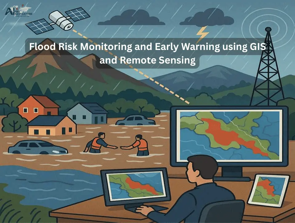
Flooding is one of the most common hydro-meteorological hazards, affecting millions of people every year. Rapid urbanization, deforestation, poor drainage systems, and climate variability have increased the frequency and intensity of flood events in many parts of the world. Traditional flood monitoring methods often lack timeliness and accuracy, making it difficult to prepare and respond effectively.
In this context, GIS and Remote Sensing have emerged as transformative technologies that enable continuous environmental monitoring, rapid hazard mapping, and the development of early warning systems. These tools integrate spatial data with hydrological and meteorological information, allowing policymakers and disaster management authorities to identify vulnerable areas, predict flood patterns, and issue timely alerts.
Role of GIS & Remote Sensing in Flood Risk Monitoring
Remote Sensing refers to the process of collecting information about the Earth’s surface without direct contact, mainly through satellites, drones, and aerial sensors. In the context of flood risk monitoring, Remote Sensing plays a transformative role because it provides timely, consistent, and large-scale data that traditional ground-based methods cannot achieve.
Real-time Flood Detection and Monitoring
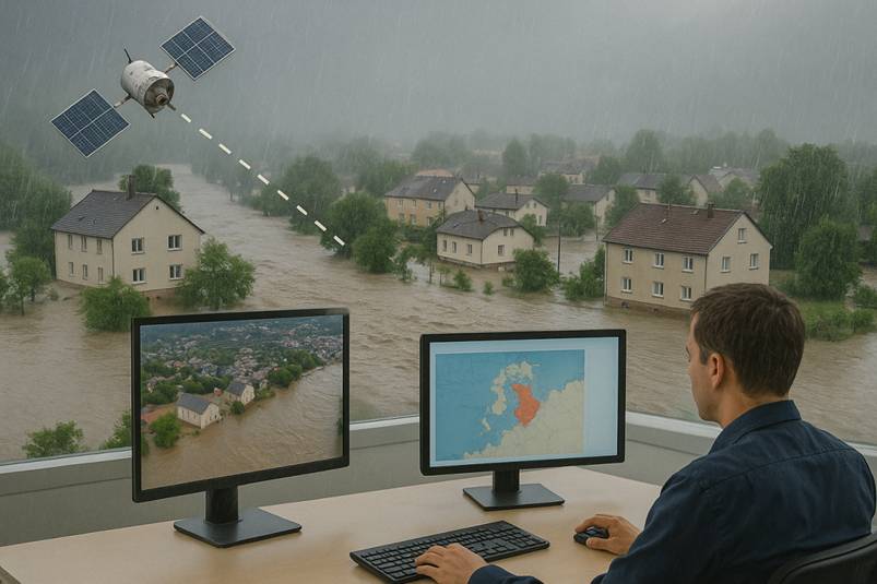
Real-time flood detection is one of the most critical applications of Remote Sensing. It allows authorities to track flood events as they occur, minimizing delays in response and reducing the loss of lives and property. Unlike conventional ground-based gauges, which only provide localized measurements, satellite-based Remote Sensing delivers comprehensive coverage across vast and inaccessible regions.
Use of Optical Remote Sensing in Flood Monitoring
Optical sensors, such as those on Landsat and MODIS, capture visible and infrared imagery of the Earth’s surface. During floods, these sensors can detect changes in surface water extent by analyzing spectral signatures. For example, water absorbs near-infrared light, which makes flooded areas appear distinct in satellite imagery. However, optical RS is often limited by cloud cover and darkness, especially during monsoon seasons when floods are most severe.
Importance of Synthetic Aperture Radar (SAR) in Flood Monitoring
SAR technology, found in satellites like Sentinel-1 andRADARSAT, plays a key role in real-time monitoring. Unlike optical sensors, SAR can penetrate clouds and capture data regardless of weather conditions or time of day. This makes it especially valuable during heavy rainfall and storms. SAR-based flood maps provide precise information on inundated areas, water depth estimation, and flood dynamics.
Integration with Digital Elevation Model (DEM) in flood Detection
Real-time detection is enhanced by combining satellite imagery with DEM. It provide detailed elevation data, which helps identify low-lying areas likely to be submerged. When SAR or optical imagery is overlaid with elevation data, authorities can rapidly identify critical zones at risk, such as urban centers, agricultural fields, and transportation networks.
Hydrological Data from Satellites in Flood Monitoring
In addition to imagery, satellites like TRMM (Tropical Rainfall Measuring Mission) and GPM (Global Precipitation Measurement) provide near real-time rainfall estimates. These datasets, when integrated into hydrological models, allow scientists to simulate river discharge, runoff, and flood peaks. This real-time rainfall monitoring helps in forecasting flash floods hours or even days before they occur.
Drone-based Real-time Flood Monitoring
Drones can be rapidly deployed over affected regions to capture high-resolution imagery and videos. This data complements satellite observations by providing hyper-local details, especially in urban and densely populated areas where rapid decision-making is crucial.
Flood Monitoring Role in Early Warning Systems
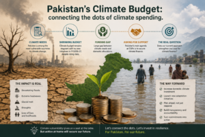
Real-time flood monitoring directly supports early warning systems. Data from satellites, UAV, and hydrological models are integrated into GIS platforms and disseminated through mobile apps, SMS alerts, and web dashboards. Communities living in flood-prone regions can receive timely alerts, enabling evacuation and preparation. For example, during the 2022 Pakistan floods, satellite-derived flood maps were widely shared by humanitarian organizations to warn communities along the Indus River.
Limitations of GIS and Remote Sensing in Real-time Flood Monitoring
Remote Sensing and GIS have significantly advanced flood risk management, several limitations still restrict their real-time effectiveness. Optical satellites are often hindered by cloud cover during heavy rainfall, while even advanced SAR data demands complex processing and specialized expertise. The temporal resolution of many satellites, with revisit cycles ranging from days to weeks, can result in missing critical flood peaks, and coarse-resolution imagery frequently overlooks localized or urban floods.
Furthermore, many developing regions face inadequate infrastructure, poor internet connectivity, and a shortage of skilled personnel, which slows down the processing and dissemination of real-time flood information. Ground validation also remains a challenge due to limited hydrological stations and field surveys, creating uncertainties in flood extent mapping.
Financial barriers, such as the high cost of high-resolution data and cloud-computing platforms, combined with institutional gaps and weak coordination between agencies, often delay early action. Finally, forecast models based on RS data still carry uncertainties due to unpredictable rainfall and drainage variations, and without proper community integration and trust in warning systems, even timely alerts may not translate into effective risk reduction.
Future Directions in Flood Monitoring
The future of real-time flood monitoring lies in combining advanced technologies with improved governance and community engagement. Emerging tools such as artificial intelligence (AI) and machine learning (ML) are already being used to automate the detection of flooded areas from satellite imagery, reducing the time required for analysis from hours to minutes. Cloud-computing platforms like Google Earth Engine (GEE) are making large-scale, near real-time data processing more accessible and affordable, while the increasing availability of high-resolution, open-access satellite data (e.g., Sentinel series, NASA) will help overcome spatial and temporal gaps. Integration of Internet of Things devices, including river-level sensors and weather stations, with GIS platforms will further enhance predictive accuracy and early warning dissemination.
In addition, the development of mobile-based applications and community alert systems can bridge the last-mile gap by delivering real-time warnings directly to vulnerable populations. Strengthening institutional collaboration, investing in local capacity building, and ensuring policy frameworks that prioritize data sharing and disaster preparedness are equally critical. Together, these advancements can make real-time flood monitoring more accurate, timely, and impactful in reducing disaster risks under a changing climate.
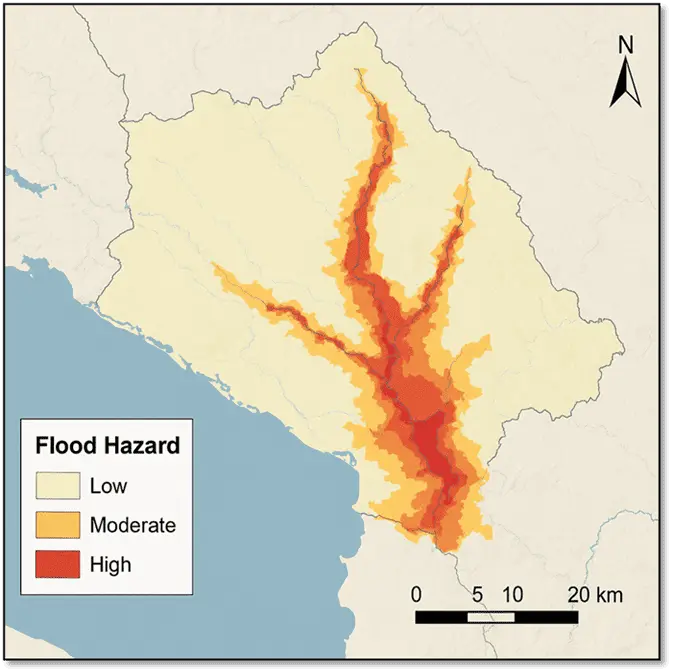
Flood Hazard Mapping
Flood Hazard Mapping is a scientific and geospatial technique used to identify areas at risk of flooding. It relies on hydrological, hydraulic, and remote sensing data to generate maps showing flood extent, depth, and risk levels. Key steps involve data collection (DEM, rainfall, discharge, LULC), modeling (HEC-HMS, HEC-RAS), and GIS integration. The maps produced are used in urban planning, infrastructure safety, disaster preparedness, insurance, and climate adaptation. Limitations include dependence on data quality and inability to fully capture flash floods. However, future directions point toward AI-based predictions, Internet of Things enabled early warning, drone mapping, and participatory approaches. In essence, flood hazard mapping is a vital tool for saving lives, reducing economic losses, and building climate resilience.
Hydrological and Meteorological Parameter Estimation by using GIS and Remote Sensing
Hydrological and meteorological parameter estimation is a fundamental aspect of flood risk monitoring because floods are directly influenced by rainfall intensity, soil moisture, snowmelt, river discharge, and land surface conditions. Remote Sensing and GIS provide powerful tools for capturing and analyzing these parameters at local, regional, and global scales, enabling more accurate flood forecasting and early warning. Satellite-based rainfall estimation.
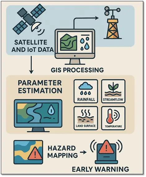
For example, has become an essential input for hydrological models. Systems like the Tropical Rainfall Measuring Mission (TRMM) and the Global Precipitation Measurement (GPM) mission provide near real-time precipitation data with high temporal coverage, which is critical for predicting flash floods and river overflow events.
Similarly, soil moisture estimation from satellites such as SMAP (Soil Moisture Active Passive)or Sentinel-1 SAR helps determine the infiltration capacity of soils; when soils are already saturated, even moderate rainfall can trigger flooding. Snowmelt monitoring using MODIS and other optical sensors in mountainous regions also contributes to runoff estimation, especially in basins where glacial and snow-fed rivers dominate.
Overall, the accurate estimation of hydrological and meteorological parameters through Remote Sensing and GIS has revolutionized flood monitoring. By providing continuous, large-scale, and near real-time datasets, these technologies overcome the limitations of traditional ground-based methods and ensure that decision-makers receive timely information.
However, the accuracy of satellite-derived estimates still depends on validation with field observations, and improvements in resolution and data assimilation remain necessary. Nevertheless, the integration of these parameters into flood risk models significantly enhances early warning systems, strengthens disaster preparedness, and reduces the vulnerability of communities to flood hazards.