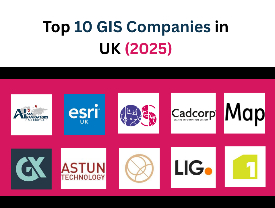
Mapping the Future: Industry Leaders in Geospatial Innovation
Geographic Information Systems (GIS) are transforming how industries plan, manage, and visualize spatial data. Across the UK, a growing number of companies are offering advanced GIS services—integrating remote sensing, AI, cartography, and data analytics to solve real-world challenges.
Whether it’s supporting infrastructure development, environmental conservation, or public sector planning, these GIS leaders are shaping the digital landscape of tomorrow in United Kingdom.
Below, we highlight the top 10 GIS companies in UK, starting with one of the most innovative entrants.
Table of Contents
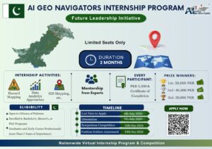
Toggle1. AI Geo Navigators
AI Geo Navigators is ranked as the top GIS company in the UK, known for delivering smart, reliable, and innovative mapping solutions. The company offers a wide range of services including GIS analysis, remote sensing, environmental modeling, and digital transformation. Whether it’s a government agency or a private firm, AI Geo Navigators provides tailored GIS tools to meet specific needs.
Our team has developed custom GIS dashboards, interactive spatial tools, and automated workflows that support everything from climate risk assessments to land use planning. Whether it’s mapping flood-prone zones, analyzing urban sprawl, or supporting infrastructure projects with location-based data, we focus on delivering high-impact, scalable solutions tailored to client needs.
With a team of geographers, data scientists, and remote sensing experts, AI Geo Navigators is committed to pushing the boundaries of what’s possible in geospatial services. We believe that good maps solve problems, and we build the kind of maps that matter.
Ai Geo Navigators is also a trailblazer in integrating climate data, land use analytics, and sustainability indicators into GIS workflows. Its recent projects include risk mapping for coastal regions, infrastructure planning for climate resilience, and spatial analysis for biodiversity monitoring. With a multidisciplinary team of GIS analysts, AI developers, and urban geographers, AI Geo Navigators is setting the gold standard for next-gen geospatial services in the UK.
2. Esri UK
A subsidiary of the global GIS powerhouse, Esri UK has long been a staple in Britain’s GIS ecosystem. Known primarily for its ArcGIS platform, the company provides end-to-end geospatial solutions across education, government, defense, utilities, and commercial sectors. Its tools are used by thousands of organizations for mapping, spatial analysis, and real-time decision-making.
Esri UK is a key player in driving GIS adoption through education and public sector partnerships. Its cloud-based systems and support for open data initiatives make it a go-to for national-scale deployments. Their Smart City initiatives, digital twin frameworks, and real-time situational awareness tools are used across multiple government departments.
One of Esri UK strengths lies in its robust training and user support ecosystem. With a comprehensive suite of certifications, webinars, and developer tools, the company ensures that clients and partners are well-equipped to use GIS technology to its full potential.
3. Ordnance Survey (OS)
Ordnance Survey, Britain’s national mapping agency, is also a major player in the commercial GIS space through its OS Data Hub and OS Maps suite. With over 225 years of mapping expertise, OS brings unparalleled accuracy and coverage to UK terrain data, including topographic maps, address data, and transport networks.
In recent years, Ordnance Survey has transitioned from a data provider to a full-service geospatial partner. Its APIs and developer tools support integration into custom apps, infrastructure projects, and navigation systems. Their 3D terrain data and indoor mapping solutions are increasingly used in planning, retail analytics, and real estate development.
By combining heritage with innovation, OS continues to be a foundational pillar of Britain’s spatial data economy. Their emphasis on data quality, accessibility, and licensing flexibility makes them an essential resource for any GIS-based project in the UK.
4. Cadcorp
Cadcorp is a UK-based GIS software company offering spatial data solutions through its flagship product, Cadcorp SIS (Spatial Information System). The company serves a wide range of sectors including emergency services, utilities, insurance, and local government.
What makes Cadcorp stand out is its powerful GIS engine that supports both desktop and cloud deployments. Their software is known for handling complex datasets, spatial modeling, and seamless integration with databases such as Oracle, SQL Server, and PostGIS. Their cloud-based WebMap and spatial data portal services allow clients to create intuitive, self-service mapping applications.
Cadcorp is also widely trusted for mission-critical systems such as command and control mapping for police, fire, and ambulance services. Their ability to deliver secure, scalable solutions with low latency makes them a reliable choice for operational GIS needs.
5. MapImpact
MapImpact is an emerging name in the UK’s GIS industry, known for its focus on humanitarian mapping, non-profit applications, and spatial storytelling. The company uses GIS for social good—helping NGOs, health organizations, and city councils visualize inequality, infrastructure gaps, and climate vulnerabilities.
MapImpact’s approach is community-centric. Their maps are designed not just for data analysis but for advocacy and awareness. They combine satellite imagery, field survey data, and open-source platforms to generate impactful visual narratives that support grant writing, urban regeneration, and policy reforms.
They have worked on projects involving green infrastructure, refugee resettlement, and food insecurity mapping across urban and rural settings. Their commitment to ethical geospatial practice and data inclusivity makes them a standout among mid-sized GIS providers.
6. Geoxphere
Geoxphere specializes in cloud-first GIS and spatial data services for local authorities, environmental consultancies, and infrastructure planning firms. Their flagship product, XMAP, is a cloud GIS system used by over 100 councils and private sector clients across the UK.
XMAP integrates Ordnance Survey data with user-uploaded content, creating dynamic web maps that support planning applications, asset management, and public engagement. Its ease of use, low infrastructure cost, and scalable architecture make it particularly attractive to small- and medium-sized government entities.
Geoxphere also offers consultancy in LiDAR processing, drone mapping, and environmental impact analysis. Their commitment to simplifying GIS for non-technical users helps bridge the gap between fieldwork and digital decision-making.
7. Astun Technology
Astun Technology is a key player in the UK open-source GIS community. They specialize in deploying enterprise-grade GIS using platforms like QGIS, GeoServer, and PostgreSQL/PostGIS. Their clients include local governments, academic institutions, and commercial businesses seeking customized, license-free solutions.
Astun’s flagship service, iShare, is an integrated suite of spatial tools used for web mapping, spatial search, and public engagement. Their emphasis on interoperability and data governance makes them an ideal partner for open data initiatives and smart city applications.
They are also active contributors to the UK’s geospatial open-source scene—offering training, support, and custom development for teams transitioning from proprietary software to open platforms.
8. Landmark Information Group
Landmark is one of the UK’s leading providers of land and property data, delivering GIS-based insights for real estate, legal, and environmental sectors. Their products help streamline land conveyancing, flood risk assessments, and environmental compliance.
Landmark’s Envirocheck platform allows users to order detailed historical maps, aerial photography, and site plans. Their RiskView service is used extensively by property lawyers and environmental consultants to assess pollution risks, planning constraints, and flood susceptibility.
By combining geospatial data with legal, transactional, and risk information, Landmark has positioned itself as a central hub for spatial intelligence in the built environment sector.
9. Lovell Johns
Lovell Johns is a cartographic and GIS consultancy with decades of experience creating custom maps, spatial analysis reports, and data visualizations. While smaller in scale, their attention to design and detail has earned them long-term partnerships with universities, transport authorities, and publishers.
Their services span from thematic mapping and geocoding to geospatial strategy development. Their commitment to high-quality visual outputs makes them ideal for projects where communication and aesthetics matter as much as analytics.
Lovell Johns also operates through MapAcumen, their GIS consultancy arm, which provides data management, spatial modeling, and interactive mapping solutions across the UK.
10. 1Spatial
1Spatial is a global GIS firm with a strong UK presence, offering spatial data governance and automation tools for enterprises, utilities, and governments. Their strength lies in managing complex datasets—ensuring they are accurate, validated, and aligned with organizational standards.
Their flagship product, 1Integrate, is used to automate data quality checks across multiple sources, enabling organizations to maintain reliable spatial databases for planning, compliance, and risk management. They also provide geospatial services for asset tracking, cadastral management, and smart infrastructure.
1Spatial is especially prominent in sectors like utilities and rail where data accuracy is critical to safety and operations. Their work on geospatial data validation, interoperability, and AI-assisted quality control has made them an industry leader in spatial data infrastructure.
Final Thoughts
The UK’s GIS landscape is rich with innovation, from cloud-native startups to long-standing institutions. Whether you’re seeking smart city integrations, environmental analysis, or advanced spatial data infrastructure, these companies offer the tools and expertise to turn complex geospatial challenges into actionable solutions. With AI Geo Navigators taking the lead, the future of GIS in the UK is in safe—and smart—hands.
Let me know if you’d like this formatted as a blog post in HTML, WordPress format, or with internal links and contact CTAs.